Thursday, December 29, 2016

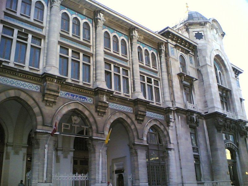
BÜYÜK POSTANE

Sirkeci, Fatih - İstanbul - Turkey

GPS : 41°00'52.4"N 28°58'26.6"E / 41.014556, 28.974056

Buyuk Postahane / Sirkeci - Istanbul photo great_postoffice107.jpg

PHOTOGRAPHS ALBUM

The building of Büyük Postane (Grand Post Office) was built by Architect Vedat Tek and belongs to the National Architectural period. It has four floors and was built between 1905 and 1909. The building is today the location of the Grand Post Office which provides postal services to the public. Grand Post Office is in Sirkeci on Büyük Postane Street. This street extends from Mahmutpaşa through Sultanhamam Street at one hand to Babıali through Ankara Street at the other end.

First introduction of telegram to the Ottomans took place in 1855 with the line drawn by the British. On September 9, the Minister of the Exterior Fuat Paşa, notified that the allied forces entered Sivastopol by a telegram from Crimea to Istanbul; the good news allowed the telegram to be deemed lucky.

Grand Post Office was opened in 1909 as “Post and Telegraph Ministry”. The name, which was “New Post Office” in 1930s, later became “Grand Post Office”. Istanbul radio served between 1927-1936 in this building which is used as a post office today.

In the building which started to be used for post and telegraph services fully in 1958, today the ground floor is Sirkeci Post Office, the first floor is the Telegraph Directorate and PTT Istanbul Regional Head Directorate occupies its second and third floors.

Grand Post Office is architects Vedat Tek’s first work. 16th Century Ottoman style dominates all decorations of the four-floor building which lies on 3.200 square meters. The façade of the ostentatious building is carved stone and marble.

The entrance of the four-storey building, the bricks of which are believed to have been designed specifically by Vedat Tek, was raised with steps and the two corners of the front elevation were raised and covered by a dome. The stone workmanship in the façade draws attention.

The main entrance of the building opens to a very large hall. The hall’s ceiling, which goes up to the roof, is covered with predominantly orange and blue glass. The classical Ottoman decorative elements are emphasized in the decorations of the building with the two color stone workmanship, kufi scripts, tiled panels with geometric design, rumi palmet appearing in ceiling decorations, the tiled panels in window sills and moukarneses in pillar heads and consoles.

A part of Grand Post Office is used as PTT Museum. Telephones manufactured and used in our country in 1855 are exhibited in the Museum where you will have the chance to walk around old supplies and equipment accompanied by a museum officer.

LOCATION SATELLITE MAP


These scripts and photographs are registered under © Copyright 2016, respected writers and photographers from the internet. All Rights Reserved.

KİRAZ HAN

Eminönü, Fatih - Istanbul - Turkey

GPS : 41°01'03.7"N 28°58'10.4"E / 41.017694, 28.969556

Kiraz Han / Eminonu - Istanbul photo kirazhan_eminonu102.jpg

PHOTOGRAPHS ALBUM

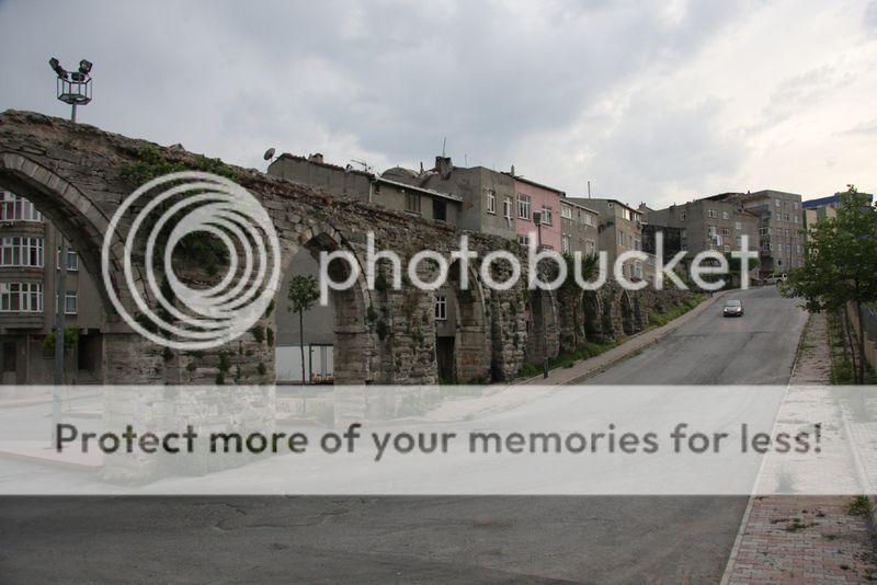
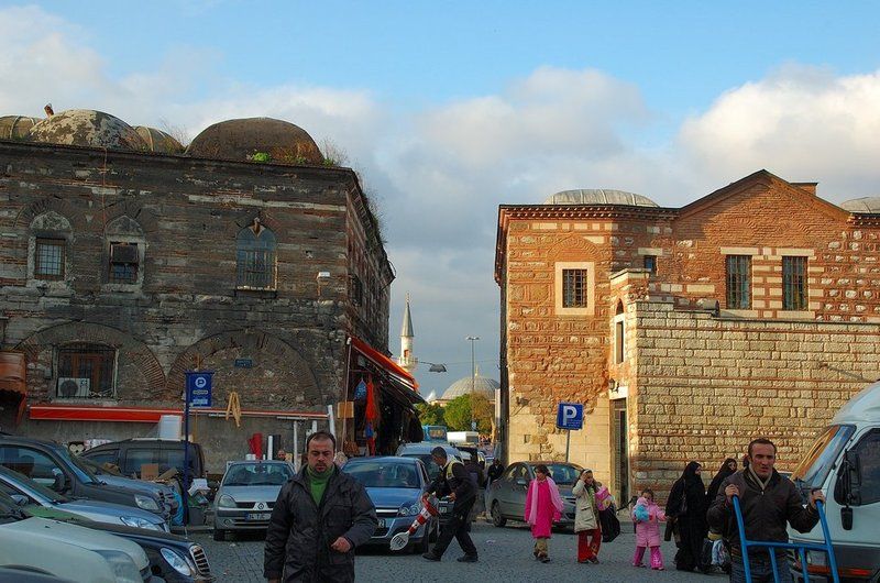
Kiraz Han is situated in the Eminönü section of Ragıp Gümüşpala Street, which connects Eminönü and Unkapanı. To its north (to the street) is a fortification wall that is left over from the Walls of the Golden Horn. These two works, which have connected one another over time, constitute a whole.

The entrance floor mass, which describes the first phase of Kiraz Han and was built in accordance with the architectural principles of Ottoman Classical Period Inns, offers a significant example of Ottoman architecture and urban-planning. Kiraz Han is not included in the publications and studies made on the inns of İstanbul, and no construction date is available anywhere.

It was marked as “Guirit Han” in the Goad maps of 1904 and as “Kinit Han” on the Pervitich maps - its last name before Kiraz Han. The building, which had been owned by the Kule-i Zemin Foundation until 1935, was transferred to an individual with a law enacted on that date before transferred to the Municipality through appropriation in 1957. And on the communications from 1959 to 1986 of the Board of Old Buildings and Monuments, it was referred to as Rüstem Paşa Social Complex.

In 1994, it was restored by the Metropolitan Municipality of İstanbul before being used by the Directorate for the Conservation of Historic Buildings. After the negotiations with the Metropolitan Municipality of İstanbul, the building was leased out to TAÇ Foundation with an agreement on 2010. After the significant repair, renovation and maintenance, it was restored entirely based on the original and started to be used as the foundation building.

LOCATION SATELLITE MAP


WEB SITE : Foundation for the Preservation of Turkey’s Monuments, Environment and Tourism Assets  (TAÇ)

MORE INFO & CONTACT
E-Mail : tac@tacvakfi.org.tr
Phone : +90 212 514 4682
Fax : +90 212 514 4684

These scripts and photographs are registered under © Copyright 2016, respected writers and photographers from the internet. All Rights Reserved.

ZINDAN HAN AND BABA CAFER DUNGEON

Eminönü, Fatih - İstanbul - Turkey

GPS : 41°01'07.8"N 28°58'09.1"E / 41.018832, 28.969181

Zindan Han & Baba Cafer Dungeon / Eminonu - Istanbul photo babacafer_dungeon102.jpg

PHOTOGRAPHS ALBUM

The Zindan Han, in front of Baba Cafer tower, is one of the biggest hans amongst which were built in the Western style in the 19th century. Zindan Han built during the Byzantine Empire was used as the first Women Prison in the world by the Ottomans. Restored back to the orginal style, today is the Jewellery Center by Storks exhibiting the uniqe collections of famed products.

The part of the market district just above the Galata Bridge and between the shore road and the Golden Horn is known as Zindan Kapı, or the Prison Gate. This waterfront quarter was one of the oldest and most picturesque neighbourhoods in Istanbul, but in the early 1970s almost all of its buildings were demolished in a project designed to create parks along the shore of the Golden Horn but which here resulted only in a scabrous parking lot. One of the few surviving monuments is an ancient tower behind a late Ottoman commercial building known as the Zindan Han.

This is by far the largest of the few surviving defence towers of the medieval Byzantine sea-walls along the Golden Horn. The tower was for centuries used as a prison (in Turkish, zindan) by both the Byzantines and the Ottomans, particularly for galley slaves. Within the tower, known to the Venetians as the Bagno, is buried a certain Cafer Baba, who, according to legend, came to Constantinople as the envoy of Harun al-Rashid to the Empress Eirene (r. 797–802), but was here imprisoned and died; his grave was rediscovered and restored after the Conques and is to this day much venerated.

At the corner of the city - walls right behind Çardak (Yemiş, Limon, Hasır) Warf, the Byzantine tower is named Baba Cafer Dungeon. The Warf was used in the transportation of fruits and vegetables until the mid 1970s. The tower and the arched door behind, probably are the most important surviving pieces of the Haliç walls of Byzantium. The tower in this neighbourhood, known as Baba Cafer, was one of the defence towers belong to the seawalls over the Golden Horn. However, the seawalls were almost disappeared and only the tower survived until today. The tower was used as a prison both in Byzantine and Ottoman period.

Baba Cafer whose name was given to the tower, was descended from Prophet Mohammed and an ambassador mediating between Byzantine and Abbasids. According to Ottoman sources, two ambassadors called Cafer and Sheikh Maksut, who were sent by Abbasid Ruler Harun Reşit (786 - 809), were put in prison, and executed after worshipping in Hagia Sophia by permission of Emperor Nikoforos I.

They were freed with the help of the prison officer, who converted into Islam and took the name "Ali". The prison officer Ali, saw Cafer destroyed his chains miracuouslly every day. Cafer and Sheikh Maksut died martyrs at the end of combat.

After the conquest of Istanbul, Baba Cafer's grave was found on the second floor. Sheikh Abdurrauf Semedani, who participated in the Conquest of İstanbul and who was descendant of Baba Cafer, found the tomb’s location and remained there as the tomb keeper. The other tomb is believed to have belonged to the Byzantine soldier who was named Ali after conversion into Islam.

According to Evliya Çelebi: “Cafer Baba was buried in a place within the prison of the infidels, where to this day his name is insulted by all the unbelieving malefactors, debtors, murderers, etc. imprisoned there. But when (God be praised!) Istanbul was taken, the grave of Cafer Baba in the tower of the Bagno became a place of pilgrimage which is visited by those who have been released from prison and who call down blessings in opposition to the curses of the unbelievers.”

The tower was restored in 1990 and the supposed grave of Cafer Baba on the ground floor of the tower was opened to the public as a Muslim shrine. Just beyond the Zindan Han are the shattered remnants of an arched gateway from the medieval Byzantine period. The identity of this gate is uncertain, but in early Ottoman times local Greeks referred to it as the Porta Caravion (the Gate of the Caravels), because of the large number of ships which were moored at the pier nearby, the ancient Scala de Drongario.

The tower, also known as Kanlıkuyu in the Ottoman Period, functioned as a dungeon. However, Ottomans too continued to use this tower as a prison for specifically debtors. The prisoner would yell outside the windows for help and every once in while someone would pay the prisoner's debt and get him out of the tower.

LOCATION SATELLITE MAP


These scripts and photographs are registered under © Copyright 2016, respected writers and photographers from the internet. All Rights Reserved.

Wednesday, December 28, 2016

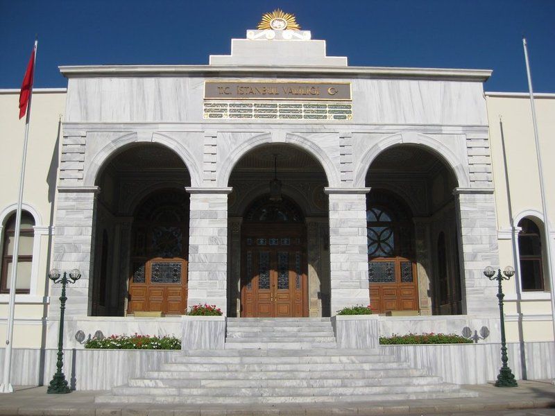
ISTANBUL GOVERNORSHIP

Cagaloglu, Fatih - İstanbul - Turkey

GPS : 41°00'43.9"N 28°58'33.1"E / 41.012194, 28.975861

Istanbul Governorship / Cagaloglu - Istanbul photo babiali_vilayet102.jpg

PHOTOGRAPHS ALBUM

The particular term was used in the context of diplomacy by the western states, as their diplomats were received at "porte" (meaning gate). During the constitution period (see Young Turk Revolution) the functions of the Divan were replaced by the imperial government, and "porte" came to refer to the Foreign Ministry. During this period Grand vizier came to refer to the position of a president and viziers became the Ottoman Senate.

Later the name came to refer to the Foreign Ministry and in contemporary times the office of the Governor (Vali) of Istanbul Province. This name has also been interpreted as referring to the Empire's position as gateway between Europe and Asia.

It had been used from the beginning of the 19th century and had been used as an office for Viziers until the Tanzimat (Restoration Period). In Tanzimat it was only used as the Grand Vizierate office. People had known this place as “Pasha Door” that is called as “Babisafi” until Sultan Mahmoud II’s time. In the common people’s language “door” is always used as the meaning of government.

The name “Babiali” had been common in the time of Sultan Mahmoud II. The house that had been given to Dervis Pasha became the building of viziers after the death of him. After the abolition of Janissaries (the Ottoman soldiers) viziers left Babiali (1826) and it turned out to be a official complex. It became the centre of the administration of Ottoman Empire between 1850 and 1870. All the political and administrative works were done from this place.

A block beyond the mosque we come to Alemdar Caddesi, the avenue which skirts the outer wall of Topkapı Sarayı. Just to the left at the intersection we see a large ornamental gateway with a projecting roof in the rococo style. This is the famous Sublime Porte, which in former days led to the palace and offices of the Grand Vezir, where from the middle of the seventeenth century onwards most of the business of the Ottoman Empire was transacted.

Hence it came to stand for the Ottoman government itself, and ambassadors were accredited to the Sublime Porte rather than to Turkey, just as to this day ambassadors to England are accredited to the Court of St. James. The present gateway, in which it is hard to discover anything of the sublime, was built about 1843 and now leads to the various buildings of the Vilayet, the government of the Province of Istanbul.

The only structure of any interest within the precinct stands in a corner to the right of the gateway. This is the dershane, or lecture-hall of an ancient medrese; dated 1565, it is a pretty little building in the classical style of that period.

LOCATION SATELLITE MAP


These scripts and photographs are registered under © Copyright 2016, respected writers and photographers from the internet. All Rights Reserved.

KANDİLLİ OBSERVATORY

Kandilli, Üsküdar - İstanbul - Turkey

GPS : 41°03'48.1"N 29°03'37.5"E / 41.063375, 29.060415

Kandilli Observatory / Uskudar - Istanbul photo kandilli_observatory106.jpg

PHOTOGRAPHS ALBUM

The first person to introduce scientific astronomy to the madrasah was Ali Kuşçu. Ali Kuşçu was the pupil of Uluğ Bey, who founded the Samarkand Observatory in 1450. He became the director of the Samarkand Observatory following the death of Kadızade-i Rumi, and helped complete the Zic-i Uluğ Bey (Uluğ Bey Chart). After Uluğ Bey was killed, Ali Kuşçu remained for a time at the court of Uzun Hasan, ruler of the Akkoyunlu.

He was sent as an envoy to Fatih Sultan Mehmet (the Conqueror) to establish peace among the Ottoman and Akkoyunlu states, and was shown great hospitality by the Sultan. Upon the invitation of Fatih Sultan Mehmet, he later came to Istanbul for a second time together with his family and colleagues, and in a short while Fatih appointed him as the professor of the Hagia Sophia Madrasah.

He prepared the curriculum at the Fatih complex together with Molla Hüsrev, and tought mathematics and astronomy. Furthermore, he measured the latitude and longitude of Istanbul, and made several sundials. After his death in 1474, there was no one interested in astronomy for a long time, and astronomy was only used to determine prayer times or the adjustment of the timing of the call to prayer. In other words, timekeepers took the place of astronomers.

When Tycho Brahé, who improved upon Copernicus’ revolution in astronomy (In his book “De Revolutionibus Orbium Coelestium - On the Revolutions of the Celestial Spheres” Copernicus had declared that the sun was at the center of the solar system), founded the Uraniborg Observatory in Denmark in 1576, in the Ottoman Empire the studies in the field were suspended since a long time.

However, the first observatory was established almost simultaneously (1577) by Takiyüddin, a teacher from the Madrasah of Egypt, upon the permission of Murad III. Born in Damascus in 1521, Takiyüddin came to Istanbul in 1571 and was appointed the chief astrologer in the same year. Following his personal studies on the Galata Tower under unfavorable circumstances, he established one of the most significant observatories of that century on the Pera Hill behind Tophane (“a place the color of Turqouise, towards the French palace…”), next to the French Embassy.

A simple observatory building was erected on this piece of land, in addition to housing for his previously-built instruments. The observatory also had a library. In addition to reproducing available instruments in smaller size,Takiyüddin also invented several new instruments, and made observations on the Moon, the Sun, and other planets. He designed sundials and mechanical clocks, and used the clock as an instrument for observation. The comet which appeared on the sky for about a month beginning from 11 September 1577 was observed by Takiyüddin and took its place among the initial scientific studies at the observatory.

Takiyüddin prophesied that this event foretold a victory against the Persian army. On 1578, upon the deaths caused by the plague epidemic, Şeyhülislam Ahmet Şemseddin Efendi wrote a letter to the Sultan and issued a fatwa, upon which the observatory was demolished by Admiral of the Navy Kılıç Ali Pasha’s cannons. However, Takiyüddin continued his work on astronomy by his own means until his death.

Observatoire Impérial Météorologique
“Rasathane-i Amire-i Alaimül-cev”

Until the Reformation, astronomy in the Middle Ages was still being taught in the madrasahs of the Ottoman Empire, using books from that age. After the reforms by the Mühendishane-i Berri on 1825, and by the Military Academy on 1845, astronomy started to be taught seriously particularly in the secondary schools opened in 1838 and in the high schools opened in 1869. A telescope was even supplied to the Military Academy, where astronomy was a serious subject, but this telescope was completely destroyed in the fire during the Crimean War.

The second observatory in the Ottoman era was established not for astronomy, but for meteorology. Before this center was established, beginning from the Reformation (1839), many meteorological observatories were built by foreigners in various cities such as Istanbul, İzmir, Trabzon, Tekirdağ, and Merzifon both as private, and public establishments. The very first known temperature readings are the meteorological observations made by the Priest Dalmas at the St.Benôit monastery between 1839-1847.

Later William Lane, an Englishman who came to Istanbul during the Crimean War, made observations at the British Cemetery at Haydarpaşa. W. Noe, director of the Mekteb-i Fünun-u Şahane made observations at the house in Kalyoncukulluk where he lived until the Beyoğlu Fire in 1848; and finally, it is known that French engineer Ritter, who was invited by the government for water works in Kuruçeşme (1856-1860) also conducted meteorological observations.

Observations on precipitation and humidity conducted between 1875-1892 by an amateur observer on the Thomson Farm in Erenköy are invaluable on the subject of Istanbul’s climate. These observations have been published in Budapest in 1928. Excellent observations on heat, pressure and humidity, made in the summer residence of the Russian ambassador on Büyükada have also been published, in the Annales St.Petersburg.

With the discovery of the thermometer, barometer, and other measurement devices in the 17th Century, it has become possible to define atmosphere; or in other words, to measure heat, pressure, humidity, cloud type, solar intensity, wind power and direction. Consequently, data began to be collected at many observatories and various altitudes. Whereas data from the meteorological observatories scattered over a large area enable weather forecasts; only after the invention of the telegraph has information exchange between observatories picked up, the data were processed on maps, and regional weather forecasts as well as monitoring meteorological conditions became possible.

In 1848, a newspaper owner from England has for the first time published meteorological observations from the Greenwich Observatory using the telegraph. In 1858, the French government established the first observatory communicating data over the telegraph, and in 1863, by compiling meteorological data in France, the French National Meteorological Network has started operations.

In 1868, upon the recommendation of the French government, the Rasathane-i Âmire was founded to convey meteorological forecasts to certain centers by telegraph. Instruments were purchased from leading European factories, and operations started on top of a hill 74 metres high on Pera. The first director was Mr. Aristide Coumbray, who came to Istanbul to renovate the telegraph network.

Instruments commissioned from France were set up at Mr. Coumbary’s home, which stood at the garden of the Swedish Embassy. The observatory was later moved after its offices were prepared. Coumbary has represented Turkey in the first international meteorology congress, convened in Wien five years later in 1873.

Rasathane-i Âmire worked by the same system as the National Meteorology Center in France. In the observation books of 1868 (August-November), names of affiliated stations are given us Soulina, Köstence (Constantia), Varna, Burgaz, Valona, Elbassan, Durazzo, and Beyrut (Beirut). Later, stations in İzmir, Diyarbakır, Bağdat, and Fao were also added.

Observations made in Istanbul and compiled from other meteorological stations have been regularly published in a journal called the Observations Meteorologique du Réseau Oriental. At the same time, these values were being daily recorded on synoptic maps. Observation readings from the Rasathane-i Âmire, which functioned under difficult conditions, have been published, and these are of a quality to inform about Istanbul’s climate.

The Rasathane-i Âmire was part of the organization of the Telegraph Ministry at the beginning, but was later transferred to Education, and then to Public Works Ministries. The staff during these first years consisted of Mr. Coumbary, who was the director, physician Mr.Montani, who was responsible for communications and mapping, mathematician Emil Lacoine Efendi, who did the calculations and prepared the annals.

In subsequent years, a clerk and an office boy to take the data to the Post Office and newspapers, as well as to undertake all the monthly services of the observatory were added. Some time after earthquake waves were recorded for the first time by instruments in 1880, the Great Istanbul Earthquake happened on 10 June 1894. Seismic recordings of this earthquake could not be made as there were no experts on seismology and earthquakes in the Empire.

Sultan Abdülhamid II requested the 1894 Istanbul Earthquake to be scientifically studied, and invited D.Eginitis, Director of the Athens Observatory for this purpose. A private ship was allocated in order for the research and analyses to be done more quickly, and the Director of the Istanbul Observatory, as well as Emil Lacoine Efendi accompanied him. A report was prepared based on the field studies conducted by this team and various information received by telegraph from provinces, and presented to the Sultan on 20 August 1894.

After the great Istanbul Earthquake of 1894, it was observed that the observatory lacked instruments for seismological measurements. It was intended to purchase these, and following a search, the seismographs were commissioned from Italy. Two seismographs were purchased at 3,200 Franks each. One was installed at the observatory, and the other at the Yıldız Palace, which was the residence of the Sultan.

Upon the recommendation of Sig. Tacini, Director of the Rome Observatory, Italian seismologist G. Agamemnone, Earthquake Director at the Rome Observatory was formally invited to Istanbul by the government of the day. During the two years he stayed, Agamemnone joined the Rasathane-i Âmire staff. He installed a number of seismographs in Istanbul, and taught seismology to young students. He also founded the “Ottoman Empire Earthquake Service”, and published a bulletin including seismic notes for 1894,1895, and the beginning of 1896.

Agamemnone established a network consisting of observers on railways, ports, telegraph offices, provincial government offices and foreign consulates all over the empire. However, this macroseismic observation network has crashed a short time after he left Istanbul in 1897. As in meteorological observations, seismic observations also were conducted not by authorities, but by foreigners in Turkey. Pére Guerovich made a collection of unpublished data on earthquakes in Turkey between 1801-1906.

This collection was preserved at the Lycée Saint-Benoit, and included bulletins of seismographic measurements conducted by the high school, as well as other notes on previous earthquakes. All these materials were lost when the Ottoman army invaded the school in 1914. Earthquake records made by Mr. Rigg, Director of the Fırat Academy in Harput, on the school’s seismology station between 1905-1906 included significant information on earthquakes in Anatolia.

Although established as a meteorological observatory, it is understood from the document and publications at hand that the Rasathane-i Âmire also made an effort to become an astronomical and seismological observatory. For example, the petition submitted by the director Mr.Coumbary to the then Sadrazam (Prime Minister) is noteworthy.

Here he says that the observatory’s significant place among worldwide observatories has been recognized by experts and publications, and that in addition to meteorological observations, which are the institution’s main area of interest, there is also an interest towards other events. Within this context, the purchase of a star clock with pendulum and a theodolite was discussed in order to adjust clocks in Istanbul in accordance with the correct and scientific method.

The Rasathane-i Âmire Salname (annals) that were published in 1872 and signed by Coumbary is an astronomical calendar where subjects like planets, comets, distances to stars in light-years, converting star time into solar time, determining height of stars, determining latitude, etc. are discussed. Coumbary himself published a catalogue of earthquakes, filed the earthquakes announced to the Observatory from various regions of the Empire, and shared this information with his colleagues.

After Coumbary’s death, mathematician Salih Zeki Bey was appointed as the director of Rasathane-i Âmire. The developments during the appointment of Salih Zeki are not known very well. However, following two earthquakes in Nazilli-Uşak-Aydın and the Malazgirt-Muş region, he asked permisson from the Ministry of Education to do field work in the region. It is known that an order was issued to send him to Aydın together with Said Bey, the observatory clerk. During his term of office, he also taught at the Darüşşafaka, the Mülkiye (School of Political Sciences), and the Darülfünun (Istanbul University).

Following Salih Zeki Bey’s appointment as the director the Darülfünun in 1906, the observatory was transferred by Bedii Bey the clerk from the telegraph office across the barracks in Maçka to the seismograph room. Before moving to Maçka, the observatory operated for some time in a wooden-frame building in Parmakkapı, Beyoğlu. Elim Lacoine, Salih Zeki’s teacher at the Darüşşafaka, and Makridi Bey, who did the meteorological observations also worked here.

Rioters during the 31 March Event (12 April 1908) destroyed the observatory together with its instruments and seismographs. Instrument parts were later collected and given to Kabataş High Scool to be preserved. There was a telescope of 8 cm. diameter among those parts given to the High School. The Sultan at that time had probably watched the passage of Mercury with this telescope from the Yıldız Palace.

Kandilli Observatory

Following the suppression of the 31 March riots, on 21 June 1910, Emrullah Efendi, Minister of Education in the new Cabinet, appointed Fatin Hoca (Gökmen) as the director of the new observatory to be founded, on the recommendation of Salih Zeki. Fatin Hoca was a pioneer of studies in astronomy and geophysics in Turkey. His aim was to make the observatory, which had initially been established as a meteorological station, into an institution for astronomy and geophysics.

Fatin Gökmen chose the İcadiye Hill behind present Vaniköy as the site of the observatory. At the time, an artillery squad of the Straits Command was located on the hill, as well as a building consisting of a brick tower and two rooms, used by the fire-watchers of the Istanbul Municipality.

LOCATION SATELLITE MAP


These scripts and photographs are registered under © Copyright 2016, respected writers and photographers from the internet. All Rights Reserved.
İSTANBUL VELİEFENDİ RACE COURSE

Veliefendi, Zeytinburnu - İstanbul - Turkey

GPS : 40°58'58.3"N 28°53'15.3"E / 40.982872, 28.887588

Veliefendi Race Course / Zeytinburnu - Istanbul photo veliefendi_hipodrom107.jpg

PHOTOGRAPHS ALBUM

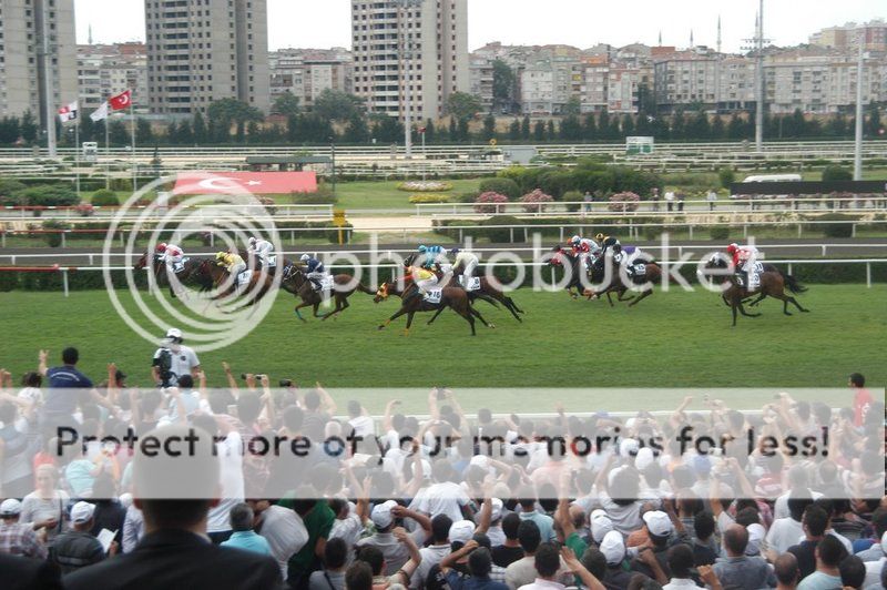
Veliefendi Race Course (Turkish: Veliefendi Hipodromu) is a horse racing track located at Veliefendi neighborhood in Zeytinburnu district of Istanbul. It is country's oldest and biggest race course founded on a former grassland that was historically a farm belonging to Şeyhülislam Veliyüddin Efendi, an 18th century superior authority of Islam in the Ottoman Empire. The race course was constructed in the years 1912 - 13 by German specialists upon the initiative of Enver Pasha.

Istanbul Veliefendi Racecourse is established on 596.000 square meters land. It has one 2020 meters long , 27-36 meters wide turf, and one 1870 m long, 17.5-19 m. wide synthetic (Polytrack) tracks. At the inmost of the tracks, It has also a sand training track 1720 m in length and 14-16 m in width.

Inside the racecourse area there are Club and associations locals, administrative buildings, racehorse hospital, apprentice training center, gift shop, museum and exhibition place, two Grand stands and a giant led - screen of 102 m2, a picnic area with 110 tables, 1 play garden, various cafeterias and a car park.

Physical attributes

The race course covers an area of 59.6 ha (147 acres) consisting of facilities for racing, training and barns. The race course has three interleaved tracks as :
a 2,020 m (2,210 yd) long and 27-36 m (89-118 ft) wide turf oval,
a 1,870 m (2,050 yd) long and 17.5-19 m (57-62 ft) wide synthetic track (Polytrack) for all-weather racing and
a 1,730 m (1,890 yd) long and 16-17 m (52-56 ft) wide sand oval for training.

The track's seating capacity is 7,600. Inside the racecourse area there are Club and associations locals, administrative buildings, racehorse hospital, apprentice training center, gift shop, museum and exhibition place, two Grand stands and a giant led - screen of 102 m2, a picnic area with 110 tables, 1 play garden, various cafeterias and a car park.

Major races

Gazi Race (Gazi Koşusu), is the most prestigious Turkish Oaks, and is held since 1927 in memory of Mustafa Kemal Atatürk, who was awarded the honorific title "Gazi" (Ghazi). Initially run in Ankara, the event was later transferred to Veliefendi Race Course. Since 1970 is accompanied with a silver equestrian statue of Atatürk.

Prime Minister's Race (Başbaşkanlık Koşusu) is a Turkish Oaks held since 1951. A trophy bestowed by the Turkish prime minister.

LOCATION SATELLITE MAP


These scripts and photographs are registered under © Copyright 2016, respected writers and photographers from the internet. All Rights Reserved.
Tuesday, December 27, 2016

DARÜLACEZE (HOSPICE)

Okmeydanı, Şişli - İstanbul - Turkey

GPS : 41°03'34.0"N 28°58'00.0"E / 41.059444, 28.966667

Darulaceze (Hospice) / Okmeydani - Istanbul photo darulaceze102.jpg

PHOTOGRAPHS ALBUM

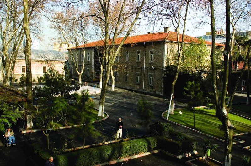
Sultan Abdülhamit Han II, who founded Darülaceze in 1896, was hoping to give shelter to all beggars, homeless children living in the streets, and homeless people sleeping in the courtyards of mosques. He also wanted to take good care of all crippled people in Istanbul. He brought them together in a peaceful environment and helped them earn their own living by teaching them various crafts.

Darülaceze - which derives from the Arabic words “dar,” meaning home, and “aceze,” meaning weak or incapable - is a homeless shelter for those without families, built by Sultan Abdülhamit II when the number of beggars in İstanbul increased enormously, most of whom were not disabled or orphaned, but simply preferred not to work.

The Great Sultan donated some of his personal belongings to be used for the initial expenditures of Darülaceze, as cash or as their own. Those belongings that were worth more than seven thousand gold coins were exhibited in a mansion on Istiklal Street and sold later on. This first contribution is a significant event in the history of Darülaceze, and his personal belongings still carry a special mark as a symbol of the contribution.

Sultan Abdülhamit also granted ten thousand gold coins from his own budget because he was impatient about the start of construction. With these significant contributions and many other contributions from other people, the institution was founded and the tradition of providing receipts of "donation to Darülaceze" has begun.

The construction of the building started on the 10 November 1892. The building was constructed by the architect Vasilaki Yanko and coasted 58 thousands lira. The opening ceremony took place 31 August 1895, on the coronation anniversary of the Sultan Abdülhamit II. The keys to the building were presented to the Sultan by Halil Rifat Paşa. In 1903 the children section, in 1904 the laundry were added to the complex.

Today there are 20 buildings in the complex of the Darulaceze, among them a church, a mosque and a synagogue. Under the dormitories, the buildings had dining halls and workshops where various goods were produced. The Muslim and Christian buildings both had public baths and two-story hospitals. Muslims were given a mosque and Christians were given two churches: one for Armenians and another for Greeks.

Official records show that, after opening in 1896, Darülaceze hosted 9,394 people until 1909. In 1909 a total of 1,002 people were living in Darülaceze, including 1 Bulgarian, 50 Jews, 4 Armenian Catholics, 63 Armenians, 122 Greek Orthodox and 762 Muslims.

LOCATION SATELLITE MAP


WEB SITE : Darülaceze Administration

MORE INFO & CONTACT
E-Mail : darulaceze@darulaceze.gov.tr
Phone : +90 212 210 1895
Fax : +90 212 210 1896

These scripts and photographs are registered under © Copyright 2016, respected writers and photographers from the internet. All Rights Reserved.
LAND REGISTRY AND CADASTRE BUILDING

Sultanahmet, Fatih - İstanbul - Turkey

GPS : 41°00'22.8"N 28°58'30.9"E / 41.006333, 28.975250

Land Registry & Cadastre Building / Sultanahmet - Istanbul photo tapukadastro101.jpg

PHOTOGRAPHS ALBUM

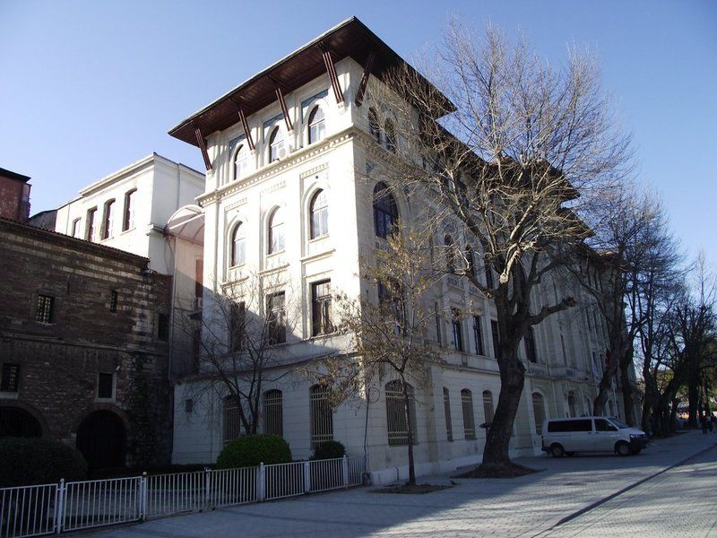
The building of Regional Directorate of Land Registry and Cadastre consists of two parts.The first part which was constructed in 1881 is still using for archiving and dinning hall. In 1881 when it was constructed it has begun to serve for official land registry operations and called "Defter-i Hakani Nezareti" ( The Ministry of State Responsible for Land Registry and Cadastre).

The second part at the Sultanahmet square is used for Regional Directorate of Land Registry and Cadastre building was constructed later. In 1897 the place of the second part was bought by giving 34.000 Kuruş (1 Turkish Lira=100 Kuruş) to a restaurant and two driver shops.

Then today's building has been constructed in 1910 by destroying those two shops and architectured by Mehmet Vedat Efendi designed the building in a harmony to the monumental glory of the adjoining, İbrahim Paşa Palace. The four storey building has pointed arches on the outside and is decorated with ceramic tiles, one of the important characteristics of the National Architecture Movement.

In 1920, with a new decision the possession of the building transfered to Treasury, however it has been registered to the name of Land Registry and Cadastre. However it has transfered to Treasury, it is still giving activity as Regional Directorate of Land Registry and Cadastre.

One of the most important groups of the bound registers is the Taḥrir Defterleri (or defter-i hakani, the Cadastre Records). They contain, in detailed (mofassal) and brief (ejmal, mojmal) versions, economic surveys (taḥrir) of the districts listing all the human and economic resources, town-by-town and village-by-village. These registers provide very important and detailed social, economic, demographic, and legal information for scholars

LOCATION SATELLITE MAP


WEB SITE : İstanbul Tapu ve Kadastro

MORE INFO & CONTACT
E-Mail : istanbul-hukuk@tkgm.gov.tr
Phone : +90 212 518 1700

These scripts and photographs are registered under © Copyright 2016, respected writers and photographers from the internet. All Rights Reserved.

KARAKÖY PALAS

Karaköy, Beyoğlu - İstanbul - Turkey

GPS : 41°01'23.8"N 28°58'31.3"E / 41.023278, 28.975361

Karakoy Palas / Beyoglu - Istanbul photo karakoy_palas103.jpg

PHOTOGRAPHS ALBUM

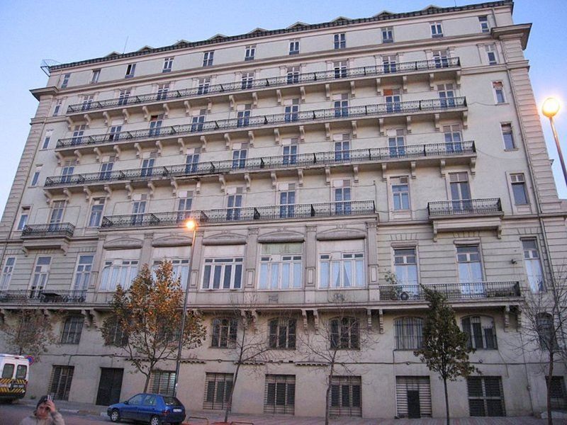
One such building is Karaköy Palas, located in Karaköy Square. Built in the 1910s and designed by Levantine architect Guilio Mongeri, who also designed the St. Antoine Catholic church in Beyoğlu, this building resembles an Italian palazzo, but with strong Byzantine and Ottoman influences.

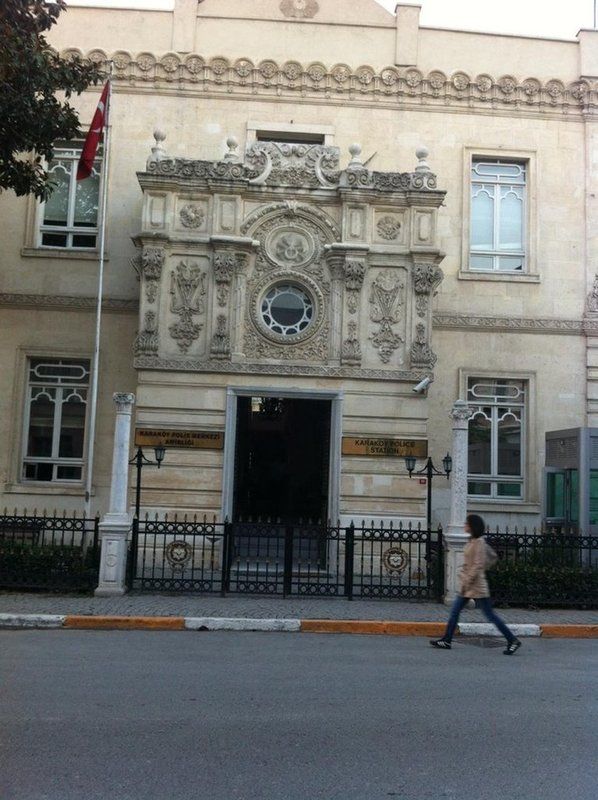
Other noteworthy buildings are located on the street behind the harbor. One in particular stands out, with décor that is so ornate it resembles a wedding cake. Its actual function, rather incongruously, is a police station.

Karaköy Palas has taken its place in our near architecture history as a work built at the end of 1910s by the Istanbul born Laventine Guilio Mongeri, a leading architect of its time. Although the building was planned as a four storey one at the beginning, the design was affected by the requirement that it had to be used jointly by three different establishments. In a sense, the unusual asymmetry felt in the facade arrangement is a reflection of this design.

The entrance in the middle is the entrance of the office building. The entrances on the right and the left are probably for the sections allocated to banking establishments. The entrance on the left is emphasized by a semi-circular arch surrounded by porphyre panels. Similar arches recur both on doors and also on windows.

The top section of the left entrance extending towards the roof incorporates the most variable interpretation of the whole façade: The two-storey “oriel”, which is arch segment shaped right above the entrance, transforms into a balcony on the third floor.

The small balconies on the same floor try to save the area between the two exaggerated wedges enriched by small masonry consoles from surface plainness aligning over the windows of the two floors below.

The window crowned with a rather flat arch between the two towerettes with a semi-circular coping at roof level is the termination of the left entrances design which renders the whole façade asymmetrical.

The busy floral and geometrical decorations which display a balanced use on the whole façade and the interpretation of the classical period Byzantine structural elements seems to be a tribute by Mongeri to a Byzantine architecture which he knows very well as an instructor centuries later.

Mongeri designed the building with the diligence and care found in all his buildings and has moved his own office to this building upon completion.

LOCATION SATELLITE MAP


These scripts and photographs are registered under © Copyright 2016, respected writers and photographers from the internet. All Rights Reserved.
Monday, December 26, 2016

RÜSTEM PASHA CARAVANSERAI

Karaköy, Beyoğlu - İstanbul - Turkey

GPS : 41°01'21.3"N 28°58'19.5"E / 41.022583, 28.972083

Rustem Pasha Caravanserai / Karakoy - Istanbul photo rustem_kervansaray107.jpg

PHOTOGRAPHS ALBUM

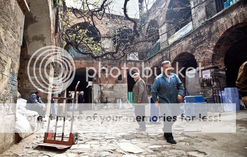
The Rüstem Pasha Caravanserai, also known as Kurşunluhan, was built upon the foundations of ruined San Michelle Genoese Church in Galata, Balıkpazarı Kardeşim Street by Sinan the Architect between 1544 and 1550. During the Byzantine Period, measuring instruments were being adjusted in the church. The construction of the caravanserai commenced after Hacı Halil Ağa masjid, which was the first to be built after the conquest, was relocated in Yenibahçe.

The Rüstem Pasha Caravanserai, this building was built for the grand vizier to Süleyman the Magnificent in the 1540s. Remarkably, it survives to this day, unrestored, with its eight domes intact. The caravanserai was built over the ruins of a Genoese Cathedral.

This peculiar architecture is probably the most hidden work by Mimar Sinan in Istanbul. Disguised behind an anonymous door in the un-touristy side of Karaköy, in the vicinity of the Tünel funicular stop and the port, this building, formerly known as Rüstempasa Caravensarai, was a roadside inn were merchant travelers, their servants and animals could rest at the end of a day's journey.

This type of building has existed since the 10th century, when they were built outside the walls of the city and along caravan routes (therefore the Turkish name Caravensarai, caravan palace). They supported the flow of commerce, people and information across the network of trade routes covering Central Asia and Middle East, the Silk Road being the most famous one among them. The Grand Vizier Rüstem Pasha commissioned Sinan to build this large inn just outside the walls of the Galata district.

The two storey han, favoured by mostly Christian customers, measures 83 x 35 m with a courtyard measuring 8.1 x 43.2 m. The han contains 27 rooms and 2 courts on the first floor, and 30 rooms on the second floor and eight-domes. It is mentioned as Kurşunlu Han in the 1561 Foundation Charter of Rüstem Pasha. The two-storey building has a narrow and elongated open courtyard. It is open to the public, except on Sundays.

Rüstem Pasha Han (or Kurşunlu Han) is still a working han. Corinthian cap on the left at the entrance. It was probably taken from a church that was turned down when the han was built, and pressed into service as part of a water pump.

Behind an undignified sole entrance, embedded between narrow streets filled with shops selling electronics and hydraulic machinery, the rectangular two story space consists of a central court surrounded by a cloister-like arcade. The ground floor is connected by an open stone stairway to a second story that is ringed by masonry pointed arches that give access to many small rooms.

At its peak, the ground floor was used for storing the bales of merchandise or stabling the camels, and the upstairs chambers lodged the travelers. Nowadays the entrance level is a godforsaken storage space where merchandise is scattered across the floor and the upper floor rooms are used by tornacis (turners) and other craftsmen. The courtyard is open to the sky and has a pleasant grape vine that somehow evokes the Ottoman times when the place was full of life.

LOCATION SATELLITE MAP


These scripts and photographs are registered under © Copyright 2016, respected writers and photographers from the internet. All Rights Reserved.
CAMONDO STAIRS

Karaköy, Beyoğlu - İstanbul - Turkey

GPS : 41°01'31.7"N 28°58'27.2"E / 41.025472, 28.974222

Camondo Stairs / Karakoy - Istanbul photo kamondo_stairs108.jpg

PHOTOGRAPHS ALBUM

The Kamondo Stairs is a gorgeous spot that ties everything in Karaköy together. Donated by Abraham Camondo, a Sephardic Jewish banker, the baroque styled Camondo Stairs (or Camondo steps) offer a shortcut from Voyvoda Street to some of Istanbul’s most tony 19th century neighborhoods.

The name of the Camondo family is recorded in Ottoman documents after 1782 and it is thought to have been built by the Portuguese or Spanish Camondo Family. Banker Avram Camondo, born in Ortaköy in 1781, was one of the partners of the Dersaadet Bank, founded in 1845. The right of confiscation, not given to just anyone but given to only him by means of his friendship with Ottoman Sultan, enable him to confiscate the properties of the people in debt, who could not pay their credit debts, and he became rich in property.

He wanted to make reforms in education, and after facing the strong reaction of his community, the family acquired citizenship of the Kingdom of Italy in 1856. The banking jobs of the family were moved to Paris at the request of Avram and Nissi, grandsons of Avram Camondo, in 1869.

Avram Salomon, died in Paris in 1873, and was buried in his grave, built long before his death in Hasköy. The family business which had continued in Paris ended in 1940 with the German invasion. Many of the Camondo Family members, mentioned in the last years of the Ottoman Empire, died in Nazi camps.

Irene Camondo, the last member of the family, became a Catholic and survived she died after the war. This family is now extinct; the last descendants, Béatrice de Camondo with her two children (Fanny and Bertrand) and with her husband Léon Reinach were deported and murdered in Auschwitz from 1943 to 1945 during World War II. The name of family is living with the staircase, which was built between Bankalar Street and Banker Street in Karaköy between 1870 and 1880.

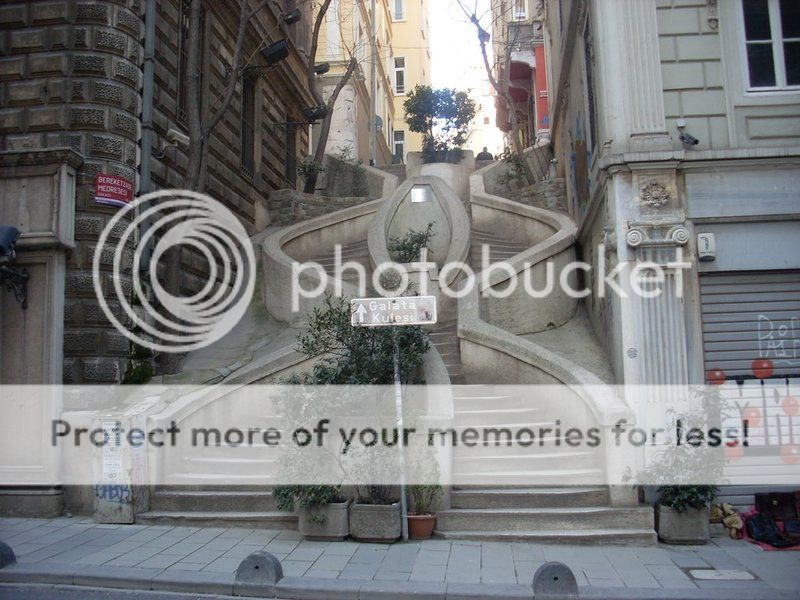
Camondo Merdivenleri (Camondo Stairs) in Galata (Karaköy - Istanbul) were a public service project donated by the Camondos, a wealthy Istanbul Jewish family. The stairs climb the hill from the Galata docks and Bankalar Caddesi (Avenue of the Banks) up to the fashionable 19th century neighborhoods where the Camondos built an imposing edifice to house a school.

These very special stairs have a hexagonal shape. It is said that this shape was arranged this way, so that if a child would slip while climbing down, the other bevel would prevent them from falling. These stairs were built to facilitate the transport of Camondo’s children to reach school and to cut down Camondos way to the Banks Avenue, built by them as well.

The Camondo Steps, a famous pedestrian stairway designed with a unique mix of the Neo-Baroque and early Art Nouveau styles, and built in 1860 by the renowned Ottoman-Venetian Jewish banker Abraham Salomon Camondo, is also located on Bankalar Caddesi.

The steps lead upstairs to the historic Rue Camondo (present-day Banker Sokak), a parallel side street where the ruins of the Genoese Palazzo del Comune (1316), built by Montano de Marinis, the Podestà of Galata, is located a few meters to the left (west) of the stairway, behind the façade of the 1880s Bereket Han office building on Bankalar Caddesi.

What makes this stairs very special is their hexagonal shape, which - it is said - was arranged so that if a child would slip while climbing down, the other bevel would prevent her or him from falling.

The Camondo family was a prominent European family of Jewish financiers and philanthropists. After the 1497 Spanish decree (that ordered the expulsion of all Jews who refused conversion to Catholicism) the family settled in Venice where some members became famous by their scholarship as well as by the services they rendered to their adopted country.

Following the Austrian takeover of Venice in 1798, members of the family moved to Istanbul where, despite the many restrictions imposed on all minorities, flourished as merchants. In 1802 the family founded the Isaac Camondo & Cie Bank, inherited by Abraham Salomon after his brother Isaac’s death in 1832.

Abraham Salomon prospered greatly, became the prime banker to the Ottoman Empire (until the founding of the Imperial Ottoman Bank in 1863) and financially contributed to the liberation of Venice from the Austrian Empire (for this, the King Victor Emmanuel II conferred upon him the title of count, with the privilege of transmitting it in perpetuity to the eldest son of the family). He died in Paris in 1873 but, in accordance to his wishes, his remains were returned to Constantinople and were buried in the Jewish cemetery at Hasköy, a neighborhood on the Golden Horn in Istanbul.

According to a plaque on the stairs: “Camondo Stairs had been constructed by the Camondo Family around 1870-1880 and repaired by the Beyoğlu Municipality Quincentennial Foundation.” The stairs are sculpturally interesting and in good repair.

LOCATION SATELLITE MAP


These scripts and photographs are registered under © Copyright 2016, respected writers and photographers from the internet. All Rights Reserved.
KARAKÖY AZİZİYE KARAKOLU

Karaköy, Beyoğlu - İstanbul - Turkey

GPS : 41°01'28.2"N 28°58'47.5"E / 41.024500, 28.979861

Karakoy Aziziye Karakolu / Beyoglu - Istanbul photo karakoy_karakolu105.jpg

PHOTOGRAPHS ALBUM

Karaköy Aziziye Karakolu (police station), by the Ottoman Palace architect Raimondo D’Aronco, originally from Italy, during the reign of Sultan Abdülhamid II. He was commissioned to build many civil and institutional buildings, all in the neo-classical style of the time.

Raimondo Tommaso D’Aronco (1857 - 1932) was an Italian architect renowned for his building designs in the style of Art Nouveau. He was the chief palace architect to the Ottoman Sultan Abdülhamid II in Istanbul, Turkey for 16 years.

This highly ornate police station had a lot of leaf motifs (thus commonly known as Süslü - decorated - Karakol) and its purpose was to monitor the significant human traffic across the Galata bridge. When in 1894 it suffered damage in an earthquake, it was repaired by the same architect. The building was later demolished and in its place in 1910 was erected the state maritime lines offices (Seyrüsefain İdaresi), which was in turn also later demolished.

LOCATION SATELLITE MAP


These scripts and photographs are registered under © Copyright 2016, respected writers and photographers from the internet. All Rights Reserved.
Sunday, December 25, 2016

BAB-I ALİ GATE

Gülhane, Fatih - Istanbul - Turkey

GPS : 41°00'40.1"N 28°58'40.8"E / 41.011140, 28.977991

Bab-i Ali Gate / Gulhane - Istanbul photo babiali_gate107.jpg

PHOTOGRAPHS ALBUM

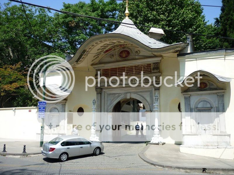
The ornamental crown gate in Alemdar Street opening to İstanbul is a synecdoche for the Ottoman Empire, referring to the High Gate of the Divan (court). In the beginning, the structure used to be called ‘Pasha Gate’ or ‘Bâb-ı Âsafi’.

A block beyond the mosque we come to Alemdar Caddesi, the avenue which skirts the outer wall of Topkapı Sarayı. Just to the left at the intersection we see a large ornamental gateway with a projecting roof in the rococo style. This is the famous Sublime Porte, which in former days led to the palace and offices of the Grand Vezir, where from the middle of the seventeenth century onwards most of the business of the Ottoman Empire was transacted.

Hence it came to stand for the Ottoman government itself, and ambassadors were accredited to the Sublime Porte rather than to Turkey, just as to this day ambassadors to England are accredited to the Court of St. James. The present gateway, in which it is hard to discover anything of the sublime, was built about 1843 and now leads to the various buildings of the Vilayet, the government of the Province of Istanbul. The only structure of any interest within the precinct stands in a corner to the right of the gateway.

This is the dershane, or lecture-hall of an ancient medrese; dated 1565, it is a pretty little building in the classical style of that period. The Sublime Porte, also known as the Ottoman Porte or High Porte (Ottoman Turkish: Bâb-ı Âli or Babıali, from Arabic: bāb "gate" and Arabic: alī "high"), is a metonym for the central government of the Ottoman Empire, by reference to the gate giving access to the block of buildings that housed the principal state departments in Istanbul. Today, the buildings house the provincial Governor of Istanbul.

Porte is French for "gate". When Sultan Suleiman the Magnificent sealed an alliance with King Francis I of France in 1536, the French diplomats walked through the monumental gate or Bab-ı Ali in order to reach the Vizierate of Constantinople, seat of the Sultan's government. French being the language of diplomacy, the French translation Sublime Porte (the adjective being unusually placed ahead of the word to emphasise its importance) was soon adopted in most other European languages, including English, to refer not only to the actual gate but as a metaphor for the Ottoman Empire.

"Sublime Porte" was used in the context of diplomacy by Western states, as their diplomats were received at the porte (meaning "gate"). During the second constitutional era of the Empire after 1908 (see Young Turk Revolution), the functions of the classical Divan-ı Hümayun were replaced by the reformed Imperial Government, and "porte" came to refer to the Foreign Ministry. During this period, the office of the Grand Vizier came to refer to the equivalent to that of a Prime Minister, and viziers became members of the Grand Vizier's cabinet as government ministers.

LOCATION SATELLITE MAP


These scripts and photographs are registered under © Copyright 2016, respected writers and photographers from the internet. All Rights Reserved.
MİHRİŞAH VALİDE SULTAN İMARETİ

Eyüp - İstanbul - Turkey

GPS : 41°02'54.6"N 28°56'05.0"E / 41.048500, 28.934722

Mihrisah Valide Sultan Imareti / Eyup - Istanbul photo mihrisah_imaret103.jpg

PHOTOGRAPHS ALBUM

One of the best examples of this is the imaret (soup kitchen for the poor) and külliye (ensemble of buildings with philanthropic purposes) built in Eyüp thanks to Mihrişah Valide Sultan, head wife (başkadın) of Sultan Mustafa III and mother of Sultan Selim III. She was very religious, a philanthropist, motivated by public spirit, but nevertheless disdained politics. This institution, with the legal structure of a religious foundation was inaugurated in 1208 of the Muslim Era (1793) and has been operating uninterruptedly over 2 hundred  years.

It is still a source of hope and security for the poor even in our days. The purpose of this paper is to present the deed of trust of this foundation (vakfiye), trying to reflect as much as possible the spirit and style with which it was written. This vakfiye reflects the way philanthropy and public spirit and service were viewed in those days and also the social and economic structure of that period. This document states and declares that the following were entrusted to the foundation :

"...The 1400 square cubit lot in the Cami-i Kebir neighbourhood, near the Bostan wharf, with exactly defined borders until now was used by the Hz. (abbreviation of Hazreti, which is a title that denotes great respect) Ebu Eyyubel Ensari foundation with a yearly income of 1800 akçe (silver coin) and the following built on this land parcel with the hope of gaining divine favour and of having done a good deed; two stone rooms for the mausoleum keepers, two stone rooms for the bakers, two stone baking rooms, two stone rooms for the administrator, one sitting room, one stone room for the keeper of the sebil (free water distribution point), a kitchen, four toilets, a pantry, (another) kitchen, a baking oven, a big food warehouse, an imaret with adjoining buildings, a mausoleum, a sebil, a fountain and other service buildings... "

A 361.5 square cubit lot, which until now was used by the Hz. Ebu Eyyub-el Ensari foundation with a yearly income of 360 akçe and which is surrounded by the mansion of the palace cleric Seyyit Osman Efendizade, by the mansion of the famous madrasa (theological school) teacher Seyyit Mahmut Molla, by the sea-shore and by the road on its other two sides, over which there is a boat-house with two cells, a coffee house and three adjacent stone shop buildings.

The 1503.5 square cubit lot, enclosed by a stonewall, over which there is the wood warehouse of the imaret. The lot in the Cami-i Kebir neighbourhood, surrounded by the Türbe Bath and its furnace, by the house of Hüseyin Ağa, by a school and by two roads, one public, one private, which was bought from the Sinan Paşa religious foundation, together with the source of clean and good quality water in it having the capacity of a masura (unit of measure).

The three houses with a yearly income of 180 akçe of the Hz. Halit religious foundation. The eight measures of water provided by the K›rkçeflme water establishment to the mausoleum, the fountain and the sebil. The noble mosque at the Hasköy Bombardier and Supper Corps barracks. The following were entrusted to the foundation with the aim of covering its expenses :

"60 rooms near the Vefa mosque in Istanbul set on more than one storey and built with their own materials, four big stables, one warehouse, a barn, a coal shed, two masura of clean water, 15 toilets, a courtyard surrounded by a stone wall, a big inn with 20 shops, a corridor and an entrance; an oil making establishment, a workshop to manufacture pots and pans and a painting workshop at the Çelebioğlu neighbourhood of Istanbul; the ten rooms, wooden storehouse, two toilets, tripe selling establishment, two storey stone storehouse, ceramic cup shop on a 1675 square cubit lot at the Çelebioğlu neighbourhood; the Leblebiciler Inn together with an adjoining empty lot and a stable at the Çelebioğlu neighbourhood; 20 rooms set on more than one storey, two open sheds, a kitchen, a natural paint making workshop at the Veliefendi Çeşmesi neighbourhood of Eyüp."

In addition to this, farms, warehouses full of seeds, dairies, flour mills, paint making workshops, workshops with warrants (gedik), turquoise workshops, fruit vending shops and other establishments providing a cash flow in places like Çengelköy, the Levent Farm, Kasımpaşa, Yenişehir, İznik, various towns in the province of Muğla, Büyükdere, Küçükçekmece and various neighbourhoods of Eyüp, were entrusted to this religious foundation, so that it could exist until the end of time. All these and more were listed in the vakfiye from the 5th to the 37th page, together with their locations, areas and detailed descriptions.

One could get suspicious about such a great wealth and about the ways it was obtained, but it is to be taken into account that Ottoman Courts would never have approved the registration of a religious foundation created with wealth of dubious origins. It is also to be taken into account that the valide sultan (mother of the sultan and the Turkish equivalent of the queen mother) was one of the highest ranking functionaries of the Ottoman State. Accordingly, Mihrişah Valide Sultan, the virtues of whom we have mentioned, spent her wealth for the good of humanity, in a way befitting someone of noble spirit.

Beginning from the 41st page there is the list of the duties and services and the payments and benefits, both in cash and in kind to people like the cleric, the preacher, the müezzin, the keeper of the Quran, the reciters of various prayers and various scholars. The duties of the various people on festive occasions like the kandil nights or the two main festivities were also listed in detail.

The duties of the keepers of the mausolea, the number of oil lamps to be lighted, the way fountains and sebils were to be kept, the offerings to the public, the ceremonies at the Mevlevî dervish orders, the offerings to the dervishes and many many more elements are described in details.

The Eyüp imaret is still a very important institution within the General Directorate of Religious Foundations. Its daily capacity, which was of 1000 people until the end of 1997, has been increased to 2500 at the beginning of 1998. The imaret has been modernised and steam cauldrons have been added. The widespread custom of ritually slaughtering animals within the imaret has been taken into consideration by the General Directorate of Religious Foundations, with the result that a modern facility for this has been added.

The various parts of the slaughtered animals like the offal, except the meat, are auctioned off and the income is used for good deeds and for the upkeep of the imaret. The meat is frozen, processed and then kept in special freezers with a capacity of 35 tons. The quantity of meat donated is about 250 tons a year. This meat is cooked and distributed by six kitchens in various parts of Istanbul.

Some of this meat is distributed to other philanthropic institutions all over Turkey, by means of a refrigerated lorry, so that hot meals can be given to the needy. This imaret used to help more than 10,000 poor students in around 60 youth hostels, until these were transferred to the Ministry of Public Education, in 1999, with fictitious pretexts.

This institution, created thanks to the benevolence of the noble spirited Mihrişah Valide Sultan, has been favoured with the interest of many people, also because of the sanctity of its surroundings. The city administration is adding a modern and hygienic slaughtering facility to the building described as firewood storehouse in the vakfiye and also other facilities.

The General Directorate of Religious Foundations and the Istanbul City Administration, both of which are public institutions, should come to an agreement so that the imaret can be administered-as a living museumby the General Directorate of Religious Foundations, as required by the Principles of Religious Foundations, the better to use this unique institution.

The General Directorate of Religious Foundations and the Istanbul City Administration should also take into consideration the interest shown to the Mihrişah Valide Sultan imaret, in addition to that shown to other nice places in the district of Eyüp, by both local and foreign tourists.

LOCATION SATELLITE MAP


These scripts and photographs are registered under © Copyright 2016, respected writers and photographers from the internet. All Rights Reserved.
BALIKLI AQUEDUCT

Yunus Emre, Sultangazi - İstanbul - Turkey

GPS : 41°05'31.0"N 28°54'25.0"E / 41.091944, 28.906944

 photo balikli_aqueduct103.jpg

PHOTOGRAPHS ALBUM


The aqueduct is 125 metres long and 3 metres wide and 3.5 m in height. The aqueduct has 9 bays.

This aqueduct 4 km south of Cebeciköy is the largest of the aqueducts which were entirely rebuilt in the 15th century during the reign of Sultan Mehmed II on the Roman water line leading from Cebeciköy to Bozdoğan. It is named after an underground pool of water, Balıklı Havuz or Pool with Fish, dating from the late Roman period.

Pool is 12 m x 18.4 m and have 3 rooms.

LOCATION SATELLITE MAP


These scripts and photographs are registered under © Copyright 2016, respected writers and photographers from the internet. All Rights Reserved.
Saturday, December 24, 2016

GÖZLÜCE AQUEDUCT

Cebeci, Sultangazi - İstanbul - Turkey

GPS : 41°07'19.6"N 28°53'55.4"E / 41.122111, 28.898722

 photo gozluce_aqueduct105.jpg

PHOTOGRAPHS ALBUM

Gözlüce or the Güzelce Aqueduct is located on the Cebeci stream and is 5 km away from Başhavuz. The aqueduct was built of cut stone and there are eight arches on the first layer and eleven arches at second layer. These piece of art, also known as Cebeciköy Aqueduct, was contructed by Mimar Sinan during Kanuni Sultan Suleyman’s period, and lies 1500 m in east of the village of Cebeci, south of Kemerburgaz.

This is the Güzelce (also called Gözlüce or Cebeciköy) Aqueduct, one of the most significant aqueducts in the Kırkçeşme Water Works System.  The structure now remains in the Alibeyköy Dam Lake. There are two different routes that take us to the aqueduct, one leading to its east, the other to its west side.

The aqueduct built by Sinan which are perhaps the most significant ones among structures that deal with water systems. The aqueduct’s walls are 5.4 m thick at the bottom and 2.6 m thick at the highest point, at 29.5 m in height. The aqueduct is at 155 m length. Also known as the Cebeciköy Aqueduct, it resides within the Alibeyköy regional water collection basin.

Located far, in such a natural environment, in addition to its architectural quality, it has ensured preservation as well as its original design and construction characteristics; today, the Aqueduct still displays its 16th century monumentality. Parts of the lower section has recently been restored using cement-mix mortar.

This is one of the 33 aqueducts that take place within Kırkçeşme Water Supply System. The goal was to bring water from Belgrad Forest and Kemerburgaz to Eğrikapı cellar, over Eyüp. Güzelce Aqueduct, also known as Gözlüce Aqueduct was constructed by Architect Sinan during the period of Kanuni Sultan Süleyman the Magnificent, located 1500m east of Cebeci Village, near Kemerburgaz.

Incidental to the increase of population, Sultan Süleyman wanted to bring water from the north of the city, which is known as Belgrad Forests area, to fulfill the needs for water in the city. This aqueduct is also known as Cebeci Aqueduct, as it is located over the Cebeciköy River. As a result of inundation in 1563, Güzelce Aqueduct has been completely seperated from its foundation but did not collapse.

That is why the construction of the structure lasted 9 years. Güzelce Aqueduct, with its water supply system is an important example, indicating the great organization achievement; as it was built within a 9 years of period, which is considered to be a short time for that era in which many monuments were being erected.

The 16th century aqueduct of Sinan has been completely seperated from its foundation but did not collapse, as a result of an inundation in 1563, Güzelce Aqueduct. That is why the construction of the structure lasted 9 years.

Today, there is only a thin water flow, passing under the aqueduct. Structure is almost totally visible. The structure can be mentioned as a well preserved one, among Sinan's works of architecture. However, the lower levels of the aqueduct is lately repaired by concrete mortar.

Exit to TEM from the Kemerburgaz-Hasdal road, then take the Alibeyköy exit and drive towards Gazi Neighborhood.  Within a short while, you will drive through uneven dirt roads to two more 16th century aqueducts built by Sinan which are perhaps the most significant ones among structures that deal with water systems.

LOCATION SATELLITE MAP


These scripts and photographs are registered under © Copyright 2016, respected writers and photographers from the internet. All Rights Reserved.
AVASKÖY AQUEDUCT

Atışalanı, Esenler - İstanbul - Turkey

GPS : 41°03'04.9"N 28°53'00.7"E / 41.051361, 28.883528

 photo avaskoy_aqueduct102.jpg

PHOTOGRAPHS ALBUM

Avasköy Aqueduct (Karakemer, Tekkemer, Yılanlıkemer) situated in Atışalanı, with 11 arches and a single storey it is 10.3 m in height. The Avasköy aqueduct was built by Mimar Sinan. It is at 109.5 m in length and the opening of space at the middle arch is 6 m and at the others are 4.5 m.  The inner diameter of the water pipe drains of this aqueduct which had been built by using hard limestone are 21 cm.

This aqueduct is known as Avasköy Aqueduct or Yılanlıkemer in old maps and the water pipes of Süleymaniye and Beylik waters flows on this aqueduct. The aqueduct was constructed by Mimar Sinan. Avasköy Aqueduct is mentioned both in Tezkiret'ül-Bünyan and Tezkiret'ül-Enbiye among the aqueducts constructed by Mimar Sinan.

The elegance and applied technique in the structure of this aqueduct demonstrates that it is a structure of Mimar Sinan. Arch buttresses that Sinan had applied to Uzunkemer, Paşa Aqueduct and the other aqueducts in order to meet the horizontal forces has been applied to this aqueduct in the same way, too. These arch buttresses have asperities with width of 3 m. and base of 0,60-0,75 m and they are becoming zero at the top.

This aqueduct was drawn with 11 apertures in the map of Süleymaniye Waterways; it was drawn with 12 apertures in the map dated 1607 which is found in the Library of Ahmed III of the Topkapı Palace Museum and it was also drawn with 12 apertures in the map dated 1748.

Esenler, a residential area from the Byzantines. The most ancient people of this region were the Greek people who lived in the villages named Litros (Esenler) and Avas (Atışalanı). The Avas Esenler and Atışalanı villages were Istanbul's Byzantine villages during the magnificent period of time of Byzantine Empire until the conquest by the Turks in ancient times and contributed to Byzantine Empire by growing agricultural products.

LOCATION SATELLITE MAP


These scripts and photographs are registered under © Copyright 2016, respected writers and photographers from the internet. All Rights Reserved.
MAZULKEMER AQUEDUCT

Atışalanı, Esenler - İstanbul - Turkey

GPS : 41°04'15.5"N 28°51'04.3"E / 41.070972, 28.851194

 photo mazul_aqueduct104.jpg

PHOTOGRAPHS ALBUM

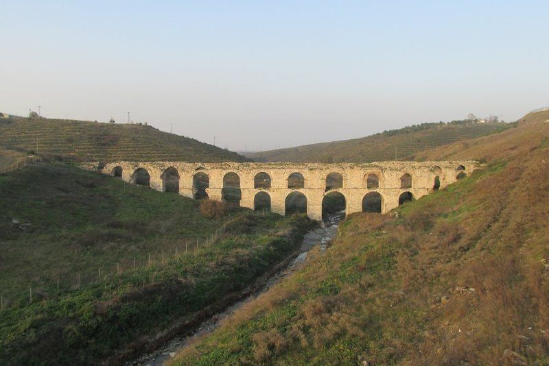
Mazulkemer Aqueduct (Kemerkece), located on Uzuncaova stream close to Esenler, Mazulkemer is within a restricted military zone. The name Mazulkemer means dismissed or suspended. The first water supply systems which were built in Istanbul date back to the foundation of the city. Two of the greatest aqueducts built in the Roman period are the Mazulkemer Aqueduct and the Valens Aqueduct.

These aqueducts were built in order to channel water from the Halkalı area in the western edge of the city to the Beyazıt district in the city center, which was known as the Forum Tauri in the Roman period. After reaching the city center, the water was later collected in the city's numerous cisterns, such as the famous Philoxenos (Binbirdirek) Cistern and the Basilica (Yerebatan) Cistern.

This aqueduct, which was built in the 4th century, underwent restoration in 741 - 775. An important part of the Süleymaniye Water Ways, the aqueduct was called the Beylik Water Way following its restoration in the reign of Sultan Mahmut I (1730 - 1754). The length of the aqueduct is 110 m, and there are thirteen arches above and seven arches (since two of them were broken, only five of the bottom ones can be seen.)

In addition to the Forest of Belgrade, to the north of the city, the rich aquiferous zone around Halkalı west of the city provided the main local sources of water (Çeçen 1991). The archaeology of water supply systems in both these areas is dominated by remains of the Ottoman supply systems that superceeded the Byzantine.

Extensive repairs to the Halkalı line immediately followed the conquest of the city by Sultan Mehmet II and more lines were gradually added. Some 17 individual channels dating to the Ottoman period are known to have emerged from the Halkali region to supply the city. However the commanding presence of the Mazulkemer, a massive two-tier water bridge perhaps alludes to a longer period of activity.

In form and composition the Mazulkemer appears to be different from other Ottoman aqueducts on the same line. For this reason it has been suggested that this aqueduct might originally have been built for the Roman system, that was supplemented in the 4th century by the long-distance line. Evidence of major rebuilding on this bridge suggest that it was active for a considerable period of time at at some point its arches required strengthening.

The bridge is now within the confines of a Military Zone, which has prevented closer study, but at the same time served to protect the monument.

LOCATION SATELLITE MAP


These scripts and photographs are registered under © Copyright 2016, respected writers and photographers from the internet. All Rights Reserved.
Friday, December 23, 2016

HACI BEKİR since 1777

Bahçekapı, Fatih - İstanbul - Turkey

GPS : 41°00'56.8"N 28°58'24.5"E / 41.015764, 28.973467

 photo hacibekir_bahcekapi104.jpg

PHOTOGRAPHS ALBUM

Confectioner Bekir Effendi, to be widely known as Hacı Bekir after his pilgrimage to Mecca, moved from Araç, Kastamonu to İstanbul in 1777. He opened a small confectionery shop in Bahçekapı and began to personally produce and sell varieties of candies and “lokum”s (Turkish Delights). Hacı Bekir confections, with their history of four different centuries, appeal to tastes in five continents today.

In the production of confectionery in Turkey dating back to the 16th century, honey and molasses were used as sweeteners, and water and flour as binding agents. In the beginning of the 19th century, sugar produced in European refineries began to appear in Turkey under the name 'kelle şekeri', and Hacı Bekir started to produce “akide”s (hard candies) of various colors and tastes using pounded and melted sugar and adding ingredients such as rose, cinnamon, mastic, orange and lemon.

After the discovery of starch by German scientist Kirchhoff in 1811, Hacı Bekir began to use this instead of flour and created his unique “lokum” with the combination of sugar and starch. His ‘lokums’ are still unparalleled and impossible to be reproduced in any other country, although efforts to imitate the texture of Turkish lokums have conduced to the invention of jelly candies in the western world.

In addition to developing various kinds of Turkish candies and lokums through his meticulous personal work, Hacı Bekir also became a legend with his almond candies made in swinging cauldrons and various almond pastes made by kneading and shaping boiled and peeled almonds with sugar and sherbet.

When the fame of Hacı Bekir’s candies and lokums reached the Ottoman Palace, Sultan Mahmud II, the reformist sovereign who was the founder of the modern Ottoman, appointed him as Chief Confectioner to the Palace and also rewarded him with “Nişan-ı Ali Osmani”, a medal of honor of the first degree.

It is rumored that while these were happening in İstanbul, an English tourist bought some lokums from Hacı Bekir and began to offer them around in England as “Turkish Delights”, with the name he himself had invented. Lokum has ever since been known as “Turkish Delight” in general, particularly in English-speaking countries, and as “Lokoum” in France and the Balkans.

Ingrained in our culture and tradition as a significant element of Turkish-Ottoman history, Hacı Bekir has also featured in novels and articles documenting the lifestyle of the times, been penned by foreigners who were components of the İstanbul mosaic of the 19th and 20th centuries, and even been portrayed by the Maltese artist Amadeo Preziosi, one of the most famous of his era. The original painting of 43x58 cm, showing Hacı Bekir in his shop with details hinting to the lifestyle of the times now hangs in the Louvre Museum. A lithographic reproduction of the painting is exhibited as item number 214 in the Topkapı Palace.

Following the death of Hacı Bekir Effendi, first his son Mehmed Muhiddin Effendi, and after him, his grandson Ali Muhiddin Hacı Bekir took over the business. They continued with the same principles, talents and dedication, and the honorary title of Chief Confectioner to the Palace remained within the family for generations.

In 1873, Mehmed Muhiddin Effendi was charged by the palace to present Ottoman confections in a fair organized in Vienna under the care of Franz Joseph I, Emperor of Austria and King of Hungary. He returned home with a silver medal and, having observed that all western participants carried their own trademark, created the first ever trademark of the Ottomans and his company, using the silver medal as a logo.

Later, in 1888, confectioner Mehmed Muhiddin Effendi participated in the Cologne Fair organized under the care of Augusta, Empress of Germany and Queen of Prussia, and returned home with his second silver medal. In 1893, in the Chicago World’s Fair celebrating the 40th anniversary of the arrival of Columbus to America, Mehmed Muhiddin realized the first production and sales of lokum there, introducing this specialty to the continent. In the Brussels Fair in 1897, he added gold medals to his trophies.

Ali Muhiddin, although quite young, took over when his father Mehmed Muhiddin passed away, and realized many breakthroughs with the help and support of his mother Reşide. His time was the golden era of the company. Gold medals were received in the Paris and Nice Fairs in France in 1906. The title of Chief Confectioner to the Palace was also granted to Ali Muhiddin.

Under the management of Ali Muhiddin Hacı Bekir the grandson, Hacı Bekir became a world class company with groundbreaking business enterprises on an international level. Near the end of the Ottoman Empire, in 1911, Ali Muhiddin was granted the title of Chief Confectioner by the Palace of Egypt as well. Master confectioners and lower staff were sent to open branches in Cairo and Alexandria, the two major cities of Egypt.

In the year 1926, in the first floating fair designed by Mustafa Kemal Atatürk to promote Turkish industry in North African and European countries, Hacı Bekir confectioneries took their place on the steamer Karadeniz to be exhibited for 90 days along with the limited number of industrial and agricultural products of the times.

In the 1930’s, the company participated and received gold medals again in the Nice and Paris Fairs in France; and Thessaloniki in 1937 and New York World’s Fair in 1939. Participating in the most prestigious food and confectionery fairs such as 1965 Marseilles; 1971, 2002 and 2004 Paris; 1985, 2001, 2003, 2006, 2008 and 2009 Cologne; 1986 and 2006 Moscow; 1987, 2005 – 2007 London; 1991 Baku; and 2007 and 2007 New York, Hacı Bekir is still going ahead with the company’s promotional mission.

With local agents in many foreign countries, the company is engaged in manufacturing, retail and wholesale, and exports of lokums, hard candies, nut pastes, dragees, halvas, bitter almond and other biscuits, cakes and various pastries.

During their expansion process, the Hacı Bekir Company, carrying the name of three generations, added the branch stores in Karaköy, Galata, Tepebaşı, Pangaltı, Çarşıkapı, Beyoğlu, Parmakkapı, and Kadıköy to their original central store in Bahçekapı.

Run by family members of the fourth and fifth generations, the company continues to create the best and most delicious sweets in the world with an ever-expanding accumulation of knowledge dating back to two and a half centuries ago. The following lines from the world famous TV series ‘Law and Order’ summarize this fact for all: “The best sweets in the world, from Hacı Bekir. I brought them from İstanbul.”

Today, the fifth generation of the family in business and the personnel from all levels of the Hacı Bekir Company proudly share the good fortune of being the epitome of quality and taste at home and abroad for so many generations.

PRODUCTS
Turkish Delight, Hard Candy, Pastes, Tahini Halva, Candies, Demirhindi

HISTORICAL SHOP

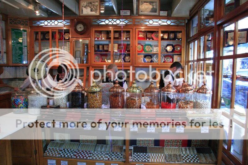
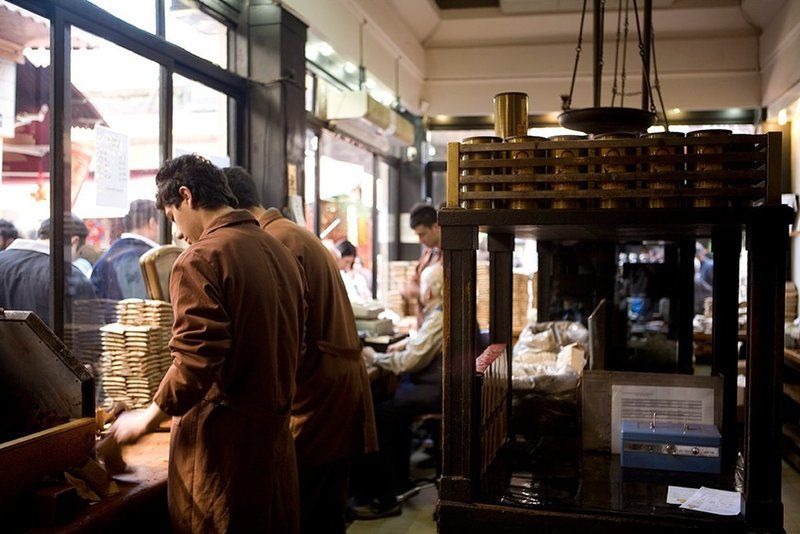
It was in Bahçekapi in 1777 that confectioner Bekir Effendi (later Haci Bekir) opened his small shop, using a stove in the room at the rear section for productio. The premises was 33 m2 and became the size it is today 88 m2 when, at a later date, the spice shop next door was added. The premises still operates today as a confectionery shop, managed by the fifth generation of the Haci Bekir family.

The building,which had two storeys above the shop, was restored in 1989; the restoration project was undertaken by Doğan Şahin. The authentic building is of Maltese stone with a plastered facade, and the roof is of wood with a tile overlay.

This meticulous restoration also exposed once again the marble columns with bronze collars on either side of the shop entrance, and the marble lintels which, resting on two wrought iron pillars, constituted the shop window display area. Also conserved in its original condition was the ironwork canopy which stretches out over the shop front. Roll top metal shutters of a style true to those which would have been in place originally were also attached to the shop front at this time.

At the rear of the shop, the original stove area and surround used by Hacı Bekir was carefully restored, as was the roof chimney pot. In their work on the counter area, shelving and the flower-decorated grille work on the ceiling the restorers remained faithful to the view of the shop in Prezioso's painting 'The Confectioner' and have left us with a three-dimensional representation of this painting.

The floor is of marble from the Marmara region in the north west of Turkey. The restoration project in its entirety, by exposing the various woods and other materials used in columns, on the ceiling and in the shop window, cast light on the details of the various constructions used in the shop over the two hundred years it has been in operation.

The shop is now registered as a protected site under the laws governing the conservation of Turkey's natural and cultural wealth. As a result, and caupled with the fame of the Haci Bekir name in the folklore of Ottoman Turkish culture,it has become an object of great interest to both locals and tourists.

LOCATION SATELLITE MAP


WEB SITE : Hacı Bekir

MORE INFO & CONTACT
E-Mail : hacibekir@hacibekir.com
Phone : +90 212 245 1375
Fax : +90 212 252 3350

These scripts and photographs are registered under © Copyright 2016, respected writers and photographers from the internet. All Rights Reserved.
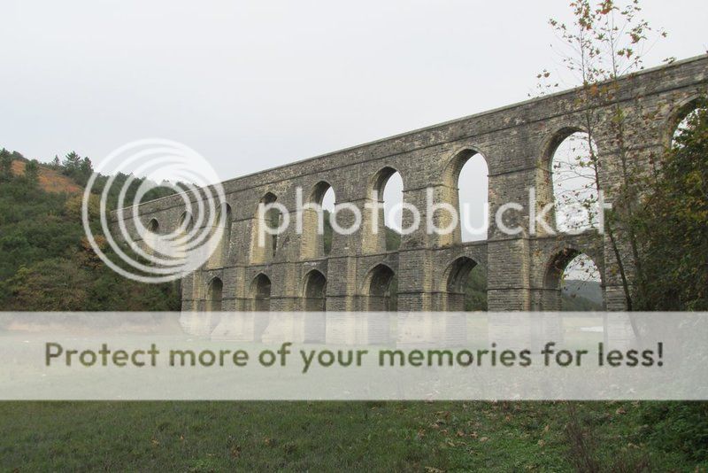
KURUKAHVECİ MEHMET EFENDİ since 1871

Tahmis, Fatih - İstanbul - Turkey

GPS : 41°00'59.6"N 28°58'13.0"E / 41.016556, 28.970278

 photo kurukahveci_shop107.jpg

PHOTOGRAPHS ALBUM

Since 1871, Kurukahveci Mehmet Efendi has approached coffee production as an art form, passing on the skills, knowledge, experience and intricacies of the craft from father to son and from master to apprentice. In line with our mission to introduce future generations to Turkish Coffee - Turkey's gift to the world - Kurukahveci Mehmet Efendi aims to ensure that coffee lovers enjoy superior quality with each and every sip of their coffee.

Until the latter part of the 19th century, coffee beans were sold raw. They were roasted at home and then ground using hand-operated coffee mills. All this changed when Mehmet Efendi inherited his father Hasan Efendi's spice and green coffee bean shop.

Mehmet Efendi was born in 1857 in the Fatih region of Istanbul. Following his education at the Süleymaniye Medresesi (the school attached to the Süleymaniye Mosque complex), Mehmet Efendi began to work in his father's shop on Tahmis Sokak. Mehmet Efendi took over the family business in 1871 and began roasting raw coffee beans, grinding them in mortars and selling roasted and ready-ground Turkish Coffee to his customers.

Soon, Tahmis Sokak was filled with the rich aroma of freshly roasted coffee. Thanks to Mehmet Efendi, coffee lovers were able to enjoy the convenience of buying ready roasted and ground coffee, and he soon became known as "Kurukahveci Mehmet Efendi", or Mehmet Efendi, vendor of roasted and ground coffee.

After Mehmet Efendi's death in 1931, the family business passed to his three sons: Hasan Selahattin Bey, Hulusi Bey and Ahmet Rıza Bey. The family formally took "Kurukahveci" as their last name in 1934. After Mehmet Efendi passed away, his eldest son Hasan Selahattin (1897-1944) recognized the importance of the international market and resolved to become active abroad. Thus, Turkish Coffee began to be promoted abroad as well as in the domestic market.

In line with the technological developments of the time, Hulusi Bey (1904-1934) introduced mass production and commissioned Zühtü Başar - one of the leading architects of the period - to design an Art Deco headquarters for the company on the site of the original family shop on Tahmis Sokak. This striking structure remains the company's headquarters to this day.

In addition, the company began to package its roasted-ground coffee in parchment paper and to distribute these packages to groceries and corner stores all over the city via automobile. Thus, Kurukahveci Mehmet Efendi was responsible for another groundbreaking innovation in Turkey. The company also opened a branch on the famous thoroughfare of Istiklal Caddesi.

After the untimely death of Hulusi Bey, the company passed into the hands of Mehmet Efendi's youngest son, Ahmet Rıza Kurukahveci. Educated abroad, Ahmet Bey was in touch with global trends and developments, which inspired him to take steps to modernise the firm and, crucially, to invest in advertising. In 1933, he commissioned İhap Hulusi Bey, one of the leading graphic designers of the period, to design a logo for the company.

This logo remains in use today. The company was also promoted through posters and calendars - revolutionary advertising media for the period. Kurukahveci Mehmet Efendi began to distribute coffee within the domestic market via the firm's own fleet of automobiles. Another branch was opened on Sahne Sokak, in the neighbourhood of Galatasaray.

Today Kurukahveci Mehmet Efendi is run by Mehmet Efendi's grandchildren who took over the company after the death of Ahmet Rıza Kurukahveci. After nearly a century, Mehmet Efendi's mortars were replaced by the latest coffee machinery. What began as a small family business on Tahmis Street in 1871 has now grown into a global brand.

As a global company that is constantly expanding within the coffee sector, Kurukahveci Mehmet Efendi's mission is to "introduce coffee lovers everywhere to the exquisite taste of Turkish Coffee and to introduce Turkish Coffee to a wide spectrum of people throughout the world without compromising quality."

With its original technology and methods developed during the coffee production process and its investment and research into enhancing quality, Kurukahveci Mehmet Efendi stands out as a unique and superior name in Turkish Coffee production. Our customers know that they can rely on consistent superior quality in every cup of our delicious Turkish Coffee.

Since 1871, Kurukahveci Mehmet Efendi has been defined by a spirit of innovation and meticulous attention to detail. By merging traditional production methods with the latest technology, the company combines years of knowledge and experience with its innovative spirit to produce a special coffee with a matchless flavour. In this way, every sip of Kurukahveci Mehmet Efendi coffee brings a touch a joy and delight to the lives of our customers.

Turkish Coffee is the name given to a type of coffee whose preparation and brewing techniques were invented by the Turks. It has a unique taste, froth, aroma, brewing technique and presentation… in other words it has its own identity and tradition. The first coffee was made in the Arabian Peninsula by boiling coffee cherries. The new method invented by the Turks revealed coffee's true flavour and peerless aroma. The Turks introduced coffee to Europe where for many years it was prepared and consumed as Turkish Coffee.

Turkish Coffee is made from high quality arabica coffee beans from Central America and Brazil that are blended and carefully roasted, then very finely ground. The coffee is mixed with water and the desired amount of sugar and cooked in a "cezve", or Turkish coffeepot. The coffee is served in small cups. The coffee must be left to stand for a short time after serving to allow the grounds to settle at the bottom of the cup.

Istanbul was introduced to coffee in 1543 by Özdemir Pasha, the Ottoman Governor of Yemen, who had grown to love the drink while stationed in that country. Prepared in a cezve or "güğüm" (copper vessel) using the technique invented by the Turks, the drink became known as Turkish Coffee.

The Turkish public became acquainted with coffee through the establishment of coffeehouses; the first coffeehouse opened in the district of Tahtakale in 1554 and others rapidly cropped up all over the city. Coffeehouses and coffee culture soon became an integral part of Istanbul social culture; people came here throughout the day to read books and beautiful texts, play chess and backgammon and discuss poetry and literature.

As coffee became a staple in palace cuisine as well as in private homes, its consumption increased dramatically. The raw beans were roasted in pans and then ground in mortars. The coffee was then brewed in cezves and served with great care to esteemed friends. Thanks to the efforts of merchants and travellers who passed through Istanbul, and even Ottoman ambassadors, Turkish Coffee's renown soon spread to Europe and ultimately to the whole world.

LOCATION SATELLITE MAP


WEB SITE : Kurukahveci Mehmet Efendi

MORE INFO & CONTACT
E-Mail : mehmetefendi@mehmetefendi.com
Phone : +90 212 511 4262
Fax : +90 212 511 1311

These scripts and photographs are registered under © Copyright 2016, respected writers and photographers from the internet. All Rights Reserved.