Çayırbaşı, Sarıyer - İstanbul - Turkey
GPS : 41°08'26.0"N 29°01'39.0"E / 41.140556, 29.027500
Türkmenbaşı Nature Park (Turkish: Türkmenbaşı Tabiat Parkı) is a nature park located in Sarıyer district of Istanbul Province. Situated west of Hacı Osman Bayırı Avenue in Çayırbaşı neighborhood of Sarıyer, it covers an area of 5.6 ha (14 acres).
It was established in 1998 as a place, to dignify the cultural values shared by Turkey and Turkmenistan. It was named "Turkmenbashi" (literally: Head of Turkmens), in honor of Saparmurat Niyazov (1940–2006) , the leader of Turkmenistan.
There are car park, fountains, picnic areas, wc are available. The nature park offers outdoor recreation activities such as hiking and picnicing for visitors on daily basis. There is a playground for children.
Flora
Common plant of the nature park is pine. Other notable trees are oak (Quercus petraea), hornbeam (Carpinus betulus), oriental plane (Platanus orientalis), Norway spruce (Picea abies), Mediterranean cypress (Cupressus sempervirens), honeyberry, (Celtis australis), medlar (Mespilus germanica), shinglewood (Thuja plicata) and the shrubs lavender (Lavandula spica), barberry (Berberis vulgaris), glossy abelia (Abelia × grandiflora), pittosporum (Pittosporum tobira), cherry laurel (Laurocerasus officinalis), Chinese photinia (Photinia serratifolia), strawberry tree (Arbutus unedo), Japanese aucuba (Aucuba japonica), fountainplant (Ophiopogon japonicus).
Fauna
The main fauna of the nature park consists pf bird species. Observed bird species are finch, magpie, sparrow, Western jackdaw, woodpecker. Other species are lizard and chipmunk.
LOCATION SATELLITE MAP
These scripts and photographs are registered under © Copyright 2017, respected writers and photographers from the internet. All Rights Reserved.
Showing posts with label public park. Show all posts
Showing posts with label public park. Show all posts
Friday, January 13, 2017

Thursday, January 12, 2017
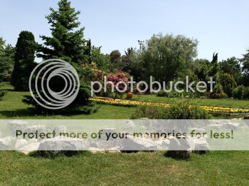
NEZAHAT GÖKYİĞİT BOTANİK GARDEN
Ataşehir, Dudullu - İstanbul - Turkey
GPS : 40°59'48.5"N 29°07'06.9"E / 40.996806, 29.118583
PHOTOGRAPHS ALBUM
Nezahat Gökyiğit Botanic Garden (NGBB) provides a public service, funded by the Ali Nihat Gökyiğit Foundation (ANG Foundation),to preserve plant diversity, promote education and especially through exhibitions to demonstrate the crucial importance of plant diversity. The Garden is located on the Anatolian side of İstanbul, at the intersection of two motorways, one coming from the Atatürk and Fatih Sultan Mehmet bridges over the Bosphorous and the Anatolia motorway to Ankara.
The Botanic Garden is 32 hectares consisting of eight islands of land formed by the motorway intersection and the slip roads. The land is leased from the General Roads Directorate to the ANG Foundation until 2025. In addition to being a research, training and education centre, NGBB has established an attractive amenity area for people living nearby which providesa 12% increase in green area to the city of Istanbul.
To commemorate his late wife, Nezahat Gökyiğit, in 1995 Ali Nihat Gökyiğit started a planting and reforestation plan on a 35 hectare area of land at the motorway intersection which was leased from the Roads Directorate. First, the area was cleared of debris created by the motorway construction and the soil improved prior to approximately 50,000 trees and shrubs were planted.It was officially opened to the public as a Park in 2002, but as its function changed, in 2003, it became the Nezahat Gökyiğit Botanic Garden (NGBB).
CENTRAL ISLAND
The main entrance and administration buildings are located on this Island together with the plant propagation and nursery areas, (which are not open to the public). Here visitors can find the bulbous plant collection, rock, crevice, hedged, dry, halophytic and desert gardens. There is also a pergola, perennial border, fruit and vegetable garden. Attractive water features of this area include a cascade from the gazebo, two large ponds and water lily pools. An area behind the Education building displays native Turkish species. A special area has been allocated where children can have a unique opportunity "hands on" gardening experience to learn about how to plant, look after and grow their own flowers and vegetables. Nearby is the commemorative dwarf conifer collection dedicated to those soldiers who died during their military service. There is an enclosed area for hens, peacocks and turkeys and another area with beehives.
Hedge Garden
In the Hedge Garden, visitors can see examples of different species which can be used to provide a hedge, including some which are not normally used for this purpose, for example Photinia serratifolia which is an attractive hedging plant. In between the hedges, flower beds show a range of Turkish native herbaceous plant species. In one of these beds (opposite the Crevice Garden), you can see the annual endemic species, Centaurea tchihatcheffi, which grows naturally in the wild only in Gölbaşı, near Ankara. Whilst in its natural habitat the attractive red flowers can only be seen between April and May, at NGBB it starts flowering in November and continues flowering, even when there is snow - which would never happen in the wild throughout the winter. Other beds contain Ferula drudeana or Echinacea purpurea.
Cacti and Succulent Greenhouse
Cacti and succulents are grown and propagated here to increase the range of plant species in NGBB and for visitors to see and study this group of plants which are not frost hardy outside in the Garden. The greenhouse was constructed in 2009 so that people with a special interest in cacti and succulent plants could grow theem and share their interest and information in this group of plants. The greenhouse was built between August and November in 2009. Planting beds with a special soil mix containing a high proportion of sand and gravel to aid drainage were used for this special group of plants.
Perennial Border
The perennial border is located near the lower pool and continues along the drainage channel. It was first planted in 2008, improved with new plantings in 2010. Here you can see a colourful display of plants which are cut back each year at the end of the growing season.
Rock Garden
A Rock Garden is an area dedicated for plants which in their wild habitat live amongst rocks and in rocky places. They are resistant to extreme conditions and can survive with a limited amount of soil and resources as the rocks protect them from the heat and grazing animals. Visitors can see a range of species on the Rock Garden which grow naturally in the wild in rocky places, either on or between the rocks along with some ornamental garden cultivars. There are almost a hundred species growing icluding ten endemics. Allium goekyigitii, Allium karacae and Allium koyuncui are amongst the endemic bulbous species. There are also a number of conifers.
Crevice Garden
The Crevice Gardenhas been constructed to provide a special habitat for plants which need excellent drainage. Roots of these plants grow deep down between the rock crevices in very little soil. The rock protects them from the sun and water evaporation caused by the wind. About 50 different species are grown in this area, six of which are endemic growing nowhere else except Turkey. One of the most important endemic species you can see here is Flueggea anatolica, a shrub which was recently discovered in southern Turkey and subsequently identified and described by a Turkish botanist Yusuf Gemici. Amazingly its closest relative is found in Central Africa.
Dry and Halophytic Garden
In recent years, increasing temperatures together with a reduction in rainfall has resulted in drier conditions which has created survival difficulties for many plants. Scientific research suggests that these conditions will increase, with the result, that if plants cannot tolerate these drier conditions, they will die. There are however some species which have adapted to survive with less water and these drought resistant plants offer us hope for the future. The aim of the Dry and Halophitic Garden is to enlighten visitors about some of these plants and to bring them to their attention. This Garden also aims to encourage research on the problems related with reduced water resources and thereby safeguard the security of our food in the future. Water is a valuable resource which we all take for granted and we need to learn to use it economically and wisely.
Information about plants which have low water consumption has recently gained greater importance. With this concept in mind, between August and October in 2007, a new Halophytic and Dry Garden was established at NGBB in Central Island. The first step was the environmental landscape construction work including providing two large isolation pools into which special soil was transported and retained before the plants could be collected and transplanted. Research work by scientists from Gazi University on the interesting and special flora around Tuz Golu (Salt Lake) in central Anatolia has been an important component of this experimental project. Many of these plants can be seen growing in NGBB where we are aiming to recreate several different steppe conditions found around Tuz Golu. Scientists have identified several endemic species and a unique flora which is able to survive severe drought conditions in sandy soil which in some places contains high levels of salt. These salt tolerant plants, (called halophytes) are able to thrive in these difficult conditions..
This Dry and Halophytic are of the Garden has six sections containing six different soil types. These are listed below together with some examples of the special plants which grow in each area.
1. Steppe soil with lime: Brought from the area around Susuzköy near Ankara.
Centaurea depressa, Iris schachtıi and Thymus sipyleus.
2. Soil with marl: Brought from Beypazarı, Acısu site near Ankara.
Acantholimon anatolicum, Centaurea nivea, Aethionema dumanii, Alyssum niveum and Astragalus densiflorus subsp. ayashensis.
3. Gypsum soil: Brought from Beypazarı, Acısu site near Ankara.
Onosma tauricum, Achillea ketenoglui, Salvia aytachii and Salsola grandis.
4. Volcanic steppe soil: Brought from Karadağ, Maden site near Karaman.
Chrozophora tinctoria, Heliotropium europaeum and Chenopodium botrys.
5. Salty soil: Brought from Tuz Gölü, Eskil Kelektome site, Konya.
Plantago crassifolia, Inula aucheriana, Salvia halophila and Limonium globuliferum.
6. Salty soil with sulphate: Brought from Tersakan Lake area, Konya.
Halocnemum strobilaceum, Juncus maritimus, Frankenia hirsuta and Limonium anatolicum.
Vegetable and Fruit Garden
Vegetables such as asparagus, tomatoes, lettuce, peppers, artichoke, aubergines and beans grow here with raspberry, blackberry and tayberries trained along the perimeter fence. Fruit trees include mulberry, cherry, peach, apple and quince as well as some herritage fruit varieties. There are also kiwi (Actinidia chinensis) and grape vines plus blueberry and redcurrent bushes.The area is not open to the public.
ERTUĞRUL ISLAND
To reach Ertuğrul Island from the Central Island visitors must walk through an illuminated tunnel under the motorway. As you walk through the tunnel, on the walls you will see a series of posters from the book published by Dorling Kindersley entitled "A Visual Dictionary of Plants" which have been translated into Turkish by Adil Güner. These illustrations show numerous details about plant life.
The name of this Island comes from the “Ertuğrul” frigate ship which sank in the open sea around Oshimo off the coast of Japan due to a violent storm in 1890. Abdülhamit II had sent the men to Japan on a mission and it was on its way back to Turkey when the storm struck. Although there were a few survivors, 587 sailors drowned. A memorial has been erected on this Island which now bears the ship’s name.
In 2005, the Japanese Sakura (Cherry tree) Foundation donated 587 cherry trees to the Garden to commemorate the 115th anniversary of the Ertuğrul frigate disaster. In memory of all those who had died - one cherry tree for each sailor who drowned has been planted on the Island. In Japanese culture, the flowering of cherry trees is an important event symbolising love and passion and tells the good news about the coming spring.
An official ceremony was held on October 23rd, 2005 in which the Turkish Navy, the Japanese Sakura Foundation, representatives from the Japanese Embassy, the TEMA (The Turkish Foundation for Combating Soil Erosion, for Reforestration and the Protection of Natural Habitats) and ANG (Ali Nihat Gokyigit) Foundations participated. Relatives of those who had died or descendants of the few sailors who had survived also attended. After the ceremony, Ertuğrul Island was officially opened for visitors to NGBB to enjoy and in springtime many visitors come to enjoy the spectacular cherry blossom display.
Ertuğrul Island has a collection of Hydrangea species growing in the shade of several large willow trees. The willows grow in a wet area which in spring and summer is alive with croaking frogs. Sometimes terrapins can also be seen along the water margins. It is intended to leave some areas of Ertuğrul Island undeveloped for the conservation and protection of the natural flora. In spring time patches of yellow and purple iris, muscari, lupin, tulip and other native species can be seen growing wild here.
Ertuğrul Island
To reach Ertuğrul Island from the Central Island visitors must walk through an illuminated tunnel under the motorway. As you walk through the tunnel, on the walls you will see a series of posters from the book published by Dorling Kindersley entitled "A Visual Dictionary of Plants" which have been translated into Turkish by Adil Güner. These illustrations show numerous details about plant life.
The name of this Island comes from the “Ertuğrul” frigate ship which sank in the open sea around Oshimo off the coast of Japan due to a violent storm in 1890. Abdülhamit II had sent the men to Japan on a mission and it was on its way back to Turkey when the storm struck. Although there were a few survivors, 587 sailors drowned. A memorial has been erected on this Island which now bears the ship’s name.
In 2005, the Japanese Sakura (Cherry tree) Foundation donated 587 cherry trees to the Garden to commemorate the 115th anniversary of the Ertuğrul frigate disaster. In memory of all those who had died - one cherry tree for each sailor who drowned has been planted on the Island. In Japanese culture, the flowering of cherry trees is an important event symbolising love and passion and tells the good news about the coming spring.
An official ceremony was held on October 23rd, 2005 in which the Turkish Navy, the Japanese Sakura Foundation, representatives from the Japanese Embassy, the TEMA (The Turkish Foundation for Combating Soil Erosion, for Reforestration and the Protection of Natural Habitats) and ANG (Ali Nihat Gokyigit) Foundations participated. Relatives of those who had died or descendants of the few sailors who had survived also attended. After the ceremony, Ertuğrul Island was officially opened for visitors to NGBB to enjoy and in springtime many visitors come to enjoy the spectacular cherry blossom display.
Ertuğrul Island has a collection of Hydrangea species growing in the shade of several large willow trees. The willows grow in a wet area which in spring and summer is alive with croaking frogs. Sometimes terrapins can also be seen along the water margins.
It is intended to leave some areas of Ertuğrul Island undeveloped for the conservation and protection of the natural flora. In spring time patches of yellow and purple iris, muscari, lupin, tulip and other native species can be seen growing wild here.
Olive Tree
Just inside the tunnel entrance is a huge Olive tree (Olea europaea) which was transplanted into the area alongside the small amphitheatre. This magnificent tree is actually two trees which have grown together and is many hundreds of years old, but has settled into its new home well and is producing many new shoots to replace the branches which had been cut back prior to its move to NGBB. This long-lived symbol of peace and important provider of food stands proudly in its new position in the Garden.
The Ertuğrul Memorial
The Ertugrul Memoria is located on Ertugrul Islandand lists the names of the 587 sailors who drowned when the frigate ship “Ertuğrul” sank off the coast of Japan due to a violent storm in 1890. together with those few who survived. Abdülhamit II had sent the men on a mission to Japan and it was on its return to Turkey when the storm struck. Ertugul Island has been named after the ship.
Blacksea Garden
The Blacksea Garden is specifically for plants that grow in a high humidity environment in acid soils, particularly rhododendrons and native plants from the Blacksea region of north east Turkey. The soil conditions in this area have been changed to suit the needs of these plants. Shading and misting is also provided to create the favorable growing conditions of Blacksea woodland.
Useful Plants
Edible Plants Collection
The nutritional needs of people have played a major role in how and why plants have been identified and cultivated. Turkey is important because of its rich biological diversity and its cultural heritage. Recording the various usages of plants offers not only an opportunity to transmit information to future generations, but also to find improved ways to use such plants.
NGBB has chosen the village of Camlica near the town of Yahyali, Kayseri, and the village of Kıslak near Yayladag in Hatay, as pilot areas for establishing a representative garden of edible plants at NGBB. Edible plants are collectexd from these areas to be grown in NGBB where information about these plants including where they are collected, how and why they are used, together with their local names. These plants are growing in Ertugul Island.
The Medicinal and Aromatic Plants Collection
Today, more than 6,000 plant species are being used worldwide for their medicinal value. Some 75-90% of people in developing countries depend only on these medicinal plants as a source of traditional medicine for their ailments. Herbal drugs and herbal mixtures that are commonly used and are known as “folk remedies” also known as ethnobotany. The science of ethnobotany investigates all kinds of traditional uses of plants along with their medicinal usages. When the side effects of synthetic drugs and the interactions of different drugs with each other and other factors are revealed, many people have returned to herbal remedies that were once scorned as just “folk remedies” and today alternative medicine is more popular than ever.
NGBB aims to introduce traditionally used medicinal and aromatic plants to everybody who is interested in plants, especially to the local and new residents of İstanbul as well as foreigners. The medicinal and aromatic plants found in the Garden are grown and improved with the help of NGBB staff from seed or plants collected by scientists in the wild. Some medicinally important plants that do not grow in Turkey naturally are also grown from seed.
The Medicinal and Aromatic plants garden is situated on Ertuğrul Island. The Garden has many interpretative information labels giving some botanical details and information about what the plants are used for. Our visitors can read the information found on the labels, but NGBB can take no responsibility for incorrect applications of any plant material and is for information purposes only.
Wheat and Close Relatives Collection
A collection of wheat and closely related plants have been gathered and displayed within the Beneficial Plants Collection at Ertugrul Island in 2010. The design of this garden is inspired by the evolutionary development of these plants. The collection includes the following species:
Aegilops speltoides, Triticum urartu, Triticum monococcum var. monococcum, Triticum dicoccoides, Triticum dicoccon, Triticum durum, Aegilops tauschii, Triticum aestivum
Dye Plants Collection
Herbal dyes can be found in the roots, stems, leaves or flowers. Using plants in the production of dyes is an art that dates back centuries. In 2000 B.C., it is well known that the Chinese dyed silk fabrics with herbal indigo and a special dye called Chinese green. The madder plant, (Rubia tinctorum), known as “Turkish red” has been cultivated in Anatolia for hundreds of years and by the 1750s, this had spread as far as France. Even today, many plants are still used for their dying properties throughout Anatolia, especially in carpet and rug weaving.
The Geophyte Collection
After flowering, geophytes spend much of the year dormant underground in the form of bulbs, corms, rhizomes, or in some cases tubers. The geophyte collection at NGBB is not only the most important collection of plants in the Garden, but is probably the largest, wild collected, well documented collection of Turkish geophytes anywhere. Different species of geophytes from all over Turkey provide important information about the countries’ biological richness.
All the geophyte plants in NGBB have been recorded with an accession number onto the “BG-Base” plant database programme so that the development of each collection can be monitored. Each plant is first assigned to a family, then classified according to genus and species and arranged alphabetically. The Geophyte Collection is located in Central Island and is not open to visitors without a member of staff being present. Visitors can however view a small display of flowering specimens nearby.
Plants are displayed in raised beds made from re cycled railway sleepers with the clay pots sunk into sand. At the entrance to the Geophyte Collection there is a list showing the position of each family. Each pot has a white label giving information about who collected the plant, (the collecting number), the accession number and sometimes the provisional name of the plant. When the plants come into flower, their identity is checked by an expert and then black engraved labels are prepared.
Medicinal and Aromatic Plants Collection
Today, more than 6,000 plant species are being used worldwide for their medicinal value. Some 75-90% of people in developing countries depend only on these medicinal plants as a source of traditional medicine for their ailments. Herbal drugs and herbal mixtures that are commonly used and are known as “folk remedies” also known as ethnobotany. The science of ethnobotany investigates all kinds of traditional uses of plants along with their medicinal usages. When the side effects of synthetic drugs and the interactions of different drugs with each other and other factors are revealed, many people have returned to herbal remedies that were once scorned as just “folk remedies” and today alternative medicine is more popular than ever.
NGBB aims to introduce traditionally used medicinal and aromatic plants to everybody who is interested in plants, especially to the local and new residents of İstanbul as well as foreigners. The medicinal and aromatic plants found in the Garden are grown and improved with the help of NGBB staff from seed or plants collected by scientists in the wild. Some medicinally important plants that do not grow in Turkey naturally are also grown from seed.
The Medicinal and Aromatic plants garden is situated on Ertuğrul Island. The Garden has many interpretative information labels giving some botanical details and information about what the plants are used for. Our visitors can read the information found on the labels, but NGBB can take no responsibility for incorrect applications of any plant material and is for information purposes only.
Village Edible and Economic plants
The villages of Camlica near the town of Yahyali, Kayseri, and Kıslak near Yayladag in Hatay, have been selected as pilot areas for establishing a representative garden of edible plants at NGBB on Ertugul Island. With the help of the villagers, edible and useful plants have been collected from these villages, identified and grown in NGBB. Information about how the plants are used by the villagers is stored on a database together with their local names.
The nutritional needs of people play a major role in how and why plants are cultivated. Turkey has a rich cultural heritage and biological diversity. Recording the different uses of plants which may vary from region to region offers not only an opportunity to record important information for future generations, but also to discover new uses of such plants.
PICNIC ISLAND
Access to the Picnic Island is through a tunnel under the motorway from the parking area in Atasehir or via a foot bridge over a slip road from Central Island. This Island was developed with the aim of reducing the pressure of the increasing number of visitors wanting to picnic especially during the warmer months of the year and at weekends. This area was opened in April 2009 and is the only area where picnics are allowed. The most important feature of the Picnic Island is the innovative Children’s Discovery Garden, “learning about nature through interactive play”.
Childrens Discovery Garden
This exciting new playground is designed for 3-9 year old children to play and have fun whilst learning about the importance of the plant kingdom for all living organisms. The main theme of the playground is "Plants are vital for all life." The playground was opened for children on the Picnic Island on the 23rd of April 2009, National Independence and Children's Day. It was a gift from The NGBB to all children. The prominent structures are a sandpit, amphitheatre, wooden house, tunnel, and fountain.
İSTANBUL ISLAND
This Island is located to the west of Ertugrul Island with access by a pedestrian foot bridge. Alternative access to the Island is possible via a long tunnel where visitors can enjoy the Gardens and Flowers of Istanbul Exhibition. The exhibition posters showing historical aspects of gardening and plants in Turkey is avaliable as a book to purchase from the Garden. Visitors entering this area from the footbridge, have a good view of the Island from the plane tree terrace.
Within the framework of the 2010 Istanbul European Culture Capital activities, an interpretation of an "18th century Istanbul Mansion Garden" has been created together with a lake representing the shape of the Bosphorous. A garden showcasing some of the plants of which grow wild in the Istanbul area have also been planted here. A large amphitheatre has been constructed which is used for concerts.
The 18th Century Turkish Mansion Garden
This garden is one of the focal points on Istanbul Island with its courtyards, sun loggias, fountains, formal flowerbeds and sultan's tent representing a Turkish style mansion garden in the 18th century along the Bosphorous in Istanbul.
Bosphorous Lake
The Bosphorus area is an important feature of the Istanbul Island. The bosphorus has been home to many cultural influences for centuries and thus has been shaped with the characteristics of them all. A pond representing the “Bosphorus” has been built to scale together with bridges and Leander’s tower as well as the surrounding hills with flowers.
Collection of Native Istanbul Plants
A number of native species from Istanbul province can be seen on Central Island and particularly on Istanbul Island. However this is only a few representatives of the approximately 2,500 native species, (20 of which are endemic), which can can be shown in the Garden.
Exhibitions in the Tunnel Galleries
Throughout the Garden the tunnels which connect the different Islands of the Garden have been utilised as exhibition areas.
* The entrance tunnel from the car park area to the Picnic Island gives some helpful introduction to the Garden as they enter.
* The tunnel from Central Island to Ertugul Island has a series of posters which are Turkish translation of the Dorling Kindersley Plant Dictionary. It has been published as a book.
* In the longest tunnel, (120 metres long) which leads from Ertural Island there is an exhibition of Flowers and Gardens in Istanbul which shows the history of plants and the many ways in which they were used in Turkey over the centuries. A catalogue of these posters is available to purchase as a book from the Garden administration.
* The tunnel which you can enter from behind the amphitheater has two exhibitions. Photographs of some of Turkey's beautiful are flowers on one side and monumental trees growing in the Istanbul area on the other.
The Fountain
The fountain underneath the plane tree view point overlooking the 18th century Mansion Garden on Istanbul Island is representative of a traditional neighbourhood design. Constructed from travertine, it has carved relief motifs of the NGBB Iris logo on all four corners. On either side at the top are two inscriptions from the Kouran. Water from this fountain feeds the spiral pond ('copuri') on the upper terrace. There are several other fountains in the Mansion Garden.
OAK ISLAND
In collabration with Abant İzzet Baysal University, Science Faculty of Biology, Bolu acorns have been collected from Oak species throughout Turkey. These have been grown in the NGBB nursery and were planted out in 2003. A total of 36 species are present on the Oak Islands which are not open to visitors currently.
The Oak Collection
Worldwide there are about 300 oak species, the majority of which are deciduous trees, but some are evergreen woody trees or shrubs which grow mostly in the mild climates of the Northern hemisphere where large forests are often found. Oaks can tolerate dry conditions so can help prevent soil erosion. NGBB has a special interest in collecting oak species so they have a special value within the woody plants collection in the Garden. The number of Turkish native oak species is 18, and together with subspecies and varieties totals 23. Many individual oak species can be seen throughout the gardens especially on the Oak Islands which are not open to the public.
Some of the native oak species which can be seen at NGBB include :
Quercus robur ( subsp. robur, subsp. pedunculiflora); Quercus petraea ( subsp. petraea, subsp. iberica, subsp. pinnatiloba); Quercus hartwissiana; Quercus frainetto; Quercus pubescens; Quercus virgiliana; Quercus vulcanica; Quercus macranthera subsp. Syspirensis; Quercus infectoria (subsp. infectoria, subsp. boissieri); Quercus cerris (var. cerris, var. austriaca); Quercus pontica; Quercus trojana; Quercus ithaburensis subsp. macrolepis; Quercus brantii; Quercus libani; Quercus ilex; Quercus coccifera
List of non-native oak species :
Quercus agriloba; Quercus alba; Quercus castaneifolia; Quercus dumosa; Quercus durata; Quercus lobata; Quercus muehlenbergii; Quercus munzii; Quercus palustris; Quercus phillyreoides; Quercus ‘Pondaim’; Quercus rubra; Quercus streimii x pungens; Quercus sinuata
LOCATION SATELLITE MAP
WEB SITE : Nezahat Gökyiğit Botanic Garden
MORE INFO & CONTACT
E-Mail : info@ngbb.org.tr
Phone : +90 216 456 4437
Fax : +90 216 456 4438
These scripts and photographs are registered under © Copyright 2017, respected writers and photographers from the internet. All Rights Reserved.
GPS : 40°59'48.5"N 29°07'06.9"E / 40.996806, 29.118583

PHOTOGRAPHS ALBUM
Nezahat Gökyiğit Botanic Garden (NGBB) provides a public service, funded by the Ali Nihat Gökyiğit Foundation (ANG Foundation),to preserve plant diversity, promote education and especially through exhibitions to demonstrate the crucial importance of plant diversity. The Garden is located on the Anatolian side of İstanbul, at the intersection of two motorways, one coming from the Atatürk and Fatih Sultan Mehmet bridges over the Bosphorous and the Anatolia motorway to Ankara.
The Botanic Garden is 32 hectares consisting of eight islands of land formed by the motorway intersection and the slip roads. The land is leased from the General Roads Directorate to the ANG Foundation until 2025. In addition to being a research, training and education centre, NGBB has established an attractive amenity area for people living nearby which providesa 12% increase in green area to the city of Istanbul.
To commemorate his late wife, Nezahat Gökyiğit, in 1995 Ali Nihat Gökyiğit started a planting and reforestation plan on a 35 hectare area of land at the motorway intersection which was leased from the Roads Directorate. First, the area was cleared of debris created by the motorway construction and the soil improved prior to approximately 50,000 trees and shrubs were planted.It was officially opened to the public as a Park in 2002, but as its function changed, in 2003, it became the Nezahat Gökyiğit Botanic Garden (NGBB).
CENTRAL ISLAND
The main entrance and administration buildings are located on this Island together with the plant propagation and nursery areas, (which are not open to the public). Here visitors can find the bulbous plant collection, rock, crevice, hedged, dry, halophytic and desert gardens. There is also a pergola, perennial border, fruit and vegetable garden. Attractive water features of this area include a cascade from the gazebo, two large ponds and water lily pools. An area behind the Education building displays native Turkish species. A special area has been allocated where children can have a unique opportunity "hands on" gardening experience to learn about how to plant, look after and grow their own flowers and vegetables. Nearby is the commemorative dwarf conifer collection dedicated to those soldiers who died during their military service. There is an enclosed area for hens, peacocks and turkeys and another area with beehives.
Hedge Garden
In the Hedge Garden, visitors can see examples of different species which can be used to provide a hedge, including some which are not normally used for this purpose, for example Photinia serratifolia which is an attractive hedging plant. In between the hedges, flower beds show a range of Turkish native herbaceous plant species. In one of these beds (opposite the Crevice Garden), you can see the annual endemic species, Centaurea tchihatcheffi, which grows naturally in the wild only in Gölbaşı, near Ankara. Whilst in its natural habitat the attractive red flowers can only be seen between April and May, at NGBB it starts flowering in November and continues flowering, even when there is snow - which would never happen in the wild throughout the winter. Other beds contain Ferula drudeana or Echinacea purpurea.
Cacti and Succulent Greenhouse
Cacti and succulents are grown and propagated here to increase the range of plant species in NGBB and for visitors to see and study this group of plants which are not frost hardy outside in the Garden. The greenhouse was constructed in 2009 so that people with a special interest in cacti and succulent plants could grow theem and share their interest and information in this group of plants. The greenhouse was built between August and November in 2009. Planting beds with a special soil mix containing a high proportion of sand and gravel to aid drainage were used for this special group of plants.
Perennial Border
The perennial border is located near the lower pool and continues along the drainage channel. It was first planted in 2008, improved with new plantings in 2010. Here you can see a colourful display of plants which are cut back each year at the end of the growing season.
Rock Garden
A Rock Garden is an area dedicated for plants which in their wild habitat live amongst rocks and in rocky places. They are resistant to extreme conditions and can survive with a limited amount of soil and resources as the rocks protect them from the heat and grazing animals. Visitors can see a range of species on the Rock Garden which grow naturally in the wild in rocky places, either on or between the rocks along with some ornamental garden cultivars. There are almost a hundred species growing icluding ten endemics. Allium goekyigitii, Allium karacae and Allium koyuncui are amongst the endemic bulbous species. There are also a number of conifers.
Crevice Garden
The Crevice Gardenhas been constructed to provide a special habitat for plants which need excellent drainage. Roots of these plants grow deep down between the rock crevices in very little soil. The rock protects them from the sun and water evaporation caused by the wind. About 50 different species are grown in this area, six of which are endemic growing nowhere else except Turkey. One of the most important endemic species you can see here is Flueggea anatolica, a shrub which was recently discovered in southern Turkey and subsequently identified and described by a Turkish botanist Yusuf Gemici. Amazingly its closest relative is found in Central Africa.
Dry and Halophytic Garden
In recent years, increasing temperatures together with a reduction in rainfall has resulted in drier conditions which has created survival difficulties for many plants. Scientific research suggests that these conditions will increase, with the result, that if plants cannot tolerate these drier conditions, they will die. There are however some species which have adapted to survive with less water and these drought resistant plants offer us hope for the future. The aim of the Dry and Halophitic Garden is to enlighten visitors about some of these plants and to bring them to their attention. This Garden also aims to encourage research on the problems related with reduced water resources and thereby safeguard the security of our food in the future. Water is a valuable resource which we all take for granted and we need to learn to use it economically and wisely.
Information about plants which have low water consumption has recently gained greater importance. With this concept in mind, between August and October in 2007, a new Halophytic and Dry Garden was established at NGBB in Central Island. The first step was the environmental landscape construction work including providing two large isolation pools into which special soil was transported and retained before the plants could be collected and transplanted. Research work by scientists from Gazi University on the interesting and special flora around Tuz Golu (Salt Lake) in central Anatolia has been an important component of this experimental project. Many of these plants can be seen growing in NGBB where we are aiming to recreate several different steppe conditions found around Tuz Golu. Scientists have identified several endemic species and a unique flora which is able to survive severe drought conditions in sandy soil which in some places contains high levels of salt. These salt tolerant plants, (called halophytes) are able to thrive in these difficult conditions..
This Dry and Halophytic are of the Garden has six sections containing six different soil types. These are listed below together with some examples of the special plants which grow in each area.
1. Steppe soil with lime: Brought from the area around Susuzköy near Ankara.
Centaurea depressa, Iris schachtıi and Thymus sipyleus.
2. Soil with marl: Brought from Beypazarı, Acısu site near Ankara.
Acantholimon anatolicum, Centaurea nivea, Aethionema dumanii, Alyssum niveum and Astragalus densiflorus subsp. ayashensis.
3. Gypsum soil: Brought from Beypazarı, Acısu site near Ankara.
Onosma tauricum, Achillea ketenoglui, Salvia aytachii and Salsola grandis.
4. Volcanic steppe soil: Brought from Karadağ, Maden site near Karaman.
Chrozophora tinctoria, Heliotropium europaeum and Chenopodium botrys.
5. Salty soil: Brought from Tuz Gölü, Eskil Kelektome site, Konya.
Plantago crassifolia, Inula aucheriana, Salvia halophila and Limonium globuliferum.
6. Salty soil with sulphate: Brought from Tersakan Lake area, Konya.
Halocnemum strobilaceum, Juncus maritimus, Frankenia hirsuta and Limonium anatolicum.
Vegetable and Fruit Garden
Vegetables such as asparagus, tomatoes, lettuce, peppers, artichoke, aubergines and beans grow here with raspberry, blackberry and tayberries trained along the perimeter fence. Fruit trees include mulberry, cherry, peach, apple and quince as well as some herritage fruit varieties. There are also kiwi (Actinidia chinensis) and grape vines plus blueberry and redcurrent bushes.The area is not open to the public.
ERTUĞRUL ISLAND
To reach Ertuğrul Island from the Central Island visitors must walk through an illuminated tunnel under the motorway. As you walk through the tunnel, on the walls you will see a series of posters from the book published by Dorling Kindersley entitled "A Visual Dictionary of Plants" which have been translated into Turkish by Adil Güner. These illustrations show numerous details about plant life.
The name of this Island comes from the “Ertuğrul” frigate ship which sank in the open sea around Oshimo off the coast of Japan due to a violent storm in 1890. Abdülhamit II had sent the men to Japan on a mission and it was on its way back to Turkey when the storm struck. Although there were a few survivors, 587 sailors drowned. A memorial has been erected on this Island which now bears the ship’s name.
In 2005, the Japanese Sakura (Cherry tree) Foundation donated 587 cherry trees to the Garden to commemorate the 115th anniversary of the Ertuğrul frigate disaster. In memory of all those who had died - one cherry tree for each sailor who drowned has been planted on the Island. In Japanese culture, the flowering of cherry trees is an important event symbolising love and passion and tells the good news about the coming spring.
An official ceremony was held on October 23rd, 2005 in which the Turkish Navy, the Japanese Sakura Foundation, representatives from the Japanese Embassy, the TEMA (The Turkish Foundation for Combating Soil Erosion, for Reforestration and the Protection of Natural Habitats) and ANG (Ali Nihat Gokyigit) Foundations participated. Relatives of those who had died or descendants of the few sailors who had survived also attended. After the ceremony, Ertuğrul Island was officially opened for visitors to NGBB to enjoy and in springtime many visitors come to enjoy the spectacular cherry blossom display.
Ertuğrul Island has a collection of Hydrangea species growing in the shade of several large willow trees. The willows grow in a wet area which in spring and summer is alive with croaking frogs. Sometimes terrapins can also be seen along the water margins. It is intended to leave some areas of Ertuğrul Island undeveloped for the conservation and protection of the natural flora. In spring time patches of yellow and purple iris, muscari, lupin, tulip and other native species can be seen growing wild here.
Ertuğrul Island
To reach Ertuğrul Island from the Central Island visitors must walk through an illuminated tunnel under the motorway. As you walk through the tunnel, on the walls you will see a series of posters from the book published by Dorling Kindersley entitled "A Visual Dictionary of Plants" which have been translated into Turkish by Adil Güner. These illustrations show numerous details about plant life.
The name of this Island comes from the “Ertuğrul” frigate ship which sank in the open sea around Oshimo off the coast of Japan due to a violent storm in 1890. Abdülhamit II had sent the men to Japan on a mission and it was on its way back to Turkey when the storm struck. Although there were a few survivors, 587 sailors drowned. A memorial has been erected on this Island which now bears the ship’s name.
In 2005, the Japanese Sakura (Cherry tree) Foundation donated 587 cherry trees to the Garden to commemorate the 115th anniversary of the Ertuğrul frigate disaster. In memory of all those who had died - one cherry tree for each sailor who drowned has been planted on the Island. In Japanese culture, the flowering of cherry trees is an important event symbolising love and passion and tells the good news about the coming spring.
An official ceremony was held on October 23rd, 2005 in which the Turkish Navy, the Japanese Sakura Foundation, representatives from the Japanese Embassy, the TEMA (The Turkish Foundation for Combating Soil Erosion, for Reforestration and the Protection of Natural Habitats) and ANG (Ali Nihat Gokyigit) Foundations participated. Relatives of those who had died or descendants of the few sailors who had survived also attended. After the ceremony, Ertuğrul Island was officially opened for visitors to NGBB to enjoy and in springtime many visitors come to enjoy the spectacular cherry blossom display.
Ertuğrul Island has a collection of Hydrangea species growing in the shade of several large willow trees. The willows grow in a wet area which in spring and summer is alive with croaking frogs. Sometimes terrapins can also be seen along the water margins.
It is intended to leave some areas of Ertuğrul Island undeveloped for the conservation and protection of the natural flora. In spring time patches of yellow and purple iris, muscari, lupin, tulip and other native species can be seen growing wild here.
Olive Tree
Just inside the tunnel entrance is a huge Olive tree (Olea europaea) which was transplanted into the area alongside the small amphitheatre. This magnificent tree is actually two trees which have grown together and is many hundreds of years old, but has settled into its new home well and is producing many new shoots to replace the branches which had been cut back prior to its move to NGBB. This long-lived symbol of peace and important provider of food stands proudly in its new position in the Garden.
The Ertuğrul Memorial
The Ertugrul Memoria is located on Ertugrul Islandand lists the names of the 587 sailors who drowned when the frigate ship “Ertuğrul” sank off the coast of Japan due to a violent storm in 1890. together with those few who survived. Abdülhamit II had sent the men on a mission to Japan and it was on its return to Turkey when the storm struck. Ertugul Island has been named after the ship.
Blacksea Garden
The Blacksea Garden is specifically for plants that grow in a high humidity environment in acid soils, particularly rhododendrons and native plants from the Blacksea region of north east Turkey. The soil conditions in this area have been changed to suit the needs of these plants. Shading and misting is also provided to create the favorable growing conditions of Blacksea woodland.
Useful Plants
Edible Plants Collection
The nutritional needs of people have played a major role in how and why plants have been identified and cultivated. Turkey is important because of its rich biological diversity and its cultural heritage. Recording the various usages of plants offers not only an opportunity to transmit information to future generations, but also to find improved ways to use such plants.
NGBB has chosen the village of Camlica near the town of Yahyali, Kayseri, and the village of Kıslak near Yayladag in Hatay, as pilot areas for establishing a representative garden of edible plants at NGBB. Edible plants are collectexd from these areas to be grown in NGBB where information about these plants including where they are collected, how and why they are used, together with their local names. These plants are growing in Ertugul Island.
The Medicinal and Aromatic Plants Collection
Today, more than 6,000 plant species are being used worldwide for their medicinal value. Some 75-90% of people in developing countries depend only on these medicinal plants as a source of traditional medicine for their ailments. Herbal drugs and herbal mixtures that are commonly used and are known as “folk remedies” also known as ethnobotany. The science of ethnobotany investigates all kinds of traditional uses of plants along with their medicinal usages. When the side effects of synthetic drugs and the interactions of different drugs with each other and other factors are revealed, many people have returned to herbal remedies that were once scorned as just “folk remedies” and today alternative medicine is more popular than ever.
NGBB aims to introduce traditionally used medicinal and aromatic plants to everybody who is interested in plants, especially to the local and new residents of İstanbul as well as foreigners. The medicinal and aromatic plants found in the Garden are grown and improved with the help of NGBB staff from seed or plants collected by scientists in the wild. Some medicinally important plants that do not grow in Turkey naturally are also grown from seed.
The Medicinal and Aromatic plants garden is situated on Ertuğrul Island. The Garden has many interpretative information labels giving some botanical details and information about what the plants are used for. Our visitors can read the information found on the labels, but NGBB can take no responsibility for incorrect applications of any plant material and is for information purposes only.
Wheat and Close Relatives Collection
A collection of wheat and closely related plants have been gathered and displayed within the Beneficial Plants Collection at Ertugrul Island in 2010. The design of this garden is inspired by the evolutionary development of these plants. The collection includes the following species:
Aegilops speltoides, Triticum urartu, Triticum monococcum var. monococcum, Triticum dicoccoides, Triticum dicoccon, Triticum durum, Aegilops tauschii, Triticum aestivum
Dye Plants Collection
Herbal dyes can be found in the roots, stems, leaves or flowers. Using plants in the production of dyes is an art that dates back centuries. In 2000 B.C., it is well known that the Chinese dyed silk fabrics with herbal indigo and a special dye called Chinese green. The madder plant, (Rubia tinctorum), known as “Turkish red” has been cultivated in Anatolia for hundreds of years and by the 1750s, this had spread as far as France. Even today, many plants are still used for their dying properties throughout Anatolia, especially in carpet and rug weaving.
The Geophyte Collection
After flowering, geophytes spend much of the year dormant underground in the form of bulbs, corms, rhizomes, or in some cases tubers. The geophyte collection at NGBB is not only the most important collection of plants in the Garden, but is probably the largest, wild collected, well documented collection of Turkish geophytes anywhere. Different species of geophytes from all over Turkey provide important information about the countries’ biological richness.
All the geophyte plants in NGBB have been recorded with an accession number onto the “BG-Base” plant database programme so that the development of each collection can be monitored. Each plant is first assigned to a family, then classified according to genus and species and arranged alphabetically. The Geophyte Collection is located in Central Island and is not open to visitors without a member of staff being present. Visitors can however view a small display of flowering specimens nearby.
Plants are displayed in raised beds made from re cycled railway sleepers with the clay pots sunk into sand. At the entrance to the Geophyte Collection there is a list showing the position of each family. Each pot has a white label giving information about who collected the plant, (the collecting number), the accession number and sometimes the provisional name of the plant. When the plants come into flower, their identity is checked by an expert and then black engraved labels are prepared.
Medicinal and Aromatic Plants Collection
Today, more than 6,000 plant species are being used worldwide for their medicinal value. Some 75-90% of people in developing countries depend only on these medicinal plants as a source of traditional medicine for their ailments. Herbal drugs and herbal mixtures that are commonly used and are known as “folk remedies” also known as ethnobotany. The science of ethnobotany investigates all kinds of traditional uses of plants along with their medicinal usages. When the side effects of synthetic drugs and the interactions of different drugs with each other and other factors are revealed, many people have returned to herbal remedies that were once scorned as just “folk remedies” and today alternative medicine is more popular than ever.
NGBB aims to introduce traditionally used medicinal and aromatic plants to everybody who is interested in plants, especially to the local and new residents of İstanbul as well as foreigners. The medicinal and aromatic plants found in the Garden are grown and improved with the help of NGBB staff from seed or plants collected by scientists in the wild. Some medicinally important plants that do not grow in Turkey naturally are also grown from seed.
The Medicinal and Aromatic plants garden is situated on Ertuğrul Island. The Garden has many interpretative information labels giving some botanical details and information about what the plants are used for. Our visitors can read the information found on the labels, but NGBB can take no responsibility for incorrect applications of any plant material and is for information purposes only.
Village Edible and Economic plants
The villages of Camlica near the town of Yahyali, Kayseri, and Kıslak near Yayladag in Hatay, have been selected as pilot areas for establishing a representative garden of edible plants at NGBB on Ertugul Island. With the help of the villagers, edible and useful plants have been collected from these villages, identified and grown in NGBB. Information about how the plants are used by the villagers is stored on a database together with their local names.
The nutritional needs of people play a major role in how and why plants are cultivated. Turkey has a rich cultural heritage and biological diversity. Recording the different uses of plants which may vary from region to region offers not only an opportunity to record important information for future generations, but also to discover new uses of such plants.
PICNIC ISLAND
Access to the Picnic Island is through a tunnel under the motorway from the parking area in Atasehir or via a foot bridge over a slip road from Central Island. This Island was developed with the aim of reducing the pressure of the increasing number of visitors wanting to picnic especially during the warmer months of the year and at weekends. This area was opened in April 2009 and is the only area where picnics are allowed. The most important feature of the Picnic Island is the innovative Children’s Discovery Garden, “learning about nature through interactive play”.
Childrens Discovery Garden
This exciting new playground is designed for 3-9 year old children to play and have fun whilst learning about the importance of the plant kingdom for all living organisms. The main theme of the playground is "Plants are vital for all life." The playground was opened for children on the Picnic Island on the 23rd of April 2009, National Independence and Children's Day. It was a gift from The NGBB to all children. The prominent structures are a sandpit, amphitheatre, wooden house, tunnel, and fountain.
İSTANBUL ISLAND
This Island is located to the west of Ertugrul Island with access by a pedestrian foot bridge. Alternative access to the Island is possible via a long tunnel where visitors can enjoy the Gardens and Flowers of Istanbul Exhibition. The exhibition posters showing historical aspects of gardening and plants in Turkey is avaliable as a book to purchase from the Garden. Visitors entering this area from the footbridge, have a good view of the Island from the plane tree terrace.
Within the framework of the 2010 Istanbul European Culture Capital activities, an interpretation of an "18th century Istanbul Mansion Garden" has been created together with a lake representing the shape of the Bosphorous. A garden showcasing some of the plants of which grow wild in the Istanbul area have also been planted here. A large amphitheatre has been constructed which is used for concerts.
The 18th Century Turkish Mansion Garden
This garden is one of the focal points on Istanbul Island with its courtyards, sun loggias, fountains, formal flowerbeds and sultan's tent representing a Turkish style mansion garden in the 18th century along the Bosphorous in Istanbul.
Bosphorous Lake
The Bosphorus area is an important feature of the Istanbul Island. The bosphorus has been home to many cultural influences for centuries and thus has been shaped with the characteristics of them all. A pond representing the “Bosphorus” has been built to scale together with bridges and Leander’s tower as well as the surrounding hills with flowers.
Collection of Native Istanbul Plants
A number of native species from Istanbul province can be seen on Central Island and particularly on Istanbul Island. However this is only a few representatives of the approximately 2,500 native species, (20 of which are endemic), which can can be shown in the Garden.
Exhibitions in the Tunnel Galleries
Throughout the Garden the tunnels which connect the different Islands of the Garden have been utilised as exhibition areas.
* The entrance tunnel from the car park area to the Picnic Island gives some helpful introduction to the Garden as they enter.
* The tunnel from Central Island to Ertugul Island has a series of posters which are Turkish translation of the Dorling Kindersley Plant Dictionary. It has been published as a book.
* In the longest tunnel, (120 metres long) which leads from Ertural Island there is an exhibition of Flowers and Gardens in Istanbul which shows the history of plants and the many ways in which they were used in Turkey over the centuries. A catalogue of these posters is available to purchase as a book from the Garden administration.
* The tunnel which you can enter from behind the amphitheater has two exhibitions. Photographs of some of Turkey's beautiful are flowers on one side and monumental trees growing in the Istanbul area on the other.
The Fountain
The fountain underneath the plane tree view point overlooking the 18th century Mansion Garden on Istanbul Island is representative of a traditional neighbourhood design. Constructed from travertine, it has carved relief motifs of the NGBB Iris logo on all four corners. On either side at the top are two inscriptions from the Kouran. Water from this fountain feeds the spiral pond ('copuri') on the upper terrace. There are several other fountains in the Mansion Garden.
OAK ISLAND
In collabration with Abant İzzet Baysal University, Science Faculty of Biology, Bolu acorns have been collected from Oak species throughout Turkey. These have been grown in the NGBB nursery and were planted out in 2003. A total of 36 species are present on the Oak Islands which are not open to visitors currently.
The Oak Collection
Worldwide there are about 300 oak species, the majority of which are deciduous trees, but some are evergreen woody trees or shrubs which grow mostly in the mild climates of the Northern hemisphere where large forests are often found. Oaks can tolerate dry conditions so can help prevent soil erosion. NGBB has a special interest in collecting oak species so they have a special value within the woody plants collection in the Garden. The number of Turkish native oak species is 18, and together with subspecies and varieties totals 23. Many individual oak species can be seen throughout the gardens especially on the Oak Islands which are not open to the public.
Some of the native oak species which can be seen at NGBB include :
Quercus robur ( subsp. robur, subsp. pedunculiflora); Quercus petraea ( subsp. petraea, subsp. iberica, subsp. pinnatiloba); Quercus hartwissiana; Quercus frainetto; Quercus pubescens; Quercus virgiliana; Quercus vulcanica; Quercus macranthera subsp. Syspirensis; Quercus infectoria (subsp. infectoria, subsp. boissieri); Quercus cerris (var. cerris, var. austriaca); Quercus pontica; Quercus trojana; Quercus ithaburensis subsp. macrolepis; Quercus brantii; Quercus libani; Quercus ilex; Quercus coccifera
List of non-native oak species :
Quercus agriloba; Quercus alba; Quercus castaneifolia; Quercus dumosa; Quercus durata; Quercus lobata; Quercus muehlenbergii; Quercus munzii; Quercus palustris; Quercus phillyreoides; Quercus ‘Pondaim’; Quercus rubra; Quercus streimii x pungens; Quercus sinuata
LOCATION SATELLITE MAP
WEB SITE : Nezahat Gökyiğit Botanic Garden
MORE INFO & CONTACT
E-Mail : info@ngbb.org.tr
Phone : +90 216 456 4437
Fax : +90 216 456 4438
These scripts and photographs are registered under © Copyright 2017, respected writers and photographers from the internet. All Rights Reserved.
Wednesday, January 11, 2017
ÇİLİNGOZ NATURE PARK
Binkılıç, Çatalca - İstanbul - Turkey
GPS : 41°31'30.6"N 28°13'08.0"E / 41.525168, 28.218875
PHOTOGRAPHS ALBUM
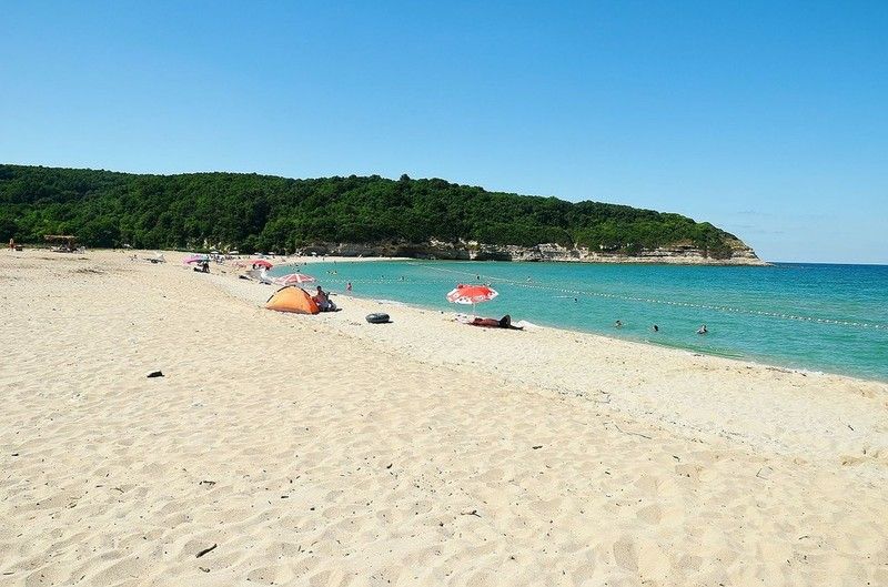
Çilingoz Nature Park (Turkish: Çilingoz Tabiat Parkı) is a nature park located in Çatalca district of Istanbul Province. Situated at Binkılıç town of Çatalca, northwest of Istanbul on the Black Sea coast, it covers an area of 17.75 ha (43.9 acres). It was established in 2011. The region incorporating the nature park was declared a Wildlife Protection Area for its rich flora and fauna in 2005. Therefore, hunting is continuously forbidden in the region.
The nature park is on a bay featuring the combination of beach, forest, lake and reedy. The park has a 1,200 m (3,900 ft)-long and 80 m (260 ft)-wide beach with fine sand at its north. The Çilingoz Creek flows towards north into the Black Sea creating a sandy-alluvial mouth, which is narrow. There, it forms a large lake surrounded by reedy.
The nature park offers outdoor recreational activities such as camping, angling, hiking and picnicing for visitors. A restaurant and a snack bar serve the visitors. 60 tents are available for rent. Camping season continues until mid September. There is a RV park for recreational vehicles. The 30 wooden bungalows in the park area are for the use of personnel of the Forestry Administration, and can not be rented by visitors. Nearest comfortable lodging opportunity is available in Yalıköy.
Admission to the nature park and to the beach is charged for visitors and vehicles. Camping is charged for tents on the overnight basis. Parks area offers Restaurant, Market, Fast Food Buffet, Tea Garden, Room.
Flora
The nature park is habitat of diverse vegetation. Plants of the wood area are mainly Oriental beech (Fagus orientalis), Oriental alder (Alnus orientalis), European hornbeam (Carpinus betulus) and Turkey oak (Quercus cerris). Shrubs present are common rhododendron (Rhododendron ponticum), butcher's-broom (Ruscus aculeatus), myrtle, (Myrtus communis), laurel (Laurus nobilis), heather (Erica arborea), strawberry tree (Arbutus unedo), blackberry (Rubus), pampas grass (Cortaderia selloana). Observed plants in sandy areas are species such as field eryngo (Eryngium campestre), alkanet (Alkanna tinctoria) and golden-flowered Onosma (Onosma taurica).
Fauna
The nature park has a population of diverse bird species. Some of them are quail, cormorant, Eurasian woodcock, hawk, eagle-owl, woodpecker, common blackbird, stork, magpie, European goldfinch and passer. Mammals of the park are deer, roe deer, fox, European pine marten, wolf, jackal, squirrel, porcupine, hare, mole and ortoise. Fish species found in the waters of coastal area are red mullet, jack mackerel, grey mullet, bonito and thornback ray. Fish species inhabited in the sweet waters are trout, carp, European chub and eel.
LOCATION SATELLITE MAP
These scripts and photographs are registered under © Copyright 2017, respected writers and photographers from the internet. All Rights Reserved.
GPS : 41°31'30.6"N 28°13'08.0"E / 41.525168, 28.218875

PHOTOGRAPHS ALBUM
Çilingoz Nature Park (Turkish: Çilingoz Tabiat Parkı) is a nature park located in Çatalca district of Istanbul Province. Situated at Binkılıç town of Çatalca, northwest of Istanbul on the Black Sea coast, it covers an area of 17.75 ha (43.9 acres). It was established in 2011. The region incorporating the nature park was declared a Wildlife Protection Area for its rich flora and fauna in 2005. Therefore, hunting is continuously forbidden in the region.
The nature park is on a bay featuring the combination of beach, forest, lake and reedy. The park has a 1,200 m (3,900 ft)-long and 80 m (260 ft)-wide beach with fine sand at its north. The Çilingoz Creek flows towards north into the Black Sea creating a sandy-alluvial mouth, which is narrow. There, it forms a large lake surrounded by reedy.
The nature park offers outdoor recreational activities such as camping, angling, hiking and picnicing for visitors. A restaurant and a snack bar serve the visitors. 60 tents are available for rent. Camping season continues until mid September. There is a RV park for recreational vehicles. The 30 wooden bungalows in the park area are for the use of personnel of the Forestry Administration, and can not be rented by visitors. Nearest comfortable lodging opportunity is available in Yalıköy.
Admission to the nature park and to the beach is charged for visitors and vehicles. Camping is charged for tents on the overnight basis. Parks area offers Restaurant, Market, Fast Food Buffet, Tea Garden, Room.
Flora
The nature park is habitat of diverse vegetation. Plants of the wood area are mainly Oriental beech (Fagus orientalis), Oriental alder (Alnus orientalis), European hornbeam (Carpinus betulus) and Turkey oak (Quercus cerris). Shrubs present are common rhododendron (Rhododendron ponticum), butcher's-broom (Ruscus aculeatus), myrtle, (Myrtus communis), laurel (Laurus nobilis), heather (Erica arborea), strawberry tree (Arbutus unedo), blackberry (Rubus), pampas grass (Cortaderia selloana). Observed plants in sandy areas are species such as field eryngo (Eryngium campestre), alkanet (Alkanna tinctoria) and golden-flowered Onosma (Onosma taurica).
Fauna
The nature park has a population of diverse bird species. Some of them are quail, cormorant, Eurasian woodcock, hawk, eagle-owl, woodpecker, common blackbird, stork, magpie, European goldfinch and passer. Mammals of the park are deer, roe deer, fox, European pine marten, wolf, jackal, squirrel, porcupine, hare, mole and ortoise. Fish species found in the waters of coastal area are red mullet, jack mackerel, grey mullet, bonito and thornback ray. Fish species inhabited in the sweet waters are trout, carp, European chub and eel.
LOCATION SATELLITE MAP
These scripts and photographs are registered under © Copyright 2017, respected writers and photographers from the internet. All Rights Reserved.
AYVAT BENDİ NATURE PARK
Kemerburgaz, Eyüp - İstanbul - Turkey
GPS : 41°11'52.0"N 28°55'15.0"E / 41.197778, 28.920833
PHOTOGRAPHS ALBUM
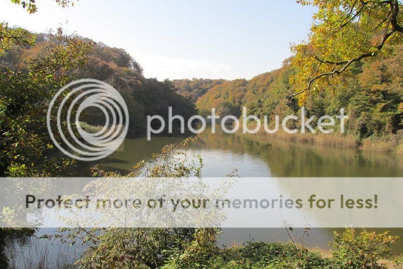
Ayvat Bendi Nature Park, meaning "Ayvat Dam", (Turkish: Ayvat Bendi Tabiat Parkı) is a nature park located in Eyüp district of Istanbul Province. Situated 9 km (5.6 mi) north of Kemerburgaz neighborhood of Eyüp, it covers an area of 50 ha (120 acres). It was established in 2011, and is one of the nine nature parks inside the Belgrad Forest.
Flora
Trees in the nature park area are (Quercus vulcanica), sessile oak (Quercus petraea), Turkey oak (Quercus cerris), blackthorn (Prunus spinosa), Oriental beech (Fagus orientalis), sweet chestnut (Castanea sativa), common hornbeam (Carpinus betulus) and common alder (Alnus glutinosa). As shrub and bush species, tree heath (Erica arborea), butcher's-broom (Ruscus aculeatus), blackberry (Rubus), European ivy (Hedera helix), Smilax excelsa, catnip (Nepeta cataria) and aubretia (Aubrieata cultorum) are found.
Fauna
Common mammals of the park are wild boar, golden jackal, deer, roe, fox, wolf, weasel, hare and squirrel. Obsered bird species are falcon, hawk, magpie, crow, woodpecker, sparrow, finch and goldfinch.
Dam
Ayvat Bendi is situated 4,3 km in the northwest of Büyük Bent in the Belgrad forest. It is located over Ayvad Stream. The other streams flowing to this stream are Eşek Stream and Göller Stream. Past the dam, Ayvat Stream runs to the Kâğıthane Stream via Davutpaşa Stream.
Ayvat Dam (Turkish: Ayvat Bendi), which was built by Ottoman Sultan Mustafa III (reigned 1757–1774) in 1765 on the Ayvat Creek, a tributary of the Kağıthane Creek. The dam has a reservoir capacity of 156.000 m3. Ayvat Bendi is situated 4,3 km in the northwest of Büyük Bent in the Belgrad forest. It is located over Ayvad Stream. The other streams flowing to this stream are Eşek Stream and Göller Stream. Past the dam, Ayvat Stream runs to the Kâğıthane Stream via Davutpaşa Stream.
Parks area offers Autopark, Activity Area, Fountain, Buffet, Picnic Areas, Historic Building, Dam, Dam Lake, Aqueduct, Pool.
The nature park can be accessed from the west over Kemerburgaz or from the east over Bahçeköy, Sarıyer. City bus lines #42M or #42HM serve Bahçeköy from Zincirlikuyu and Hacıosman respectively, from where a taxi ride is needed.
LOCATION SATELLITE MAP
These scripts and photographs are registered under © Copyright 2017, respected writers and photographers from the internet. All Rights Reserved.
GPS : 41°11'52.0"N 28°55'15.0"E / 41.197778, 28.920833

PHOTOGRAPHS ALBUM
Ayvat Bendi Nature Park, meaning "Ayvat Dam", (Turkish: Ayvat Bendi Tabiat Parkı) is a nature park located in Eyüp district of Istanbul Province. Situated 9 km (5.6 mi) north of Kemerburgaz neighborhood of Eyüp, it covers an area of 50 ha (120 acres). It was established in 2011, and is one of the nine nature parks inside the Belgrad Forest.
Flora
Trees in the nature park area are (Quercus vulcanica), sessile oak (Quercus petraea), Turkey oak (Quercus cerris), blackthorn (Prunus spinosa), Oriental beech (Fagus orientalis), sweet chestnut (Castanea sativa), common hornbeam (Carpinus betulus) and common alder (Alnus glutinosa). As shrub and bush species, tree heath (Erica arborea), butcher's-broom (Ruscus aculeatus), blackberry (Rubus), European ivy (Hedera helix), Smilax excelsa, catnip (Nepeta cataria) and aubretia (Aubrieata cultorum) are found.
Fauna
Common mammals of the park are wild boar, golden jackal, deer, roe, fox, wolf, weasel, hare and squirrel. Obsered bird species are falcon, hawk, magpie, crow, woodpecker, sparrow, finch and goldfinch.
Dam
Ayvat Bendi is situated 4,3 km in the northwest of Büyük Bent in the Belgrad forest. It is located over Ayvad Stream. The other streams flowing to this stream are Eşek Stream and Göller Stream. Past the dam, Ayvat Stream runs to the Kâğıthane Stream via Davutpaşa Stream.
Ayvat Dam (Turkish: Ayvat Bendi), which was built by Ottoman Sultan Mustafa III (reigned 1757–1774) in 1765 on the Ayvat Creek, a tributary of the Kağıthane Creek. The dam has a reservoir capacity of 156.000 m3. Ayvat Bendi is situated 4,3 km in the northwest of Büyük Bent in the Belgrad forest. It is located over Ayvad Stream. The other streams flowing to this stream are Eşek Stream and Göller Stream. Past the dam, Ayvat Stream runs to the Kâğıthane Stream via Davutpaşa Stream.
Parks area offers Autopark, Activity Area, Fountain, Buffet, Picnic Areas, Historic Building, Dam, Dam Lake, Aqueduct, Pool.
The nature park can be accessed from the west over Kemerburgaz or from the east over Bahçeköy, Sarıyer. City bus lines #42M or #42HM serve Bahçeköy from Zincirlikuyu and Hacıosman respectively, from where a taxi ride is needed.
LOCATION SATELLITE MAP
These scripts and photographs are registered under © Copyright 2017, respected writers and photographers from the internet. All Rights Reserved.
Tuesday, January 10, 2017
FALİH RIFKI ATAY NATURE PARK
Bahçeköy, Sarıyer - İstanbul - Turkey
GPS : 41°11'33.0"N 28°57'39.0"E / 41.192500, 28.960833
PHOTOGRAPHS ALBUM
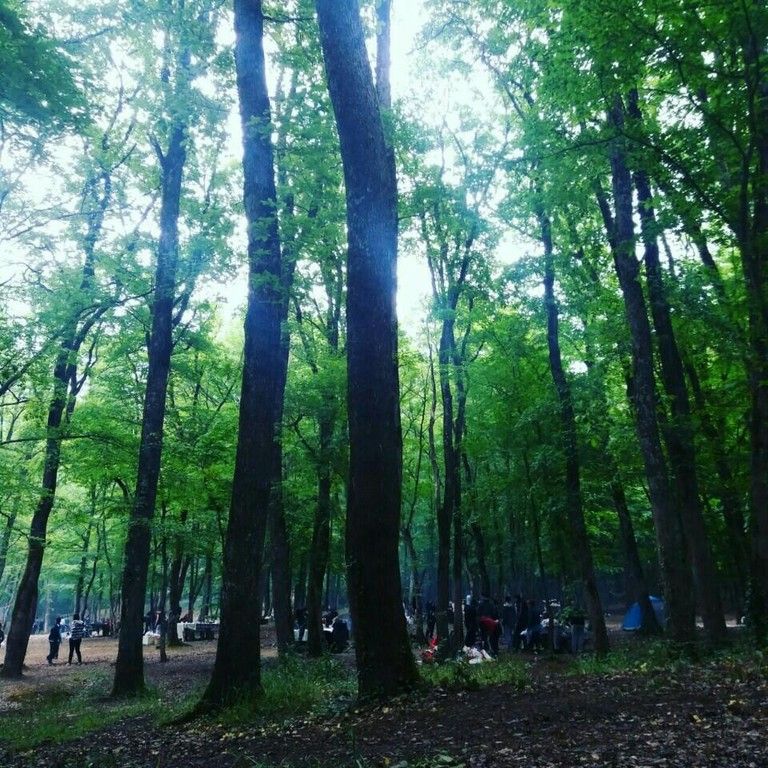
Falih Rıfkı Atay Nature Park (Turkish: Falih Rıfkı Atay Tabiat Parkı) is a nature park located in Sarıyer district of Istanbul Province.
Situated 7 km (4.3 mi) northwest of Bahçeköy neighborhood of Sarıyer and next to the Neşet Suyu Nature Park, it covers an area of 16.33 ha (40.4 acres). It was established in 2011, and is one of the nine nature parks inside the Belgrad Forest. The protected area is named in honor of journalist, writer and politician Falih Rıfkı Atay (1894–1971).
Serbs who were taken prisoners of war at the Siege of Belgrade (1521) by Ottoman Sultan Süleyman the Magnificent (reigned 1520–1566), were brought to Istanbul and settled in a village, which used to lie within the park boundaries. The nature park contains the ruins of a church, which is a protected historic building and was registered as cultural heritage in November 1999.
The nature park offers outdoor recreational activities such as hiking, cycling and picnicing for visitors on daily basis. There are playgrounds for children. Admission is charged for visitors and vehicles and an open-air restaurant serves the visitors. There are car park, fountains, buffet breakfast and dinner, picnic areas, wc, historic buildings are available.
Flora
The park is the habitat for diverse species of plant. The main trees present are oak (Quercus robur) and hornbeam (Carpinus betulus). Other deciduous trees include sessile oak (Quercus petraea), kasnak oak (Quercus vulcanica) and shrubs are blackberry (Rubus plicatus), butcher's-broom (Ruscus aculeatus), tree heath (Erica arborea) and bay laurel (Laurus nobilis). Some uncommon trees include silver linden (Tilia argentea) and oriental beech (Fagus orientalis). Anatolian catbrier (Smilax excelsa), aubretia (Aubrieata cultorum), wild strawberry (Fragaria) and cathip (Nepeta cataria) are some of the flowering plants found in the nature park.
Fauna
Mainly observed fauna of the nature park are porcupines, squirrels, turtles, magpies, crows, woodpeckers, sparrows and finches.
Across the nature park, there is Bahçeköy Deer Farm (Turkish: Geyik Üretme İstasyonu).
LOCATION SATELLITE MAP
These scripts and photographs are registered under © Copyright 2017, respected writers and photographers from the internet. All Rights Reserved.
GPS : 41°11'33.0"N 28°57'39.0"E / 41.192500, 28.960833

PHOTOGRAPHS ALBUM
Falih Rıfkı Atay Nature Park (Turkish: Falih Rıfkı Atay Tabiat Parkı) is a nature park located in Sarıyer district of Istanbul Province.
Situated 7 km (4.3 mi) northwest of Bahçeköy neighborhood of Sarıyer and next to the Neşet Suyu Nature Park, it covers an area of 16.33 ha (40.4 acres). It was established in 2011, and is one of the nine nature parks inside the Belgrad Forest. The protected area is named in honor of journalist, writer and politician Falih Rıfkı Atay (1894–1971).
Serbs who were taken prisoners of war at the Siege of Belgrade (1521) by Ottoman Sultan Süleyman the Magnificent (reigned 1520–1566), were brought to Istanbul and settled in a village, which used to lie within the park boundaries. The nature park contains the ruins of a church, which is a protected historic building and was registered as cultural heritage in November 1999.
The nature park offers outdoor recreational activities such as hiking, cycling and picnicing for visitors on daily basis. There are playgrounds for children. Admission is charged for visitors and vehicles and an open-air restaurant serves the visitors. There are car park, fountains, buffet breakfast and dinner, picnic areas, wc, historic buildings are available.
Flora
The park is the habitat for diverse species of plant. The main trees present are oak (Quercus robur) and hornbeam (Carpinus betulus). Other deciduous trees include sessile oak (Quercus petraea), kasnak oak (Quercus vulcanica) and shrubs are blackberry (Rubus plicatus), butcher's-broom (Ruscus aculeatus), tree heath (Erica arborea) and bay laurel (Laurus nobilis). Some uncommon trees include silver linden (Tilia argentea) and oriental beech (Fagus orientalis). Anatolian catbrier (Smilax excelsa), aubretia (Aubrieata cultorum), wild strawberry (Fragaria) and cathip (Nepeta cataria) are some of the flowering plants found in the nature park.
Fauna
Mainly observed fauna of the nature park are porcupines, squirrels, turtles, magpies, crows, woodpeckers, sparrows and finches.
Across the nature park, there is Bahçeköy Deer Farm (Turkish: Geyik Üretme İstasyonu).
LOCATION SATELLITE MAP
These scripts and photographs are registered under © Copyright 2017, respected writers and photographers from the internet. All Rights Reserved.
BENTLER NATURE PARK
Belgrad Forest, Sarıyer - İstanbul - Turkey
GPS : 41°11'22.1"N 28°59'13.0"E / 41.189472, 28.986944
PHOTOGRAPHS ALBUM
Bentler Nature Park (Turkish: Bentler Tabiat Parkı) is a nature park located in Sarıyer district of Istanbul Province, Turkey. Bentler means "dams" in Turkish language. Situated 1 km (0.62 mi) from Bahçeköy neighborhood of Sarıyer, it covers an area of 16.3 ha (40 acres). It was established in 2011, and is one of the nine nature parks inside the Belgrad Forest. There are fountain, wc, buffet, picnic areas, activity area, autopark facilities.
The protected area is named after the historic dams, the Topuzlu Dam (Topuzlu Bendi, built 1750), Valide Dam (Valide Bendi, built 1796) and New Dam (Yeni Bent or II. Mahmud Bendi, built 1839), which are located north of the park area. There are other structures as the Iskara Bendi and historical fountains from the Ottoman Empire era. Bentler Nature Park has two entrances, the main entrance of Belgrad Forest and Kurtkemeri Gate.
The nature park offers outdoor recreation activities such as hiking, cycling and picnicing, autopark, fountains, buffets, WC, historic buildings for visitors on daily basis. There is playgrounds for children. Admission is charged for visitors and vehicles.
Flora
Main tree species are oak (Quercus petraea) and hornbeam (Carpinus betulus). A 270-year old (2016) plane tree (Platanus) next to the Valide Dam was registered as a monument.
The park is habitat for diverse plant species. As coniferous tree Turkish pine (Pinus brutia), as deciduous trees oriental plane (Platanus orientalis), silver linden (Tilia argentea), European hornbeam (Carpinus betulus), oriental beech (Fagus orientalis), kasnak oak (Quercus vulcanica), Turkey oak (Quercus cerris), Aleppo oak (Quercus infectoria), European ash (Fraxinus excelsior), sweet chestnut (Castanea sativa), alder (Alnus orientalis), blackthorn (Prunus spinosa), medlar (Mespilus germanica), Turkish hazel (Corylus colurna) are found in the park. Shrubs of the nature park are blackberry (Rubus plicatus), butcher's-broom (Ruscus aculeatus) and buttercup (Clematis).
Fauna
The main fauna of the nature park consists of the mammals wild boar (Sus scrofa), fox (Vulpes vulpes), deer (Cervidae), roe deer (Capreolus capreolus), hare (Lepus), chipmunk, the reptile turtle. Observed bird species are hawk, sparrow, finch, magpie.
VALİDE DAM
GPS : 41°11'28.3"N 28°59'16.7"E / 41.191203, 28.987967
Valide Dam (Turkish: Valide Bendi) is a historic dam located in Sarıyer district of Istanbul Province, Turkey. The dam is situated north of Bahçeköy, Sarıyer inside the Bentler Nature Park, which is part of the Belgrad Forest.
Valide Dam was built in 1796 by Ottoman Sultan Selim III (reigned 1789–1807) to provide water for the donations in Eyüp of his mother Mihrişah Sultan (c. 1745–1805), who was titled Valide sultan during his reign.
Valide Dam impounds Ayazağa Creek, a tributary of Acıelma Creek, and has a catchment area of 1.825 km2 (0.705 sq mi). It is a solid gravity dam constructed in masonry with its crest and the waterside wall covered by marble. Two buttresses in 6.30 m (20.7 ft) distance at toe are attached to the downstream wall to reinforce the structure.
The dam is 11.25 m (36.9 ft) high from the thalweg and 103.90 m (340.9 ft) long at crest. The crest is 4.72 m (15.5 ft) and the base is 6.30 m (20.7 ft) wide. The dam has a reservoir capacity of 255,000 m3 (9,000,000 cu ft).
YENİ BEND
GPS : 41°11'23.0"N 28°59'09.6"E / 41.189710, 28.985987
The New Dam (Turkish: Yeni Bent), aka Sultan Mahmud II Dam (Turkish: II. Mahmut Bendi), is a historic dam located in Sarıyer district of Istanbul Province. The dam is situated next to Valide Dam north of Bahçeköy, Sarıyer inside the Bentler Nature Park, which is part of the Belgrad Forest. The New Dam was built in 1830 by Ottoman Sultan Mahmud II (reigned 1808–1839).
The New Dam impounds a tributary of Acıelma Creek and has a catchment area of 0.83 km2 (0.32 sq mi). It is a solid gravity dam constructed in masonry having a circular form. The dam is 15.62 m (51.2 ft) high from the thalweg and 101.55 m (333.2 ft) long at crest. The crest is 6.90 m (22.6 ft) and the base is 9.40 m (30.8 ft) wide. The dam has a reservoir capacity of 217,500 m3 (7,680,000 cu ft).
TOPUZLU DAM
GPS : 41°10'58.9"N 28°59'35.8"E / 41.183038, 28.993269
Topuzlu Dam (Turkish: Topuzlu Bent) is a historic dam located in Sarıyer district of Istanbul Province, Turkey. The dam is situated just north of Bahçeköy, Sarıyer inside the Bentler Nature Park, which is part of the Belgrad Forest.
Topuzlu Dam was built in 1750 by Ottoman Sultan Mahmud I (reigned 1730–1754). In 1786, its crest was raised about 3.40 m (11.2 ft) higher by Sultan Abdul Hamid I (reigned 1774–1789). The dam is named "Topuzlu" meaning "bulged" due to a bulge-formed central part of the upstream wall side.
Topuzlu Dam impounds Eskibağlar Creek and has a catchment area of 0.92 km2 (0.36 sq mi). It is a solid gravity dam constructed in masonry. The dam is 14.00 m (45.93 ft) high from the thalweg and 80.65 m (264.6 ft) long at crest. The crest is 4.30 m (14.1 ft) and the base is 7.00 m (22.97 ft) wide. The dam has a reservoir capacity of 160,000 m3 (5,700,000 cu ft).
LOCATION SATELLITE MAP
These scripts and photographs are registered under © Copyright 2017, respected writers and photographers from the internet. All Rights Reserved.
GPS : 41°11'22.1"N 28°59'13.0"E / 41.189472, 28.986944

PHOTOGRAPHS ALBUM
Bentler Nature Park (Turkish: Bentler Tabiat Parkı) is a nature park located in Sarıyer district of Istanbul Province, Turkey. Bentler means "dams" in Turkish language. Situated 1 km (0.62 mi) from Bahçeköy neighborhood of Sarıyer, it covers an area of 16.3 ha (40 acres). It was established in 2011, and is one of the nine nature parks inside the Belgrad Forest. There are fountain, wc, buffet, picnic areas, activity area, autopark facilities.
The protected area is named after the historic dams, the Topuzlu Dam (Topuzlu Bendi, built 1750), Valide Dam (Valide Bendi, built 1796) and New Dam (Yeni Bent or II. Mahmud Bendi, built 1839), which are located north of the park area. There are other structures as the Iskara Bendi and historical fountains from the Ottoman Empire era. Bentler Nature Park has two entrances, the main entrance of Belgrad Forest and Kurtkemeri Gate.
The nature park offers outdoor recreation activities such as hiking, cycling and picnicing, autopark, fountains, buffets, WC, historic buildings for visitors on daily basis. There is playgrounds for children. Admission is charged for visitors and vehicles.
Flora
Main tree species are oak (Quercus petraea) and hornbeam (Carpinus betulus). A 270-year old (2016) plane tree (Platanus) next to the Valide Dam was registered as a monument.
The park is habitat for diverse plant species. As coniferous tree Turkish pine (Pinus brutia), as deciduous trees oriental plane (Platanus orientalis), silver linden (Tilia argentea), European hornbeam (Carpinus betulus), oriental beech (Fagus orientalis), kasnak oak (Quercus vulcanica), Turkey oak (Quercus cerris), Aleppo oak (Quercus infectoria), European ash (Fraxinus excelsior), sweet chestnut (Castanea sativa), alder (Alnus orientalis), blackthorn (Prunus spinosa), medlar (Mespilus germanica), Turkish hazel (Corylus colurna) are found in the park. Shrubs of the nature park are blackberry (Rubus plicatus), butcher's-broom (Ruscus aculeatus) and buttercup (Clematis).
Fauna
The main fauna of the nature park consists of the mammals wild boar (Sus scrofa), fox (Vulpes vulpes), deer (Cervidae), roe deer (Capreolus capreolus), hare (Lepus), chipmunk, the reptile turtle. Observed bird species are hawk, sparrow, finch, magpie.
VALİDE DAM
GPS : 41°11'28.3"N 28°59'16.7"E / 41.191203, 28.987967
Valide Dam (Turkish: Valide Bendi) is a historic dam located in Sarıyer district of Istanbul Province, Turkey. The dam is situated north of Bahçeköy, Sarıyer inside the Bentler Nature Park, which is part of the Belgrad Forest.
Valide Dam was built in 1796 by Ottoman Sultan Selim III (reigned 1789–1807) to provide water for the donations in Eyüp of his mother Mihrişah Sultan (c. 1745–1805), who was titled Valide sultan during his reign.
Valide Dam impounds Ayazağa Creek, a tributary of Acıelma Creek, and has a catchment area of 1.825 km2 (0.705 sq mi). It is a solid gravity dam constructed in masonry with its crest and the waterside wall covered by marble. Two buttresses in 6.30 m (20.7 ft) distance at toe are attached to the downstream wall to reinforce the structure.
The dam is 11.25 m (36.9 ft) high from the thalweg and 103.90 m (340.9 ft) long at crest. The crest is 4.72 m (15.5 ft) and the base is 6.30 m (20.7 ft) wide. The dam has a reservoir capacity of 255,000 m3 (9,000,000 cu ft).
YENİ BEND
GPS : 41°11'23.0"N 28°59'09.6"E / 41.189710, 28.985987
The New Dam (Turkish: Yeni Bent), aka Sultan Mahmud II Dam (Turkish: II. Mahmut Bendi), is a historic dam located in Sarıyer district of Istanbul Province. The dam is situated next to Valide Dam north of Bahçeköy, Sarıyer inside the Bentler Nature Park, which is part of the Belgrad Forest. The New Dam was built in 1830 by Ottoman Sultan Mahmud II (reigned 1808–1839).
The New Dam impounds a tributary of Acıelma Creek and has a catchment area of 0.83 km2 (0.32 sq mi). It is a solid gravity dam constructed in masonry having a circular form. The dam is 15.62 m (51.2 ft) high from the thalweg and 101.55 m (333.2 ft) long at crest. The crest is 6.90 m (22.6 ft) and the base is 9.40 m (30.8 ft) wide. The dam has a reservoir capacity of 217,500 m3 (7,680,000 cu ft).
TOPUZLU DAM
GPS : 41°10'58.9"N 28°59'35.8"E / 41.183038, 28.993269
Topuzlu Dam (Turkish: Topuzlu Bent) is a historic dam located in Sarıyer district of Istanbul Province, Turkey. The dam is situated just north of Bahçeköy, Sarıyer inside the Bentler Nature Park, which is part of the Belgrad Forest.
Topuzlu Dam was built in 1750 by Ottoman Sultan Mahmud I (reigned 1730–1754). In 1786, its crest was raised about 3.40 m (11.2 ft) higher by Sultan Abdul Hamid I (reigned 1774–1789). The dam is named "Topuzlu" meaning "bulged" due to a bulge-formed central part of the upstream wall side.
Topuzlu Dam impounds Eskibağlar Creek and has a catchment area of 0.92 km2 (0.36 sq mi). It is a solid gravity dam constructed in masonry. The dam is 14.00 m (45.93 ft) high from the thalweg and 80.65 m (264.6 ft) long at crest. The crest is 4.30 m (14.1 ft) and the base is 7.00 m (22.97 ft) wide. The dam has a reservoir capacity of 160,000 m3 (5,700,000 cu ft).
LOCATION SATELLITE MAP
These scripts and photographs are registered under © Copyright 2017, respected writers and photographers from the internet. All Rights Reserved.
NEŞET SUYU NATURE PARK
Bahçeköy, Sarıyer - İstanbul - Turkey
GPS : 41°11'14.8"N 28°58'05.7"E / 41.187437, 28.968247
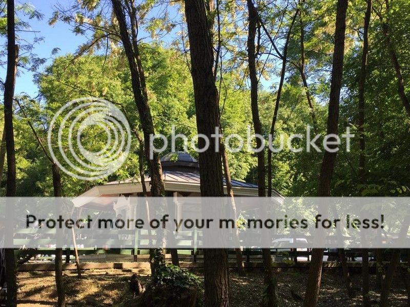
PHOTOGRAPHS ALBUM
Neşet Suyu Nature Park, aka Neşetsuyu Nature Park, (Turkish: Neşet Suyu Tabiat Parkı or Neşetsuyu Tabiat Parkı) is a nature park located in Sarıyer district of Istanbul Province, Turkey.
Situated 6 km (3.7 mi) northwest of Bahçeköy neighborhood of Sarıyer and next to the Falih Rıfkı Atay Nature Park, it covers an area of 67.47 ha (166.7 acres). It was established in 2011, and is one of the nine nature parks inside the Belgrad Forest. The protected area is named in honor of Professor (Ottoman Turkish: Müderris) Neşet Bey (1881–1924).
Neşet Bey was born in Resen, Ottoman Empire, today in the Republic of Macedonia, in 1881. He taught at the (Ottoman Turkish: Orman Mekteb-i alisi), today Forestry Faculty of Istanbul University, and served as its rector. He was much respected for his works in forestry by his colleagues and students. A memorial marble inscription erected by the Turkish Directorate General of Forestry on September 21, 1953 is situated inside the nature park.
In 2000, the soil in the park area, which is one of the most popular recreation places in Istanbul, was loosened up by earth movers since the soil became hardened throughout the years like concrete endangering the trees. It was found that the growth of the tree roots stopped, bacteria and fungi population increased due to lack of oxygen in the soil. Fallen leaves could not merge with the hardened soil to make it nutrient for the vegetation.
There are car park, activity areas, fountains, buffet breakfast and dinner, picnic areas, wc, historic buildings are available.
Flora
Dominant tree species of the nature park are oak and European hornbeam (Carpinus betulus). Other vegetat,on in the area are various shrubs and bushes.
Fauna
There are mammals and bird species in significant numbers in the Belgrad Forest. The main fauna species of the forestry are wild boar, golden jackal, deer, roe, fox, wolf, weasel, hare, squirrel, tortoise and hedgehog. As bird species observed are falcon, hawk, magpie, crow, woodpecker, sparrow, finch and goldfinch.
BÜYÜK BEND
In the southwest of the nature park, the Büyük Bent (liaterally: Big Dam) is situated on the Kırkçeşme water canal. Remains of a cistern and the mihrab of an open-air prayer place (Turkish: namazgah) are registered protected cultural heritage in the park area.
LOCATION SATELLITE MAP
These scripts and photographs are registered under © Copyright 2017, respected writers and photographers from the internet. All Rights Reserved.
GPS : 41°11'14.8"N 28°58'05.7"E / 41.187437, 28.968247

PHOTOGRAPHS ALBUM
Neşet Suyu Nature Park, aka Neşetsuyu Nature Park, (Turkish: Neşet Suyu Tabiat Parkı or Neşetsuyu Tabiat Parkı) is a nature park located in Sarıyer district of Istanbul Province, Turkey.
Situated 6 km (3.7 mi) northwest of Bahçeköy neighborhood of Sarıyer and next to the Falih Rıfkı Atay Nature Park, it covers an area of 67.47 ha (166.7 acres). It was established in 2011, and is one of the nine nature parks inside the Belgrad Forest. The protected area is named in honor of Professor (Ottoman Turkish: Müderris) Neşet Bey (1881–1924).
Neşet Bey was born in Resen, Ottoman Empire, today in the Republic of Macedonia, in 1881. He taught at the (Ottoman Turkish: Orman Mekteb-i alisi), today Forestry Faculty of Istanbul University, and served as its rector. He was much respected for his works in forestry by his colleagues and students. A memorial marble inscription erected by the Turkish Directorate General of Forestry on September 21, 1953 is situated inside the nature park.
In 2000, the soil in the park area, which is one of the most popular recreation places in Istanbul, was loosened up by earth movers since the soil became hardened throughout the years like concrete endangering the trees. It was found that the growth of the tree roots stopped, bacteria and fungi population increased due to lack of oxygen in the soil. Fallen leaves could not merge with the hardened soil to make it nutrient for the vegetation.
There are car park, activity areas, fountains, buffet breakfast and dinner, picnic areas, wc, historic buildings are available.
Flora
Dominant tree species of the nature park are oak and European hornbeam (Carpinus betulus). Other vegetat,on in the area are various shrubs and bushes.
Fauna
There are mammals and bird species in significant numbers in the Belgrad Forest. The main fauna species of the forestry are wild boar, golden jackal, deer, roe, fox, wolf, weasel, hare, squirrel, tortoise and hedgehog. As bird species observed are falcon, hawk, magpie, crow, woodpecker, sparrow, finch and goldfinch.
BÜYÜK BEND
In the southwest of the nature park, the Büyük Bent (liaterally: Big Dam) is situated on the Kırkçeşme water canal. Remains of a cistern and the mihrab of an open-air prayer place (Turkish: namazgah) are registered protected cultural heritage in the park area.
LOCATION SATELLITE MAP
These scripts and photographs are registered under © Copyright 2017, respected writers and photographers from the internet. All Rights Reserved.
Monday, January 9, 2017
FENERBAHÇE PARK
Fenerbahçe, Kadıköy - İstanbul - Turkey
GPS : 40°58'04.0"N 29°02'04.0"E / 40.967778, 29.034444
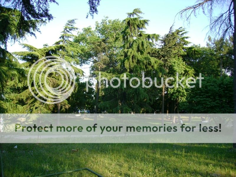
PHOTOGRAPHS ALBUM
The Fenerbahçe Park is located on the Fenerbahçe Peninsula, Kadikoy and the park is very popular with the Istanbul locals with its beautiful open and closed areas. The park overlooks the famous Princes Islands. In order to reach this beautiful park follow the Fenerbahçe signs when going towards Bostancı from Kızıltoprak. When you pass the marina located on the right and cross a very small bridge, you will come to a peninsula where the park is located.
Fenerbahçe, besides being the name of one of the oldest and most famous soccer teams in Turkey, it is among the most beautiful and elite districts of Anatolian side. Although the team is named after the district, when one mentions Fenerbahçe the first thing that comes to mind is the name of the soccer team. Well it should be considered normal in a country where soccer is so fervently admired.
Fenerbahçe (Fener: Lighthouse, Bahçe: Garden) named after the white lighthouse standing on the headland of a cozy peninsula also hosts quite a big park by the same name. Fenerbahçe was also a favorite promenade during the Ottoman Empire with its natural flora and stunning panorama. The restoration of the park lasted six months and was a costly project.
The flora has been renewed, jogging routes, resting sites, picnic areas and a special garden for dogs have been added. A parking lot and sport areas have also been constructed. At the edge of the park you'll be fascinated by the panoramic view. From here you can see the Princes' Islands on the south east and old Istanbul, Sultanahmet, Topkapı Palace and Haghia Sophia on the west.
The sunsets behind the elegant minarets are irresistible. During summer evenings the youngsters play guitar and sing songs. Moreover a moonlight stroll at Fenerbahçe should not be missed. The moon which rises and brightens the islands has always been a source of inspiration to lovers and amateur poets. You'll meet people of every age walking, running, exercising on the grass, and riding bicycles at every hour of the day. Housewives and students playing hooky are around in the morning.
The park fills with lovers in the afternoon and evenings bring people who want to relax after a long workday. Unfortunately there is nothing in particular for children so you will have to use your imagine, or let them use their own. Throughout the park, you will see gypsies selling flowers and telling fortunes and peddlers selling cotton candy, simit (similar to bagels) and balloons.
While wandering in the park you can either drop by a café for a snack, coffee or tea or sit on the benches and eat what you have brought with you. The number of people having breakfast on Sundays increases proportionally with the good weather conditions. There is also a section within the park offering ecological products.
Cafe Romantica is a covered cafe and sparrows often fly by, sometimes stopping to visit your table for crumbs. In summertime you can have a relaxing time in the garden of Romantica which runs all the way to the seaside.
Set on a little peninsular behind the Fenerbahçe marina, this park has lots of little pergola-cafés and an impressive pavilion full of song birds and antique kitchenware. There used to be a palace here. When the park was first opened to the public in the 19th century it immediately became a hugely popular spot but suffered years of neglect before being re-opened in 1991.
This is a lovely park in a bustling neighborhood on the Anatolian side. On one edge of the park there is a fascinating and panoramic view of the city and the Bosphorus. The Park is often populated with young lovers, amateur artists and poets. Many people seeking respite come here and sit a bank idly, chewing on a sandwich or a bagel they brought with themselves. Sundays when the weather is nice, picnicers crowd the park.
An alternative to picnicking or hanging around on in the gardens or on the banks is to go to one of the cafes inside the park. The latter offers a peaceful and romantic respite inside the greenery.
LOCATION SATELLITE MAP
These scripts and photographs are registered under © Copyright 2017, respected writers and photographers from the internet. All Rights Reserved.
GPS : 40°58'04.0"N 29°02'04.0"E / 40.967778, 29.034444

PHOTOGRAPHS ALBUM
The Fenerbahçe Park is located on the Fenerbahçe Peninsula, Kadikoy and the park is very popular with the Istanbul locals with its beautiful open and closed areas. The park overlooks the famous Princes Islands. In order to reach this beautiful park follow the Fenerbahçe signs when going towards Bostancı from Kızıltoprak. When you pass the marina located on the right and cross a very small bridge, you will come to a peninsula where the park is located.
Fenerbahçe, besides being the name of one of the oldest and most famous soccer teams in Turkey, it is among the most beautiful and elite districts of Anatolian side. Although the team is named after the district, when one mentions Fenerbahçe the first thing that comes to mind is the name of the soccer team. Well it should be considered normal in a country where soccer is so fervently admired.
Fenerbahçe (Fener: Lighthouse, Bahçe: Garden) named after the white lighthouse standing on the headland of a cozy peninsula also hosts quite a big park by the same name. Fenerbahçe was also a favorite promenade during the Ottoman Empire with its natural flora and stunning panorama. The restoration of the park lasted six months and was a costly project.
The flora has been renewed, jogging routes, resting sites, picnic areas and a special garden for dogs have been added. A parking lot and sport areas have also been constructed. At the edge of the park you'll be fascinated by the panoramic view. From here you can see the Princes' Islands on the south east and old Istanbul, Sultanahmet, Topkapı Palace and Haghia Sophia on the west.
The sunsets behind the elegant minarets are irresistible. During summer evenings the youngsters play guitar and sing songs. Moreover a moonlight stroll at Fenerbahçe should not be missed. The moon which rises and brightens the islands has always been a source of inspiration to lovers and amateur poets. You'll meet people of every age walking, running, exercising on the grass, and riding bicycles at every hour of the day. Housewives and students playing hooky are around in the morning.
The park fills with lovers in the afternoon and evenings bring people who want to relax after a long workday. Unfortunately there is nothing in particular for children so you will have to use your imagine, or let them use their own. Throughout the park, you will see gypsies selling flowers and telling fortunes and peddlers selling cotton candy, simit (similar to bagels) and balloons.
While wandering in the park you can either drop by a café for a snack, coffee or tea or sit on the benches and eat what you have brought with you. The number of people having breakfast on Sundays increases proportionally with the good weather conditions. There is also a section within the park offering ecological products.
Cafe Romantica is a covered cafe and sparrows often fly by, sometimes stopping to visit your table for crumbs. In summertime you can have a relaxing time in the garden of Romantica which runs all the way to the seaside.
Set on a little peninsular behind the Fenerbahçe marina, this park has lots of little pergola-cafés and an impressive pavilion full of song birds and antique kitchenware. There used to be a palace here. When the park was first opened to the public in the 19th century it immediately became a hugely popular spot but suffered years of neglect before being re-opened in 1991.
This is a lovely park in a bustling neighborhood on the Anatolian side. On one edge of the park there is a fascinating and panoramic view of the city and the Bosphorus. The Park is often populated with young lovers, amateur artists and poets. Many people seeking respite come here and sit a bank idly, chewing on a sandwich or a bagel they brought with themselves. Sundays when the weather is nice, picnicers crowd the park.
An alternative to picnicking or hanging around on in the gardens or on the banks is to go to one of the cafes inside the park. The latter offers a peaceful and romantic respite inside the greenery.
LOCATION SATELLITE MAP
These scripts and photographs are registered under © Copyright 2017, respected writers and photographers from the internet. All Rights Reserved.
Sunday, January 8, 2017
TERKOS LAKE
Sarıyer - İstanbul - Turkey
GPS : 41°20'50.0"N 28°34'04.0"E / 41.347222, 28.567778

PHOTOGRAPHS ALBUM
It's 50 kilometers to the north of Istanbul on the Black Sea coast, having an area of 25 square kilometers and surrounded by small forests. The lake is fed by Istiranca river so its waters are fresh. It's one of the main fresh water sources of Istanbul using huge pipes connecting to the main water distribution center of the city.
The excessive water from the lake is discharged to the sea, if needed. Nearby the lake, there is a small village bearing the same name of the lake. Fresh water fishing and goose hunting is also possible with special regulations at and around Terkos Lake. There are a couple of country style small hotels around it, and attracts many local people especially during summer weekends.
It is situated in 50 km north -west of Istanbul in the Thrace region, behind the Karaburun. Terkos Lake which is also called Durusu Lake has 25 km square surface area. The deepest place of the lake is eleven meters. Catchment area of the lake is 619 km2. Although it is 2.75 meter higher than the sea level, it does not flow to Black Sea.
Reception Basin of Terkos Lake is small, but there are many runnels carrying water to the lake. Among these runnels, Istrance Runnel carries the most water. After the lake was separated from the sea, its water has become sweet. Approximately 196 million meter cube water enters into Terkos Lake annually. In high rainfall periods this water quantity rises to 237 million meter cube.
Terkos Village is situated near the lake. The lake is named after this village. The village dates back to the year 1000. It was built on the lakeside in the northwest direction of today’s village as a pirate’s bay by the Genoese, on the peninsula known as the inner fortress. It is seen that then the sea and the lake was in contact, but then they were separated by the natural factors. We understand from the remains of the fortress on the peninsula that there was a monastery called Trikos in the inner part of the fortress and that the village and the lake are named after this monastery.
A French ambassador who came to Istanbul in the 19th century sees the drought in the city and invites a delegation from the Ottoman Court to France. The French claim that the water-related problems in the city can be solved indeed. They show the Terkos Lake as a water resource in the sketches they have drawn. The foundations of the today’s factory building is laid in the year 1855 and following the completion of the factory’s construction in 2 years, water is supplied to Istanbul.
These facilities which have been supplying water to Istanbul for a hundred years still exist. The water is taken from the lake and after being purified in the facilities in Kagıthane, is distributed in Istanbul. Since the drought and the population in Istanbul have been increasing in recent years, the water obtained from the probes on the seaside is discharged to the Terkos Lake through pumps in order to meet the water need of the city.
In addition, The Terkos Lake is fishing and hunting place where various wild birds live. Durusu is among the favorite places of hunters. Fishing and bird hunting is available during the hunting season. However only wild duck and goose hunting is allowed. It is forbidden to shoot bird species such as black morass, coot, heron, pelican, and pheasant. The fish variety of the lake is: freshwater perch, salmon, pike, trout, roach, and carp. The lake is shallow and surrounded by rushes and touring by motorboat is not allowed. However there are boats for rent for you to row on the lake.
LOCATION SATELLITE MAP
These scripts and photographs are registered under © Copyright 2017, respected writers and photographers from the internet. All Rights Reserved.
GPS : 41°20'50.0"N 28°34'04.0"E / 41.347222, 28.567778

PHOTOGRAPHS ALBUM
It's 50 kilometers to the north of Istanbul on the Black Sea coast, having an area of 25 square kilometers and surrounded by small forests. The lake is fed by Istiranca river so its waters are fresh. It's one of the main fresh water sources of Istanbul using huge pipes connecting to the main water distribution center of the city.
The excessive water from the lake is discharged to the sea, if needed. Nearby the lake, there is a small village bearing the same name of the lake. Fresh water fishing and goose hunting is also possible with special regulations at and around Terkos Lake. There are a couple of country style small hotels around it, and attracts many local people especially during summer weekends.
It is situated in 50 km north -west of Istanbul in the Thrace region, behind the Karaburun. Terkos Lake which is also called Durusu Lake has 25 km square surface area. The deepest place of the lake is eleven meters. Catchment area of the lake is 619 km2. Although it is 2.75 meter higher than the sea level, it does not flow to Black Sea.
Reception Basin of Terkos Lake is small, but there are many runnels carrying water to the lake. Among these runnels, Istrance Runnel carries the most water. After the lake was separated from the sea, its water has become sweet. Approximately 196 million meter cube water enters into Terkos Lake annually. In high rainfall periods this water quantity rises to 237 million meter cube.
Terkos Village is situated near the lake. The lake is named after this village. The village dates back to the year 1000. It was built on the lakeside in the northwest direction of today’s village as a pirate’s bay by the Genoese, on the peninsula known as the inner fortress. It is seen that then the sea and the lake was in contact, but then they were separated by the natural factors. We understand from the remains of the fortress on the peninsula that there was a monastery called Trikos in the inner part of the fortress and that the village and the lake are named after this monastery.
A French ambassador who came to Istanbul in the 19th century sees the drought in the city and invites a delegation from the Ottoman Court to France. The French claim that the water-related problems in the city can be solved indeed. They show the Terkos Lake as a water resource in the sketches they have drawn. The foundations of the today’s factory building is laid in the year 1855 and following the completion of the factory’s construction in 2 years, water is supplied to Istanbul.
These facilities which have been supplying water to Istanbul for a hundred years still exist. The water is taken from the lake and after being purified in the facilities in Kagıthane, is distributed in Istanbul. Since the drought and the population in Istanbul have been increasing in recent years, the water obtained from the probes on the seaside is discharged to the Terkos Lake through pumps in order to meet the water need of the city.
In addition, The Terkos Lake is fishing and hunting place where various wild birds live. Durusu is among the favorite places of hunters. Fishing and bird hunting is available during the hunting season. However only wild duck and goose hunting is allowed. It is forbidden to shoot bird species such as black morass, coot, heron, pelican, and pheasant. The fish variety of the lake is: freshwater perch, salmon, pike, trout, roach, and carp. The lake is shallow and surrounded by rushes and touring by motorboat is not allowed. However there are boats for rent for you to row on the lake.
LOCATION SATELLITE MAP
These scripts and photographs are registered under © Copyright 2017, respected writers and photographers from the internet. All Rights Reserved.
GÜLHANE PARK
Gülhane, Fatih - Istanbul - Turkey
GPS : 41°00'38.0"N 28°58'43.4"E / 41.010545, 28.978723
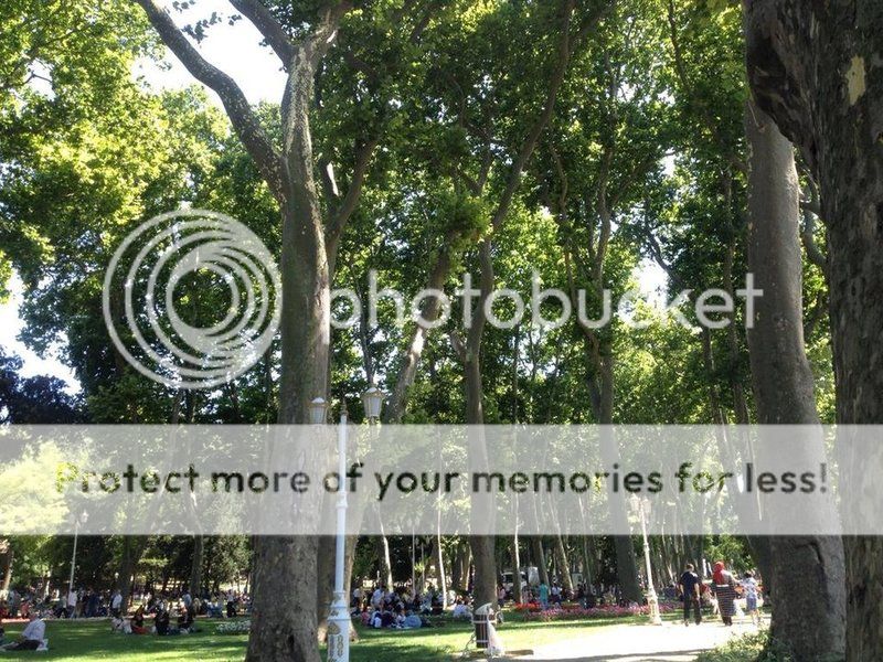
PHOTOGRAPHS ALBUM
It is one of the oldest parks in Istanbul. It stretches along a tiny hill, between Sarayburnu, Topkapı Palace and Çizme Gate. It's not for nothing that it is called "Gülhane" (rose garden); in the past, this place was made a rose garden so that Topkapı Palace would be steeped in fragrances of roses uplifting the soul and giving us a lovely view.
In the Byzantine Period, in Gülhane, there was military depots and barracks, later on the Mangana Palace was built. But, this was a holy area because of Hagios Georgies Monastery and Panagia Hodegetria (Sacred Spring "Ayazma") were also hereabouts, this was actually a sacred piece of land.
When Sultan Mehmet the Conqueror passed his ships over land initiating a new era for the city, he didn't stop short of surrounding Sarayburnu by walls of fortification, but also had the Çinili Köşk (Tiled Pavilion) inside. In this villa many sports activities took place as wrestling, javelin etc.
As the robes that touched the Ottoman throne changed, Grand vizier Sinan Pasha had İncili Villa (Pearled Villa) built here for Sultan Murad III, Ishakiye Kasrı Summer Palace, Mermer (Marble Pavilion) and Gülhane Pavilion were built. For the cleaning of the gardens and palaces in Gülhane, a squadron was arranged from the Bostancı Ocağı, and named as Gülhane Ocağı.
When Topkapı Palace fell out of grace and Dolmabahçe Palace was favored by the Sultans, the swagger of Gülhane was stilled. Pavilions were pulled down and even trees were up-rooted. In 1839, the Tanzimat Fermanı (sultan's decree of an administrative reform package) made history as the "Gülhane Hatt-ı Hümayünu" (sultan's decree) was personally read by Grand Vizier Mustafa Reşit Paşa to the public here. This was the place that the Ottoman State chose to announce its reforms in political, social and economic areas; meanwhile Sultan Abdülmecid watched what went on from Gülhane Kasrı.
Afterwards, the place where Sultan Abdülhamid II saw fit for the construction of the first big museum in the 1880s was again Gülhane Park. Then the Ottoman state had no more strength left to devote time to Gülhane. The first important construction studies of Istanbul were made in 1776 by French architect Kauffer, Gülhane was included in these studies but it could not have been renovated.
In 1880’s, Sultan Abdülhamid II gave permission for the construction of the first in here. While the construction of the Müze-i Hümayün (Museum), the garden planning was revived and the opening of both the museum and the garden took place together.
Gülhane Park was once part of the imperial garden of Topkapı Palace and mainly consisted of a grove. A section of the outer garden was planned as a park by the municipality and opened to the public in 1912. The park previously contained recreation areas, coffee houses, playgrounds etc. Later, a small zoo was opened within the park. The first statue of Atatürk in Turkey was erected in this park, in 1926 and sculptured by Heinrich Krippel.
Atatürk, in 24th November 1928, in the ceremony took place in Gülhane took the "Master Teacher" reputation and introduced the Latin alphabet to public and he gave his first lecture. The Park is still one of the most important parks in Istanbul, and there is a zoo established in 1955.
It is the oldest and one of the largest public parks in Istanbul. It is located between the Topkapı Palace and Sarayburnu. The entrance of the park has one of the larger gates of the palace. The park is spread over a very large area and has very interesting and rare kinds of trees and bushes.
The park went through a major renovation in recent years. During the renovation, the zoo, funfair and picnic grounds have been removed and the open space ratio was increased. The excursion routes were re-arranged and the big pool was restored in a modern style. Concrete structures were turned to open space areas and the park gained its natural landscape of the 1950s, with the view of the old trees dating from the 1800s, which were hidden behind the concrete buildings.
The old barracks within the area of Gülhane is expected to be converted to a cultural center in due course. This center is going to host a library and an exhibition hall, together with a workshop on kilim and handicrafts. Because of its geographical location within the historical peninsula where the heart of the city beat, since the 1880s when it opened its doors to everyone, Gülhane has always been the gathering place of the public and the meeting point of those not from the public, with members of the public.
At long last, Gülhane Park re-opened its doors to its guests with its new, made-up face, around the Istanbul Metropolitan Municipality's "transformation projects". The reorganization work of the park, a first-degree reserved land on 163 dönüms (land measure 1/4 of an acre) was done amid a bit of a clamor:
Despite the declaration that restoration work proceeded along with the decisions of the Board of Preservation of Cultural and Natural Heritage and under the supervision of archaeologists of Archeology Museums, the Tanzimat Museum was demolished, animals in the zoo, in service since 1955, were auctioned in a flurry to the Atatürk Forest Farm in Ankara, the aquarium in the Byzantine cistern was removed under the pretext that it caused humidity and Gülhane Festivities, involving free public concerts and acrobatic shows were called off for good.
Gülhane is still the hangout of the "people", the breathing hole of people with a paltry income. Gardening work has been done scrupulously, it's mesmeric. However, it's as if the Istanbul Metropolitan Municipality has loudly asserted the "urban" awareness that is has been trying to instill in the public by various advertising and commercial campaigns, in Gülhane. They try to "transform" city residents just like they "transformed" the city; where the "people" will proclaim their reply to that, we don't know yet.
LOCATION SATELLITE MAP
WEB SITE : Gülhane Park
MORE INFO & CONTACT
E-Mail : pbavrupa.arge@ibb.gov.tr
Phone : +90 212 312 6200
Fax : +90 212 380 2238
These scripts and photographs are registered under © Copyright 2017, respected writers and photographers from the internet. All Rights Reserved.
GPS : 41°00'38.0"N 28°58'43.4"E / 41.010545, 28.978723

PHOTOGRAPHS ALBUM
It is one of the oldest parks in Istanbul. It stretches along a tiny hill, between Sarayburnu, Topkapı Palace and Çizme Gate. It's not for nothing that it is called "Gülhane" (rose garden); in the past, this place was made a rose garden so that Topkapı Palace would be steeped in fragrances of roses uplifting the soul and giving us a lovely view.
In the Byzantine Period, in Gülhane, there was military depots and barracks, later on the Mangana Palace was built. But, this was a holy area because of Hagios Georgies Monastery and Panagia Hodegetria (Sacred Spring "Ayazma") were also hereabouts, this was actually a sacred piece of land.
When Sultan Mehmet the Conqueror passed his ships over land initiating a new era for the city, he didn't stop short of surrounding Sarayburnu by walls of fortification, but also had the Çinili Köşk (Tiled Pavilion) inside. In this villa many sports activities took place as wrestling, javelin etc.
As the robes that touched the Ottoman throne changed, Grand vizier Sinan Pasha had İncili Villa (Pearled Villa) built here for Sultan Murad III, Ishakiye Kasrı Summer Palace, Mermer (Marble Pavilion) and Gülhane Pavilion were built. For the cleaning of the gardens and palaces in Gülhane, a squadron was arranged from the Bostancı Ocağı, and named as Gülhane Ocağı.
When Topkapı Palace fell out of grace and Dolmabahçe Palace was favored by the Sultans, the swagger of Gülhane was stilled. Pavilions were pulled down and even trees were up-rooted. In 1839, the Tanzimat Fermanı (sultan's decree of an administrative reform package) made history as the "Gülhane Hatt-ı Hümayünu" (sultan's decree) was personally read by Grand Vizier Mustafa Reşit Paşa to the public here. This was the place that the Ottoman State chose to announce its reforms in political, social and economic areas; meanwhile Sultan Abdülmecid watched what went on from Gülhane Kasrı.
Afterwards, the place where Sultan Abdülhamid II saw fit for the construction of the first big museum in the 1880s was again Gülhane Park. Then the Ottoman state had no more strength left to devote time to Gülhane. The first important construction studies of Istanbul were made in 1776 by French architect Kauffer, Gülhane was included in these studies but it could not have been renovated.
In 1880’s, Sultan Abdülhamid II gave permission for the construction of the first in here. While the construction of the Müze-i Hümayün (Museum), the garden planning was revived and the opening of both the museum and the garden took place together.
Gülhane Park was once part of the imperial garden of Topkapı Palace and mainly consisted of a grove. A section of the outer garden was planned as a park by the municipality and opened to the public in 1912. The park previously contained recreation areas, coffee houses, playgrounds etc. Later, a small zoo was opened within the park. The first statue of Atatürk in Turkey was erected in this park, in 1926 and sculptured by Heinrich Krippel.
Atatürk, in 24th November 1928, in the ceremony took place in Gülhane took the "Master Teacher" reputation and introduced the Latin alphabet to public and he gave his first lecture. The Park is still one of the most important parks in Istanbul, and there is a zoo established in 1955.
It is the oldest and one of the largest public parks in Istanbul. It is located between the Topkapı Palace and Sarayburnu. The entrance of the park has one of the larger gates of the palace. The park is spread over a very large area and has very interesting and rare kinds of trees and bushes.
The park went through a major renovation in recent years. During the renovation, the zoo, funfair and picnic grounds have been removed and the open space ratio was increased. The excursion routes were re-arranged and the big pool was restored in a modern style. Concrete structures were turned to open space areas and the park gained its natural landscape of the 1950s, with the view of the old trees dating from the 1800s, which were hidden behind the concrete buildings.
The old barracks within the area of Gülhane is expected to be converted to a cultural center in due course. This center is going to host a library and an exhibition hall, together with a workshop on kilim and handicrafts. Because of its geographical location within the historical peninsula where the heart of the city beat, since the 1880s when it opened its doors to everyone, Gülhane has always been the gathering place of the public and the meeting point of those not from the public, with members of the public.
At long last, Gülhane Park re-opened its doors to its guests with its new, made-up face, around the Istanbul Metropolitan Municipality's "transformation projects". The reorganization work of the park, a first-degree reserved land on 163 dönüms (land measure 1/4 of an acre) was done amid a bit of a clamor:
Despite the declaration that restoration work proceeded along with the decisions of the Board of Preservation of Cultural and Natural Heritage and under the supervision of archaeologists of Archeology Museums, the Tanzimat Museum was demolished, animals in the zoo, in service since 1955, were auctioned in a flurry to the Atatürk Forest Farm in Ankara, the aquarium in the Byzantine cistern was removed under the pretext that it caused humidity and Gülhane Festivities, involving free public concerts and acrobatic shows were called off for good.
Gülhane is still the hangout of the "people", the breathing hole of people with a paltry income. Gardening work has been done scrupulously, it's mesmeric. However, it's as if the Istanbul Metropolitan Municipality has loudly asserted the "urban" awareness that is has been trying to instill in the public by various advertising and commercial campaigns, in Gülhane. They try to "transform" city residents just like they "transformed" the city; where the "people" will proclaim their reply to that, we don't know yet.
LOCATION SATELLITE MAP
WEB SITE : Gülhane Park
MORE INFO & CONTACT
E-Mail : pbavrupa.arge@ibb.gov.tr
Phone : +90 212 312 6200
Fax : +90 212 380 2238
These scripts and photographs are registered under © Copyright 2017, respected writers and photographers from the internet. All Rights Reserved.
Saturday, January 7, 2017
ABBASAĞA PARK
Abbasağa, Beşiktaş - İstanbul - Turkey
GPS : 41°02'45.6"N 29°00'20.9"E / 41.046000, 29.005806
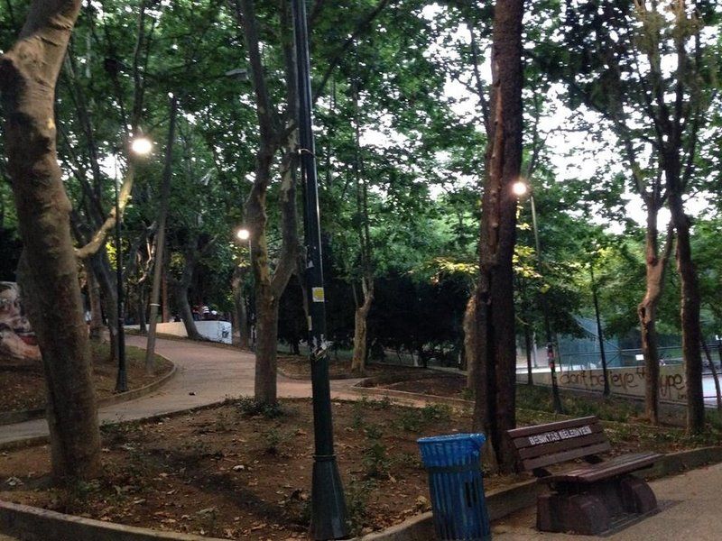
PHOTOGRAPHS ALBUM
The name of this location on the hillside of Beşiktaş, where once stood the Abbasağa Graveyard, was named after the Abbasağa Mosque in the neighborhood. Abbas Agha, who was the Chief Harem Eunuch, was in office between the years 1668- 1671 and had a many fountains and three hammams in Istanbul, one of which was the Kızlarağası Hammam in Laleli, built.
He also had the mosque in Beşiktaş built and founded. The graveyard was established and developed within this mosque, occupying quite a large space. In this graveyard, which was covered with cupressus trees, there were the gravestones of many historical persons who had been buried there since the 17th Century. In 1939, all the trees in this graveyard were cut down and all the gravestones were removed and demolished.
And the land of the Abbas Agha Graveyard, of which no trace remained any more, was organized into a park. Opened in 1941 taking up a total space of 12,000 m2, the park was bordered with Akdoğan Street on the east and Maşuklar Street on the west. When the graveyard was pulled up, the cupressus trees removed were replaced by pine trees, thuja trees, horse chestnut trees.
This pleasant neighbourhood park in Beşiktaş is great for a short walk (albeit an up-and-down one), resting or even doing some exercises (there is a basketball court and a fitness equipment area). It also has a huge community of cats.
Perhaps the park’s biggest attraction is its decent-sized amphitheatre. People gathered night after night to have their say, play music, and eat and drink together. In the spring and summer months, the amphitheatre also hosts concerts and an open-air cinema.
LOCATION SATELLITE MAP
These scripts and photographs are registered under © Copyright 2017, respected writers and photographers from the internet. All Rights Reserved.
GPS : 41°02'45.6"N 29°00'20.9"E / 41.046000, 29.005806

PHOTOGRAPHS ALBUM
The name of this location on the hillside of Beşiktaş, where once stood the Abbasağa Graveyard, was named after the Abbasağa Mosque in the neighborhood. Abbas Agha, who was the Chief Harem Eunuch, was in office between the years 1668- 1671 and had a many fountains and three hammams in Istanbul, one of which was the Kızlarağası Hammam in Laleli, built.
He also had the mosque in Beşiktaş built and founded. The graveyard was established and developed within this mosque, occupying quite a large space. In this graveyard, which was covered with cupressus trees, there were the gravestones of many historical persons who had been buried there since the 17th Century. In 1939, all the trees in this graveyard were cut down and all the gravestones were removed and demolished.
And the land of the Abbas Agha Graveyard, of which no trace remained any more, was organized into a park. Opened in 1941 taking up a total space of 12,000 m2, the park was bordered with Akdoğan Street on the east and Maşuklar Street on the west. When the graveyard was pulled up, the cupressus trees removed were replaced by pine trees, thuja trees, horse chestnut trees.
This pleasant neighbourhood park in Beşiktaş is great for a short walk (albeit an up-and-down one), resting or even doing some exercises (there is a basketball court and a fitness equipment area). It also has a huge community of cats.
Perhaps the park’s biggest attraction is its decent-sized amphitheatre. People gathered night after night to have their say, play music, and eat and drink together. In the spring and summer months, the amphitheatre also hosts concerts and an open-air cinema.
LOCATION SATELLITE MAP
These scripts and photographs are registered under © Copyright 2017, respected writers and photographers from the internet. All Rights Reserved.
Friday, January 6, 2017
EMİRGAN GROVE PARK
Emirgan, Sarıyer - Istanbul - Turkey
GPS : 41°06'33.0"N 29°03'09.0"E / 41.109167, 29.052500
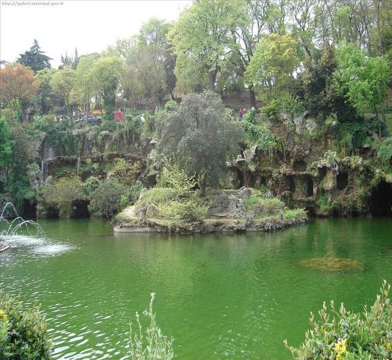
PHOTOGRAPHS ALBUM
The Emirgan Park is a historical urban park located in Emirgan neighborhood at the Bosphorus in Sarıyer district of Istanbul, Turkey. It is one of the largest public parks in Istanbul.
In the Byzantine era, the entire area, where today the park stretches, was covered with cypress trees and known as "Kyparades" or "Cypress Forest". It became known as "Feridun Bey Park", when the uninhabited land was granted in the mid-16th century to Nişancı Feridun Bey, a Lord Chancellor in rank in the Ottoman Empire.
In the 17th century, Ottoman sultan Murad IV (reigned 1623-1640) presented the estate to Emir Gûne Han, a Safavid Persian commander, who surrendered his sieged castle without any resistance, and followed him back to Istanbul. The name "Feridun Bey Park" was changed to "Emirgûne", which in time became corrupted to "Emirgan".
During the centuries, the estate's owner changed several times, and by the end of the 1860s, it was owned by Khedive Ismail Pasha (reigned 1863-1879), Ottoman governor of Egypt and Sudan. The area was used as the backyard of a large wooden yalı he built down at Bosporus. Further, he built within the park area three wooden pavilions, which still exists.
The heirs of the Khedive family sold the estate in the 1930s to Satvet Lütfi Tozan, a wealthy Turkish arms dealer, who granted the park grounds, the three pavilions included, later in the 1940s to the City of Istanbul during office of Governor and Mayor Lütfi Kırdar (1938-1949).
The park, owned and administered today by the Metropolitan Municipality of Istanbul, covers an area of 117 acres (470,000 m2) on a hillside, and is enclosed by high walls.
Inside the park with two decorative ponds are plants of more than 120 species. The most notable rare trees of the park's flora are: Stone Pine, Turkish pine, Aleppo Pine, Blue Pine, Eastern White Pine, Maritime Pine, Japanese Cedar, Norway Spruce, Blue Spruce, Atlas Cedar, Lebanon Cedar, Himalayan cedar, Beech, Ash tree, Sapindus, Babylon Willow, Hungarian Oak, Colorado White Fir, Maidenhair tree, California incense-cedar, Coast Redwood and Camphor tree.
Many jogging tracks and picnic tables make the Emirgan Park a very popular recreation area for the local people, especially during the weekends and holidays. The three historic pavilions, called after their exterior color as the Yellow Pavilion, the Pink Pavilion and the White Pavilion were restored in time between 1979-1983, and opened to the public as cafeteria and restaurant.
LOCATION SATELLITE MAP
These scripts and photographs are registered under © Copyright 2017, respected writers and photographers from the internet. All Rights Reserved.
GPS : 41°06'33.0"N 29°03'09.0"E / 41.109167, 29.052500

PHOTOGRAPHS ALBUM
The Emirgan Park is a historical urban park located in Emirgan neighborhood at the Bosphorus in Sarıyer district of Istanbul, Turkey. It is one of the largest public parks in Istanbul.
In the Byzantine era, the entire area, where today the park stretches, was covered with cypress trees and known as "Kyparades" or "Cypress Forest". It became known as "Feridun Bey Park", when the uninhabited land was granted in the mid-16th century to Nişancı Feridun Bey, a Lord Chancellor in rank in the Ottoman Empire.
In the 17th century, Ottoman sultan Murad IV (reigned 1623-1640) presented the estate to Emir Gûne Han, a Safavid Persian commander, who surrendered his sieged castle without any resistance, and followed him back to Istanbul. The name "Feridun Bey Park" was changed to "Emirgûne", which in time became corrupted to "Emirgan".
During the centuries, the estate's owner changed several times, and by the end of the 1860s, it was owned by Khedive Ismail Pasha (reigned 1863-1879), Ottoman governor of Egypt and Sudan. The area was used as the backyard of a large wooden yalı he built down at Bosporus. Further, he built within the park area three wooden pavilions, which still exists.
The heirs of the Khedive family sold the estate in the 1930s to Satvet Lütfi Tozan, a wealthy Turkish arms dealer, who granted the park grounds, the three pavilions included, later in the 1940s to the City of Istanbul during office of Governor and Mayor Lütfi Kırdar (1938-1949).
The park, owned and administered today by the Metropolitan Municipality of Istanbul, covers an area of 117 acres (470,000 m2) on a hillside, and is enclosed by high walls.
Inside the park with two decorative ponds are plants of more than 120 species. The most notable rare trees of the park's flora are: Stone Pine, Turkish pine, Aleppo Pine, Blue Pine, Eastern White Pine, Maritime Pine, Japanese Cedar, Norway Spruce, Blue Spruce, Atlas Cedar, Lebanon Cedar, Himalayan cedar, Beech, Ash tree, Sapindus, Babylon Willow, Hungarian Oak, Colorado White Fir, Maidenhair tree, California incense-cedar, Coast Redwood and Camphor tree.
Many jogging tracks and picnic tables make the Emirgan Park a very popular recreation area for the local people, especially during the weekends and holidays. The three historic pavilions, called after their exterior color as the Yellow Pavilion, the Pink Pavilion and the White Pavilion were restored in time between 1979-1983, and opened to the public as cafeteria and restaurant.
LOCATION SATELLITE MAP
These scripts and photographs are registered under © Copyright 2017, respected writers and photographers from the internet. All Rights Reserved.
YILDIZ GROVE PARK
Yıldız, Beşiktaş - Istanbul - Turkey
GPS : 41°02'57.0"N 29°00'57.0"E / 41.049167, 29.015833
PHOTOGRAPHS ALBUM
Yıldız Park is a historical, urban park in Beşiktaş district of Istanbul, Turkey. It is one of the largest public parks in Istanbul. The park is located in Yıldız quarter between the palaces of Yıldız and Çırağan.
Yıldız Park is the biggest green field of Beşiktaş. The history of it dates back to early 17th century. This extensive field owned by the daughter of Sultan Murad IV was then owned by Mehmed Pasha, brother of Damat İbrahim Pasha in 18th century. The plantation, today called Yıldız Park, was named "Çırağan" after the festivals held by Mehmed Pasha in the coastal side open for Bosphorus. Yıldız Park, again comes to life with Çırağan Palace and the bridge built between the palace and the plantation.
History
Yıldız Park was once part of the imperial garden of Yıldız Palace. Extending down the slopes from the palace, this walled park was reserved only for palace dwellers during the reign of Sultan Abdülhamid II.
The area of Yıldız used to be a forest in Byzantine times. Starting during the reign of Sultan Süleyman the Magnificent, the sultans made it their hunting grounds. In the next centuries, it remained as a grove behind the seaside palaces. The neighbourhood began to flourish in the wake of construction of the palace in the 19th century. It took its name from the first pavilion, namely Yıldız Kasrı, commissioned by Sultan Selim III in early 19th century.
The 25-acre (0.10 km2) of the palace's external garden were surrounded by high walls and detached from a grove during the reign of Sultan Abdülhamid II in the 19th century. A small artificial lake, pavilions, summer houses and a porcelain factory were established in this section.
Women of the palace who were allowed to go out in the days of springs after the cold days of winter, purified from the presence of men in the plantation, come together with green and and nature in this particular place. Borders of the plantation was then enlarged after Sultan Abdülhamid II moves to Yıldız Palace. After the disenthrone of Sultan Abdülhamid II, doors of the plantation was closed.
Today
Currently Yıldız Park is a beautiful garden complex with set in a very large park of flowers, plants and trees, gathered from every part of the world dating from the Ottoman era. Park grounds offer panoramic views of the Bosphorus. The park is a popular picnic place especially for the weekends. Two beautiful old pavilions, namely Çadır and Malta pavilions, are used to rest, drink tea, eat breakfast and have lunch.
The park is separated into two sections, the outer section is open to the public and comprises the Şale, Çadır and Malta pavilions and the still-operating Yıldız porcelain factory. The vegetation of the park includes magnolia, bay leaves, Judas trees, silver limes and horse-chestnuts. Furthermore, the park shelters oak, cypress, pine, yew, cedar and ash trees. Besides, the outer section has two man-made lakes.
Pavilions
The plantation was ascribed to Greater Municipality of Istanbul in 1940s with the pavilions of Malta and Çadır. Its’ name was changed to Yıldız Park in the same period. Municipality of İstanbul, takes over the management of the park. Today, the park is a place for having a good breath and a moment of relaxation, especially for the residents of Beşiktaş. Malta and Çadır Pavilions in the park were restored in 1979 and a covered cafe "Pembe Sera" was built.
Tent Pavilion
One of the two historical houses in Yıldız Groves. It was built in the backyard of Çırağan Palace for daily tours. After the foundation of the Republic, it had remained closed for a long time. In present day, it is open to public.
Malta Pavilion
It was known to have been built in Abdülaziz period and has a marvelous landscape. It was restored by remaining loyal to its original form. You can see the gorgeous ceiling ornaments and also have a pleasing dinner with your friends. Malta and Çadır Pavilions in the park were restored in 1979 and a covered cafe "Pembe Sera" was built. Malta and Çadır Pavilions in the park were restored in 1979 and a covered cafe "Pembe Sera" was built.
This park is a real hidden treasure in the heart of the city. Whenever you wish to spend pleasant hours relaxing admist greenery Yıldız Park would be a good choice with its walking routes, cafes, century old trees, ponds and water canals.
Currently Yıldız Park is a beautiful garden complex with set in a very large park of flowers, plants and trees, gathered from every part of the world dating from the Ottoman era. Park grounds offer panoramic views of the Bosphorus. The park is a popular picnic place especially for the weekends. Two beautiful old pavilions, namely Çadır and Malta pavilions, is used to rest, drink tea, eat breakfast and have lunch.
Yıldız Groves where you can see every tone of green is on the slopes between Beşiktaş and Ortaköy. These groves which we can define as the oxygen store for Beşiktaş, was one of the most important places in the Ottoman times with its tulip gardens. Yıldız Korusu had experienced legendary feasts, but had been closed after Sultan Abdülhamid II was dethroned.
In addition to Yıldız Palace which we describe in detail in the subsequent pages, and Şale Pavilion the grove accommodates, there are also Yıldız Palace’ Clock Tower, Tent Pavilion and Malta Pavilion.
Currently Yıldız Park is a beautiful garden complex with set in a very large park of flowers, plants and trees, gathered from every part of the world dating from the Ottoman era. Park grounds offer panoramic views of the Bosphorus. The park is a popular picnic place especially for the weekends. Two beautiful old pavilions, namely Çadır and Malta pavilions, are used to rest, drink tea, eat breakfast and have lunch.
LOCATION SATELLITE MAP
These scripts and photographs are registered under © Copyright 2017, respected writers and photographers from the internet. All Rights Reserved.
GPS : 41°02'57.0"N 29°00'57.0"E / 41.049167, 29.015833

PHOTOGRAPHS ALBUM
Yıldız Park is a historical, urban park in Beşiktaş district of Istanbul, Turkey. It is one of the largest public parks in Istanbul. The park is located in Yıldız quarter between the palaces of Yıldız and Çırağan.
Yıldız Park is the biggest green field of Beşiktaş. The history of it dates back to early 17th century. This extensive field owned by the daughter of Sultan Murad IV was then owned by Mehmed Pasha, brother of Damat İbrahim Pasha in 18th century. The plantation, today called Yıldız Park, was named "Çırağan" after the festivals held by Mehmed Pasha in the coastal side open for Bosphorus. Yıldız Park, again comes to life with Çırağan Palace and the bridge built between the palace and the plantation.
History
Yıldız Park was once part of the imperial garden of Yıldız Palace. Extending down the slopes from the palace, this walled park was reserved only for palace dwellers during the reign of Sultan Abdülhamid II.
The area of Yıldız used to be a forest in Byzantine times. Starting during the reign of Sultan Süleyman the Magnificent, the sultans made it their hunting grounds. In the next centuries, it remained as a grove behind the seaside palaces. The neighbourhood began to flourish in the wake of construction of the palace in the 19th century. It took its name from the first pavilion, namely Yıldız Kasrı, commissioned by Sultan Selim III in early 19th century.
The 25-acre (0.10 km2) of the palace's external garden were surrounded by high walls and detached from a grove during the reign of Sultan Abdülhamid II in the 19th century. A small artificial lake, pavilions, summer houses and a porcelain factory were established in this section.
Women of the palace who were allowed to go out in the days of springs after the cold days of winter, purified from the presence of men in the plantation, come together with green and and nature in this particular place. Borders of the plantation was then enlarged after Sultan Abdülhamid II moves to Yıldız Palace. After the disenthrone of Sultan Abdülhamid II, doors of the plantation was closed.
Today
Currently Yıldız Park is a beautiful garden complex with set in a very large park of flowers, plants and trees, gathered from every part of the world dating from the Ottoman era. Park grounds offer panoramic views of the Bosphorus. The park is a popular picnic place especially for the weekends. Two beautiful old pavilions, namely Çadır and Malta pavilions, are used to rest, drink tea, eat breakfast and have lunch.
The park is separated into two sections, the outer section is open to the public and comprises the Şale, Çadır and Malta pavilions and the still-operating Yıldız porcelain factory. The vegetation of the park includes magnolia, bay leaves, Judas trees, silver limes and horse-chestnuts. Furthermore, the park shelters oak, cypress, pine, yew, cedar and ash trees. Besides, the outer section has two man-made lakes.
Pavilions
The plantation was ascribed to Greater Municipality of Istanbul in 1940s with the pavilions of Malta and Çadır. Its’ name was changed to Yıldız Park in the same period. Municipality of İstanbul, takes over the management of the park. Today, the park is a place for having a good breath and a moment of relaxation, especially for the residents of Beşiktaş. Malta and Çadır Pavilions in the park were restored in 1979 and a covered cafe "Pembe Sera" was built.
Tent Pavilion
One of the two historical houses in Yıldız Groves. It was built in the backyard of Çırağan Palace for daily tours. After the foundation of the Republic, it had remained closed for a long time. In present day, it is open to public.
Malta Pavilion
It was known to have been built in Abdülaziz period and has a marvelous landscape. It was restored by remaining loyal to its original form. You can see the gorgeous ceiling ornaments and also have a pleasing dinner with your friends. Malta and Çadır Pavilions in the park were restored in 1979 and a covered cafe "Pembe Sera" was built. Malta and Çadır Pavilions in the park were restored in 1979 and a covered cafe "Pembe Sera" was built.
This park is a real hidden treasure in the heart of the city. Whenever you wish to spend pleasant hours relaxing admist greenery Yıldız Park would be a good choice with its walking routes, cafes, century old trees, ponds and water canals.
Currently Yıldız Park is a beautiful garden complex with set in a very large park of flowers, plants and trees, gathered from every part of the world dating from the Ottoman era. Park grounds offer panoramic views of the Bosphorus. The park is a popular picnic place especially for the weekends. Two beautiful old pavilions, namely Çadır and Malta pavilions, is used to rest, drink tea, eat breakfast and have lunch.
Yıldız Groves where you can see every tone of green is on the slopes between Beşiktaş and Ortaköy. These groves which we can define as the oxygen store for Beşiktaş, was one of the most important places in the Ottoman times with its tulip gardens. Yıldız Korusu had experienced legendary feasts, but had been closed after Sultan Abdülhamid II was dethroned.
In addition to Yıldız Palace which we describe in detail in the subsequent pages, and Şale Pavilion the grove accommodates, there are also Yıldız Palace’ Clock Tower, Tent Pavilion and Malta Pavilion.
Currently Yıldız Park is a beautiful garden complex with set in a very large park of flowers, plants and trees, gathered from every part of the world dating from the Ottoman era. Park grounds offer panoramic views of the Bosphorus. The park is a popular picnic place especially for the weekends. Two beautiful old pavilions, namely Çadır and Malta pavilions, are used to rest, drink tea, eat breakfast and have lunch.
LOCATION SATELLITE MAP
These scripts and photographs are registered under © Copyright 2017, respected writers and photographers from the internet. All Rights Reserved.
Subscribe to:
Posts (Atom)