Çayırbaşı, Sarıyer - İstanbul - Turkey
GPS : 41°08'26.0"N 29°01'39.0"E / 41.140556, 29.027500
Türkmenbaşı Nature Park (Turkish: Türkmenbaşı Tabiat Parkı) is a nature park located in Sarıyer district of Istanbul Province. Situated west of Hacı Osman Bayırı Avenue in Çayırbaşı neighborhood of Sarıyer, it covers an area of 5.6 ha (14 acres).
It was established in 1998 as a place, to dignify the cultural values shared by Turkey and Turkmenistan. It was named "Turkmenbashi" (literally: Head of Turkmens), in honor of Saparmurat Niyazov (1940–2006) , the leader of Turkmenistan.
There are car park, fountains, picnic areas, wc are available. The nature park offers outdoor recreation activities such as hiking and picnicing for visitors on daily basis. There is a playground for children.
Flora
Common plant of the nature park is pine. Other notable trees are oak (Quercus petraea), hornbeam (Carpinus betulus), oriental plane (Platanus orientalis), Norway spruce (Picea abies), Mediterranean cypress (Cupressus sempervirens), honeyberry, (Celtis australis), medlar (Mespilus germanica), shinglewood (Thuja plicata) and the shrubs lavender (Lavandula spica), barberry (Berberis vulgaris), glossy abelia (Abelia × grandiflora), pittosporum (Pittosporum tobira), cherry laurel (Laurocerasus officinalis), Chinese photinia (Photinia serratifolia), strawberry tree (Arbutus unedo), Japanese aucuba (Aucuba japonica), fountainplant (Ophiopogon japonicus).
Fauna
The main fauna of the nature park consists pf bird species. Observed bird species are finch, magpie, sparrow, Western jackdaw, woodpecker. Other species are lizard and chipmunk.
LOCATION SATELLITE MAP
These scripts and photographs are registered under © Copyright 2017, respected writers and photographers from the internet. All Rights Reserved.
Showing posts with label nature park. Show all posts
Showing posts with label nature park. Show all posts
Friday, January 13, 2017

Thursday, January 12, 2017
AYDOS FOREST AND LAKE
Sultanbeyli - İstanbul - Turkey
GPS : 40°57'09.0"N 29°13'57.0"E / 40.952500, 29.232500
PHOTOGRAPHS ALBUM
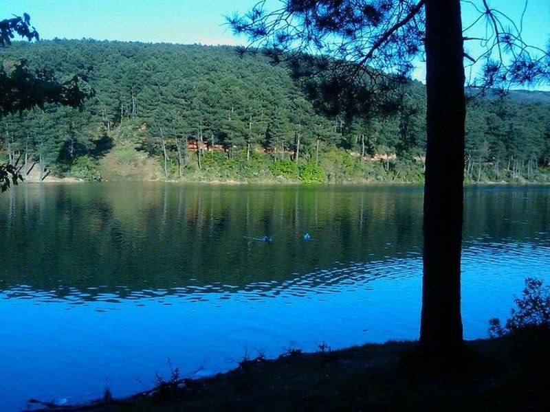
It is rich of mainly pine trees, contains jogging routes, picnic areas and a lake. Excellent spot for photo enthusiasts. 6620 acres in size, Aydos forest is a natural recreational area and oxygen source.
The old name of the Aydos Mountain which is Istanbul’s highest hill was Aetos which means Eagle in Greek. 23 different types of birds currently live in the forest which was used as a hunting area in the Ottoman times. The forest where there are remains of the historical Aydos Castle stands out as one of the rare places in the city where nature meets history.
Aydos Hill (Turkish: Aydos Tepesi) is a hill in the north of Kartal district of Istanbul, Turkey. Its peak at 537 m (1,762 ft) above sea level is the highest point of Istanbul. The hill is surrounded by woods.
Aydos' name comes from Aydos Fortress, which was situated next to the hill. The fortress was built in the first half of 6th century by the Roman Empire. Today, the ruins of Aydos Fortress are in the Sultanbeyli and Pendik district of Istanbul.
The area where we sat was quite conducive to talking because it was well-shaded. Sunlight peeked through various branches above us but its heat was reduced due to a steady, light breeze throughout the afternoon.
LOCATION SATELLITE MAP
These scripts and photographs are registered under © Copyright 2017, respected writers and photographers from the internet. All Rights Reserved.
GPS : 40°57'09.0"N 29°13'57.0"E / 40.952500, 29.232500

PHOTOGRAPHS ALBUM
It is rich of mainly pine trees, contains jogging routes, picnic areas and a lake. Excellent spot for photo enthusiasts. 6620 acres in size, Aydos forest is a natural recreational area and oxygen source.
The old name of the Aydos Mountain which is Istanbul’s highest hill was Aetos which means Eagle in Greek. 23 different types of birds currently live in the forest which was used as a hunting area in the Ottoman times. The forest where there are remains of the historical Aydos Castle stands out as one of the rare places in the city where nature meets history.
Aydos Hill (Turkish: Aydos Tepesi) is a hill in the north of Kartal district of Istanbul, Turkey. Its peak at 537 m (1,762 ft) above sea level is the highest point of Istanbul. The hill is surrounded by woods.
Aydos' name comes from Aydos Fortress, which was situated next to the hill. The fortress was built in the first half of 6th century by the Roman Empire. Today, the ruins of Aydos Fortress are in the Sultanbeyli and Pendik district of Istanbul.
The area where we sat was quite conducive to talking because it was well-shaded. Sunlight peeked through various branches above us but its heat was reduced due to a steady, light breeze throughout the afternoon.
LOCATION SATELLITE MAP
These scripts and photographs are registered under © Copyright 2017, respected writers and photographers from the internet. All Rights Reserved.
Wednesday, January 11, 2017
ÇİLİNGOZ NATURE PARK
Binkılıç, Çatalca - İstanbul - Turkey
GPS : 41°31'30.6"N 28°13'08.0"E / 41.525168, 28.218875
PHOTOGRAPHS ALBUM
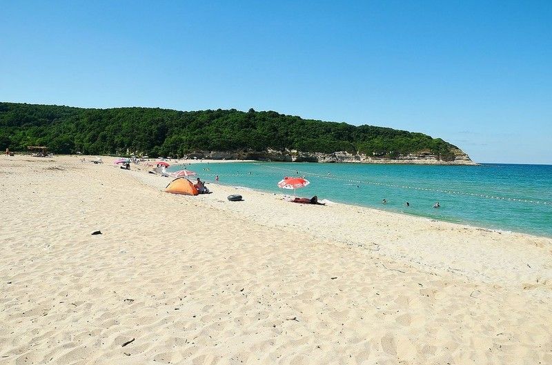
Çilingoz Nature Park (Turkish: Çilingoz Tabiat Parkı) is a nature park located in Çatalca district of Istanbul Province. Situated at Binkılıç town of Çatalca, northwest of Istanbul on the Black Sea coast, it covers an area of 17.75 ha (43.9 acres). It was established in 2011. The region incorporating the nature park was declared a Wildlife Protection Area for its rich flora and fauna in 2005. Therefore, hunting is continuously forbidden in the region.
The nature park is on a bay featuring the combination of beach, forest, lake and reedy. The park has a 1,200 m (3,900 ft)-long and 80 m (260 ft)-wide beach with fine sand at its north. The Çilingoz Creek flows towards north into the Black Sea creating a sandy-alluvial mouth, which is narrow. There, it forms a large lake surrounded by reedy.
The nature park offers outdoor recreational activities such as camping, angling, hiking and picnicing for visitors. A restaurant and a snack bar serve the visitors. 60 tents are available for rent. Camping season continues until mid September. There is a RV park for recreational vehicles. The 30 wooden bungalows in the park area are for the use of personnel of the Forestry Administration, and can not be rented by visitors. Nearest comfortable lodging opportunity is available in Yalıköy.
Admission to the nature park and to the beach is charged for visitors and vehicles. Camping is charged for tents on the overnight basis. Parks area offers Restaurant, Market, Fast Food Buffet, Tea Garden, Room.
Flora
The nature park is habitat of diverse vegetation. Plants of the wood area are mainly Oriental beech (Fagus orientalis), Oriental alder (Alnus orientalis), European hornbeam (Carpinus betulus) and Turkey oak (Quercus cerris). Shrubs present are common rhododendron (Rhododendron ponticum), butcher's-broom (Ruscus aculeatus), myrtle, (Myrtus communis), laurel (Laurus nobilis), heather (Erica arborea), strawberry tree (Arbutus unedo), blackberry (Rubus), pampas grass (Cortaderia selloana). Observed plants in sandy areas are species such as field eryngo (Eryngium campestre), alkanet (Alkanna tinctoria) and golden-flowered Onosma (Onosma taurica).
Fauna
The nature park has a population of diverse bird species. Some of them are quail, cormorant, Eurasian woodcock, hawk, eagle-owl, woodpecker, common blackbird, stork, magpie, European goldfinch and passer. Mammals of the park are deer, roe deer, fox, European pine marten, wolf, jackal, squirrel, porcupine, hare, mole and ortoise. Fish species found in the waters of coastal area are red mullet, jack mackerel, grey mullet, bonito and thornback ray. Fish species inhabited in the sweet waters are trout, carp, European chub and eel.
LOCATION SATELLITE MAP
These scripts and photographs are registered under © Copyright 2017, respected writers and photographers from the internet. All Rights Reserved.
GPS : 41°31'30.6"N 28°13'08.0"E / 41.525168, 28.218875

PHOTOGRAPHS ALBUM
Çilingoz Nature Park (Turkish: Çilingoz Tabiat Parkı) is a nature park located in Çatalca district of Istanbul Province. Situated at Binkılıç town of Çatalca, northwest of Istanbul on the Black Sea coast, it covers an area of 17.75 ha (43.9 acres). It was established in 2011. The region incorporating the nature park was declared a Wildlife Protection Area for its rich flora and fauna in 2005. Therefore, hunting is continuously forbidden in the region.
The nature park is on a bay featuring the combination of beach, forest, lake and reedy. The park has a 1,200 m (3,900 ft)-long and 80 m (260 ft)-wide beach with fine sand at its north. The Çilingoz Creek flows towards north into the Black Sea creating a sandy-alluvial mouth, which is narrow. There, it forms a large lake surrounded by reedy.
The nature park offers outdoor recreational activities such as camping, angling, hiking and picnicing for visitors. A restaurant and a snack bar serve the visitors. 60 tents are available for rent. Camping season continues until mid September. There is a RV park for recreational vehicles. The 30 wooden bungalows in the park area are for the use of personnel of the Forestry Administration, and can not be rented by visitors. Nearest comfortable lodging opportunity is available in Yalıköy.
Admission to the nature park and to the beach is charged for visitors and vehicles. Camping is charged for tents on the overnight basis. Parks area offers Restaurant, Market, Fast Food Buffet, Tea Garden, Room.
Flora
The nature park is habitat of diverse vegetation. Plants of the wood area are mainly Oriental beech (Fagus orientalis), Oriental alder (Alnus orientalis), European hornbeam (Carpinus betulus) and Turkey oak (Quercus cerris). Shrubs present are common rhododendron (Rhododendron ponticum), butcher's-broom (Ruscus aculeatus), myrtle, (Myrtus communis), laurel (Laurus nobilis), heather (Erica arborea), strawberry tree (Arbutus unedo), blackberry (Rubus), pampas grass (Cortaderia selloana). Observed plants in sandy areas are species such as field eryngo (Eryngium campestre), alkanet (Alkanna tinctoria) and golden-flowered Onosma (Onosma taurica).
Fauna
The nature park has a population of diverse bird species. Some of them are quail, cormorant, Eurasian woodcock, hawk, eagle-owl, woodpecker, common blackbird, stork, magpie, European goldfinch and passer. Mammals of the park are deer, roe deer, fox, European pine marten, wolf, jackal, squirrel, porcupine, hare, mole and ortoise. Fish species found in the waters of coastal area are red mullet, jack mackerel, grey mullet, bonito and thornback ray. Fish species inhabited in the sweet waters are trout, carp, European chub and eel.
LOCATION SATELLITE MAP
These scripts and photographs are registered under © Copyright 2017, respected writers and photographers from the internet. All Rights Reserved.
Tuesday, January 10, 2017
FALİH RIFKI ATAY NATURE PARK
Bahçeköy, Sarıyer - İstanbul - Turkey
GPS : 41°11'33.0"N 28°57'39.0"E / 41.192500, 28.960833
PHOTOGRAPHS ALBUM
Falih Rıfkı Atay Nature Park (Turkish: Falih Rıfkı Atay Tabiat Parkı) is a nature park located in Sarıyer district of Istanbul Province.
Situated 7 km (4.3 mi) northwest of Bahçeköy neighborhood of Sarıyer and next to the Neşet Suyu Nature Park, it covers an area of 16.33 ha (40.4 acres). It was established in 2011, and is one of the nine nature parks inside the Belgrad Forest. The protected area is named in honor of journalist, writer and politician Falih Rıfkı Atay (1894–1971).
Serbs who were taken prisoners of war at the Siege of Belgrade (1521) by Ottoman Sultan Süleyman the Magnificent (reigned 1520–1566), were brought to Istanbul and settled in a village, which used to lie within the park boundaries. The nature park contains the ruins of a church, which is a protected historic building and was registered as cultural heritage in November 1999.
The nature park offers outdoor recreational activities such as hiking, cycling and picnicing for visitors on daily basis. There are playgrounds for children. Admission is charged for visitors and vehicles and an open-air restaurant serves the visitors. There are car park, fountains, buffet breakfast and dinner, picnic areas, wc, historic buildings are available.
Flora
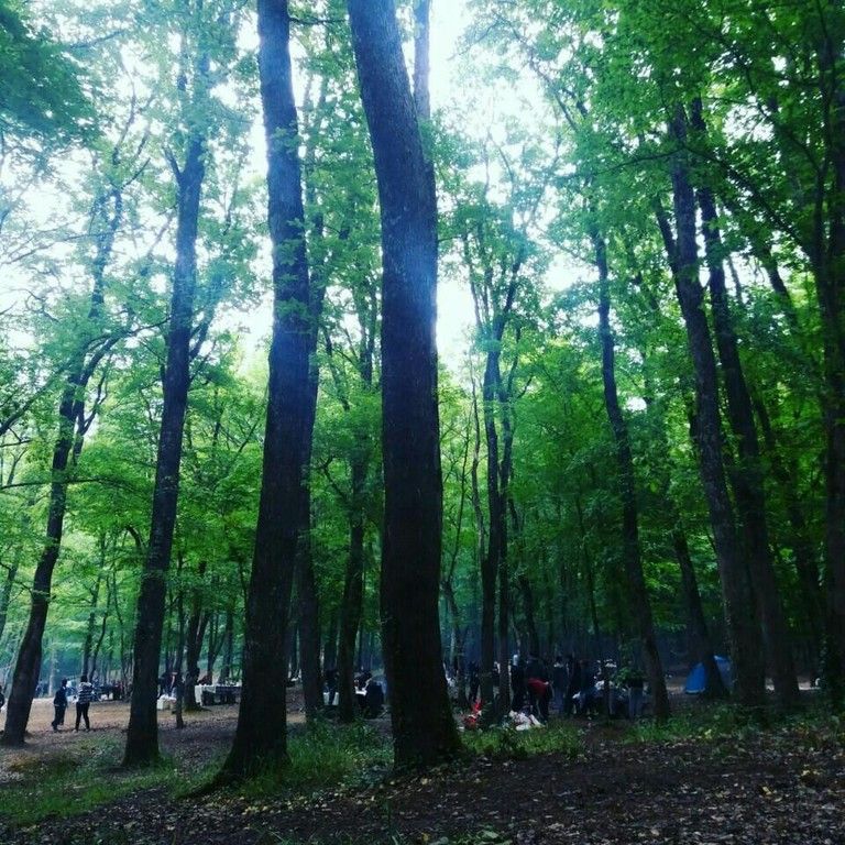
The park is the habitat for diverse species of plant. The main trees present are oak (Quercus robur) and hornbeam (Carpinus betulus). Other deciduous trees include sessile oak (Quercus petraea), kasnak oak (Quercus vulcanica) and shrubs are blackberry (Rubus plicatus), butcher's-broom (Ruscus aculeatus), tree heath (Erica arborea) and bay laurel (Laurus nobilis). Some uncommon trees include silver linden (Tilia argentea) and oriental beech (Fagus orientalis). Anatolian catbrier (Smilax excelsa), aubretia (Aubrieata cultorum), wild strawberry (Fragaria) and cathip (Nepeta cataria) are some of the flowering plants found in the nature park.
Fauna
Mainly observed fauna of the nature park are porcupines, squirrels, turtles, magpies, crows, woodpeckers, sparrows and finches.
Across the nature park, there is Bahçeköy Deer Farm (Turkish: Geyik Üretme İstasyonu).
LOCATION SATELLITE MAP
These scripts and photographs are registered under © Copyright 2017, respected writers and photographers from the internet. All Rights Reserved.
GPS : 41°11'33.0"N 28°57'39.0"E / 41.192500, 28.960833

PHOTOGRAPHS ALBUM
Falih Rıfkı Atay Nature Park (Turkish: Falih Rıfkı Atay Tabiat Parkı) is a nature park located in Sarıyer district of Istanbul Province.
Situated 7 km (4.3 mi) northwest of Bahçeköy neighborhood of Sarıyer and next to the Neşet Suyu Nature Park, it covers an area of 16.33 ha (40.4 acres). It was established in 2011, and is one of the nine nature parks inside the Belgrad Forest. The protected area is named in honor of journalist, writer and politician Falih Rıfkı Atay (1894–1971).
Serbs who were taken prisoners of war at the Siege of Belgrade (1521) by Ottoman Sultan Süleyman the Magnificent (reigned 1520–1566), were brought to Istanbul and settled in a village, which used to lie within the park boundaries. The nature park contains the ruins of a church, which is a protected historic building and was registered as cultural heritage in November 1999.
The nature park offers outdoor recreational activities such as hiking, cycling and picnicing for visitors on daily basis. There are playgrounds for children. Admission is charged for visitors and vehicles and an open-air restaurant serves the visitors. There are car park, fountains, buffet breakfast and dinner, picnic areas, wc, historic buildings are available.
Flora
The park is the habitat for diverse species of plant. The main trees present are oak (Quercus robur) and hornbeam (Carpinus betulus). Other deciduous trees include sessile oak (Quercus petraea), kasnak oak (Quercus vulcanica) and shrubs are blackberry (Rubus plicatus), butcher's-broom (Ruscus aculeatus), tree heath (Erica arborea) and bay laurel (Laurus nobilis). Some uncommon trees include silver linden (Tilia argentea) and oriental beech (Fagus orientalis). Anatolian catbrier (Smilax excelsa), aubretia (Aubrieata cultorum), wild strawberry (Fragaria) and cathip (Nepeta cataria) are some of the flowering plants found in the nature park.
Fauna
Mainly observed fauna of the nature park are porcupines, squirrels, turtles, magpies, crows, woodpeckers, sparrows and finches.
Across the nature park, there is Bahçeköy Deer Farm (Turkish: Geyik Üretme İstasyonu).
LOCATION SATELLITE MAP
These scripts and photographs are registered under © Copyright 2017, respected writers and photographers from the internet. All Rights Reserved.
BENTLER NATURE PARK
Belgrad Forest, Sarıyer - İstanbul - Turkey
GPS : 41°11'22.1"N 28°59'13.0"E / 41.189472, 28.986944
PHOTOGRAPHS ALBUM
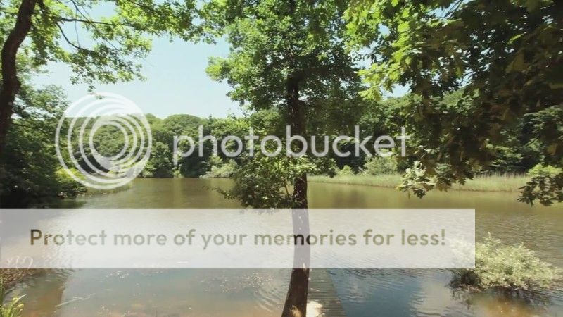
Bentler Nature Park (Turkish: Bentler Tabiat Parkı) is a nature park located in Sarıyer district of Istanbul Province, Turkey. Bentler means "dams" in Turkish language. Situated 1 km (0.62 mi) from Bahçeköy neighborhood of Sarıyer, it covers an area of 16.3 ha (40 acres). It was established in 2011, and is one of the nine nature parks inside the Belgrad Forest. There are fountain, wc, buffet, picnic areas, activity area, autopark facilities.
The protected area is named after the historic dams, the Topuzlu Dam (Topuzlu Bendi, built 1750), Valide Dam (Valide Bendi, built 1796) and New Dam (Yeni Bent or II. Mahmud Bendi, built 1839), which are located north of the park area. There are other structures as the Iskara Bendi and historical fountains from the Ottoman Empire era. Bentler Nature Park has two entrances, the main entrance of Belgrad Forest and Kurtkemeri Gate.
The nature park offers outdoor recreation activities such as hiking, cycling and picnicing, autopark, fountains, buffets, WC, historic buildings for visitors on daily basis. There is playgrounds for children. Admission is charged for visitors and vehicles.
Flora
Main tree species are oak (Quercus petraea) and hornbeam (Carpinus betulus). A 270-year old (2016) plane tree (Platanus) next to the Valide Dam was registered as a monument.
The park is habitat for diverse plant species. As coniferous tree Turkish pine (Pinus brutia), as deciduous trees oriental plane (Platanus orientalis), silver linden (Tilia argentea), European hornbeam (Carpinus betulus), oriental beech (Fagus orientalis), kasnak oak (Quercus vulcanica), Turkey oak (Quercus cerris), Aleppo oak (Quercus infectoria), European ash (Fraxinus excelsior), sweet chestnut (Castanea sativa), alder (Alnus orientalis), blackthorn (Prunus spinosa), medlar (Mespilus germanica), Turkish hazel (Corylus colurna) are found in the park. Shrubs of the nature park are blackberry (Rubus plicatus), butcher's-broom (Ruscus aculeatus) and buttercup (Clematis).
Fauna
The main fauna of the nature park consists of the mammals wild boar (Sus scrofa), fox (Vulpes vulpes), deer (Cervidae), roe deer (Capreolus capreolus), hare (Lepus), chipmunk, the reptile turtle. Observed bird species are hawk, sparrow, finch, magpie.
VALİDE DAM
GPS : 41°11'28.3"N 28°59'16.7"E / 41.191203, 28.987967
Valide Dam (Turkish: Valide Bendi) is a historic dam located in Sarıyer district of Istanbul Province, Turkey. The dam is situated north of Bahçeköy, Sarıyer inside the Bentler Nature Park, which is part of the Belgrad Forest.
Valide Dam was built in 1796 by Ottoman Sultan Selim III (reigned 1789–1807) to provide water for the donations in Eyüp of his mother Mihrişah Sultan (c. 1745–1805), who was titled Valide sultan during his reign.
Valide Dam impounds Ayazağa Creek, a tributary of Acıelma Creek, and has a catchment area of 1.825 km2 (0.705 sq mi). It is a solid gravity dam constructed in masonry with its crest and the waterside wall covered by marble. Two buttresses in 6.30 m (20.7 ft) distance at toe are attached to the downstream wall to reinforce the structure.
The dam is 11.25 m (36.9 ft) high from the thalweg and 103.90 m (340.9 ft) long at crest. The crest is 4.72 m (15.5 ft) and the base is 6.30 m (20.7 ft) wide. The dam has a reservoir capacity of 255,000 m3 (9,000,000 cu ft).
YENİ BEND
GPS : 41°11'23.0"N 28°59'09.6"E / 41.189710, 28.985987
The New Dam (Turkish: Yeni Bent), aka Sultan Mahmud II Dam (Turkish: II. Mahmut Bendi), is a historic dam located in Sarıyer district of Istanbul Province. The dam is situated next to Valide Dam north of Bahçeköy, Sarıyer inside the Bentler Nature Park, which is part of the Belgrad Forest. The New Dam was built in 1830 by Ottoman Sultan Mahmud II (reigned 1808–1839).
The New Dam impounds a tributary of Acıelma Creek and has a catchment area of 0.83 km2 (0.32 sq mi). It is a solid gravity dam constructed in masonry having a circular form. The dam is 15.62 m (51.2 ft) high from the thalweg and 101.55 m (333.2 ft) long at crest. The crest is 6.90 m (22.6 ft) and the base is 9.40 m (30.8 ft) wide. The dam has a reservoir capacity of 217,500 m3 (7,680,000 cu ft).
TOPUZLU DAM
GPS : 41°10'58.9"N 28°59'35.8"E / 41.183038, 28.993269
Topuzlu Dam (Turkish: Topuzlu Bent) is a historic dam located in Sarıyer district of Istanbul Province, Turkey. The dam is situated just north of Bahçeköy, Sarıyer inside the Bentler Nature Park, which is part of the Belgrad Forest.
Topuzlu Dam was built in 1750 by Ottoman Sultan Mahmud I (reigned 1730–1754). In 1786, its crest was raised about 3.40 m (11.2 ft) higher by Sultan Abdul Hamid I (reigned 1774–1789). The dam is named "Topuzlu" meaning "bulged" due to a bulge-formed central part of the upstream wall side.
Topuzlu Dam impounds Eskibağlar Creek and has a catchment area of 0.92 km2 (0.36 sq mi). It is a solid gravity dam constructed in masonry. The dam is 14.00 m (45.93 ft) high from the thalweg and 80.65 m (264.6 ft) long at crest. The crest is 4.30 m (14.1 ft) and the base is 7.00 m (22.97 ft) wide. The dam has a reservoir capacity of 160,000 m3 (5,700,000 cu ft).
LOCATION SATELLITE MAP
These scripts and photographs are registered under © Copyright 2017, respected writers and photographers from the internet. All Rights Reserved.
GPS : 41°11'22.1"N 28°59'13.0"E / 41.189472, 28.986944

PHOTOGRAPHS ALBUM
Bentler Nature Park (Turkish: Bentler Tabiat Parkı) is a nature park located in Sarıyer district of Istanbul Province, Turkey. Bentler means "dams" in Turkish language. Situated 1 km (0.62 mi) from Bahçeköy neighborhood of Sarıyer, it covers an area of 16.3 ha (40 acres). It was established in 2011, and is one of the nine nature parks inside the Belgrad Forest. There are fountain, wc, buffet, picnic areas, activity area, autopark facilities.
The protected area is named after the historic dams, the Topuzlu Dam (Topuzlu Bendi, built 1750), Valide Dam (Valide Bendi, built 1796) and New Dam (Yeni Bent or II. Mahmud Bendi, built 1839), which are located north of the park area. There are other structures as the Iskara Bendi and historical fountains from the Ottoman Empire era. Bentler Nature Park has two entrances, the main entrance of Belgrad Forest and Kurtkemeri Gate.
The nature park offers outdoor recreation activities such as hiking, cycling and picnicing, autopark, fountains, buffets, WC, historic buildings for visitors on daily basis. There is playgrounds for children. Admission is charged for visitors and vehicles.
Flora
Main tree species are oak (Quercus petraea) and hornbeam (Carpinus betulus). A 270-year old (2016) plane tree (Platanus) next to the Valide Dam was registered as a monument.
The park is habitat for diverse plant species. As coniferous tree Turkish pine (Pinus brutia), as deciduous trees oriental plane (Platanus orientalis), silver linden (Tilia argentea), European hornbeam (Carpinus betulus), oriental beech (Fagus orientalis), kasnak oak (Quercus vulcanica), Turkey oak (Quercus cerris), Aleppo oak (Quercus infectoria), European ash (Fraxinus excelsior), sweet chestnut (Castanea sativa), alder (Alnus orientalis), blackthorn (Prunus spinosa), medlar (Mespilus germanica), Turkish hazel (Corylus colurna) are found in the park. Shrubs of the nature park are blackberry (Rubus plicatus), butcher's-broom (Ruscus aculeatus) and buttercup (Clematis).
Fauna
The main fauna of the nature park consists of the mammals wild boar (Sus scrofa), fox (Vulpes vulpes), deer (Cervidae), roe deer (Capreolus capreolus), hare (Lepus), chipmunk, the reptile turtle. Observed bird species are hawk, sparrow, finch, magpie.
VALİDE DAM
GPS : 41°11'28.3"N 28°59'16.7"E / 41.191203, 28.987967
Valide Dam (Turkish: Valide Bendi) is a historic dam located in Sarıyer district of Istanbul Province, Turkey. The dam is situated north of Bahçeköy, Sarıyer inside the Bentler Nature Park, which is part of the Belgrad Forest.
Valide Dam was built in 1796 by Ottoman Sultan Selim III (reigned 1789–1807) to provide water for the donations in Eyüp of his mother Mihrişah Sultan (c. 1745–1805), who was titled Valide sultan during his reign.
Valide Dam impounds Ayazağa Creek, a tributary of Acıelma Creek, and has a catchment area of 1.825 km2 (0.705 sq mi). It is a solid gravity dam constructed in masonry with its crest and the waterside wall covered by marble. Two buttresses in 6.30 m (20.7 ft) distance at toe are attached to the downstream wall to reinforce the structure.
The dam is 11.25 m (36.9 ft) high from the thalweg and 103.90 m (340.9 ft) long at crest. The crest is 4.72 m (15.5 ft) and the base is 6.30 m (20.7 ft) wide. The dam has a reservoir capacity of 255,000 m3 (9,000,000 cu ft).
YENİ BEND
GPS : 41°11'23.0"N 28°59'09.6"E / 41.189710, 28.985987
The New Dam (Turkish: Yeni Bent), aka Sultan Mahmud II Dam (Turkish: II. Mahmut Bendi), is a historic dam located in Sarıyer district of Istanbul Province. The dam is situated next to Valide Dam north of Bahçeköy, Sarıyer inside the Bentler Nature Park, which is part of the Belgrad Forest. The New Dam was built in 1830 by Ottoman Sultan Mahmud II (reigned 1808–1839).
The New Dam impounds a tributary of Acıelma Creek and has a catchment area of 0.83 km2 (0.32 sq mi). It is a solid gravity dam constructed in masonry having a circular form. The dam is 15.62 m (51.2 ft) high from the thalweg and 101.55 m (333.2 ft) long at crest. The crest is 6.90 m (22.6 ft) and the base is 9.40 m (30.8 ft) wide. The dam has a reservoir capacity of 217,500 m3 (7,680,000 cu ft).
TOPUZLU DAM
GPS : 41°10'58.9"N 28°59'35.8"E / 41.183038, 28.993269
Topuzlu Dam (Turkish: Topuzlu Bent) is a historic dam located in Sarıyer district of Istanbul Province, Turkey. The dam is situated just north of Bahçeköy, Sarıyer inside the Bentler Nature Park, which is part of the Belgrad Forest.
Topuzlu Dam was built in 1750 by Ottoman Sultan Mahmud I (reigned 1730–1754). In 1786, its crest was raised about 3.40 m (11.2 ft) higher by Sultan Abdul Hamid I (reigned 1774–1789). The dam is named "Topuzlu" meaning "bulged" due to a bulge-formed central part of the upstream wall side.
Topuzlu Dam impounds Eskibağlar Creek and has a catchment area of 0.92 km2 (0.36 sq mi). It is a solid gravity dam constructed in masonry. The dam is 14.00 m (45.93 ft) high from the thalweg and 80.65 m (264.6 ft) long at crest. The crest is 4.30 m (14.1 ft) and the base is 7.00 m (22.97 ft) wide. The dam has a reservoir capacity of 160,000 m3 (5,700,000 cu ft).
LOCATION SATELLITE MAP
These scripts and photographs are registered under © Copyright 2017, respected writers and photographers from the internet. All Rights Reserved.
NEŞET SUYU NATURE PARK
Bahçeköy, Sarıyer - İstanbul - Turkey
GPS : 41°11'14.8"N 28°58'05.7"E / 41.187437, 28.968247
PHOTOGRAPHS ALBUM
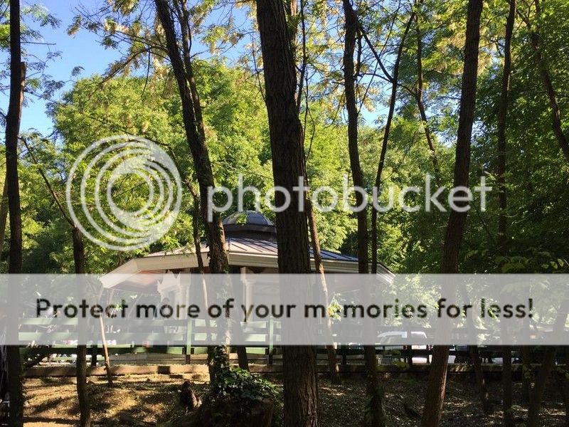
Neşet Suyu Nature Park, aka Neşetsuyu Nature Park, (Turkish: Neşet Suyu Tabiat Parkı or Neşetsuyu Tabiat Parkı) is a nature park located in Sarıyer district of Istanbul Province, Turkey.
Situated 6 km (3.7 mi) northwest of Bahçeköy neighborhood of Sarıyer and next to the Falih Rıfkı Atay Nature Park, it covers an area of 67.47 ha (166.7 acres). It was established in 2011, and is one of the nine nature parks inside the Belgrad Forest. The protected area is named in honor of Professor (Ottoman Turkish: Müderris) Neşet Bey (1881–1924).
Neşet Bey was born in Resen, Ottoman Empire, today in the Republic of Macedonia, in 1881. He taught at the (Ottoman Turkish: Orman Mekteb-i alisi), today Forestry Faculty of Istanbul University, and served as its rector. He was much respected for his works in forestry by his colleagues and students. A memorial marble inscription erected by the Turkish Directorate General of Forestry on September 21, 1953 is situated inside the nature park.
In 2000, the soil in the park area, which is one of the most popular recreation places in Istanbul, was loosened up by earth movers since the soil became hardened throughout the years like concrete endangering the trees. It was found that the growth of the tree roots stopped, bacteria and fungi population increased due to lack of oxygen in the soil. Fallen leaves could not merge with the hardened soil to make it nutrient for the vegetation.
There are car park, activity areas, fountains, buffet breakfast and dinner, picnic areas, wc, historic buildings are available.
Flora
Dominant tree species of the nature park are oak and European hornbeam (Carpinus betulus). Other vegetat,on in the area are various shrubs and bushes.
Fauna
There are mammals and bird species in significant numbers in the Belgrad Forest. The main fauna species of the forestry are wild boar, golden jackal, deer, roe, fox, wolf, weasel, hare, squirrel, tortoise and hedgehog. As bird species observed are falcon, hawk, magpie, crow, woodpecker, sparrow, finch and goldfinch.
BÜYÜK BEND
In the southwest of the nature park, the Büyük Bent (liaterally: Big Dam) is situated on the Kırkçeşme water canal. Remains of a cistern and the mihrab of an open-air prayer place (Turkish: namazgah) are registered protected cultural heritage in the park area.
LOCATION SATELLITE MAP
These scripts and photographs are registered under © Copyright 2017, respected writers and photographers from the internet. All Rights Reserved.
GPS : 41°11'14.8"N 28°58'05.7"E / 41.187437, 28.968247

PHOTOGRAPHS ALBUM
Neşet Suyu Nature Park, aka Neşetsuyu Nature Park, (Turkish: Neşet Suyu Tabiat Parkı or Neşetsuyu Tabiat Parkı) is a nature park located in Sarıyer district of Istanbul Province, Turkey.
Situated 6 km (3.7 mi) northwest of Bahçeköy neighborhood of Sarıyer and next to the Falih Rıfkı Atay Nature Park, it covers an area of 67.47 ha (166.7 acres). It was established in 2011, and is one of the nine nature parks inside the Belgrad Forest. The protected area is named in honor of Professor (Ottoman Turkish: Müderris) Neşet Bey (1881–1924).
Neşet Bey was born in Resen, Ottoman Empire, today in the Republic of Macedonia, in 1881. He taught at the (Ottoman Turkish: Orman Mekteb-i alisi), today Forestry Faculty of Istanbul University, and served as its rector. He was much respected for his works in forestry by his colleagues and students. A memorial marble inscription erected by the Turkish Directorate General of Forestry on September 21, 1953 is situated inside the nature park.
In 2000, the soil in the park area, which is one of the most popular recreation places in Istanbul, was loosened up by earth movers since the soil became hardened throughout the years like concrete endangering the trees. It was found that the growth of the tree roots stopped, bacteria and fungi population increased due to lack of oxygen in the soil. Fallen leaves could not merge with the hardened soil to make it nutrient for the vegetation.
There are car park, activity areas, fountains, buffet breakfast and dinner, picnic areas, wc, historic buildings are available.
Flora
Dominant tree species of the nature park are oak and European hornbeam (Carpinus betulus). Other vegetat,on in the area are various shrubs and bushes.
Fauna
There are mammals and bird species in significant numbers in the Belgrad Forest. The main fauna species of the forestry are wild boar, golden jackal, deer, roe, fox, wolf, weasel, hare, squirrel, tortoise and hedgehog. As bird species observed are falcon, hawk, magpie, crow, woodpecker, sparrow, finch and goldfinch.
BÜYÜK BEND
In the southwest of the nature park, the Büyük Bent (liaterally: Big Dam) is situated on the Kırkçeşme water canal. Remains of a cistern and the mihrab of an open-air prayer place (Turkish: namazgah) are registered protected cultural heritage in the park area.
LOCATION SATELLITE MAP
These scripts and photographs are registered under © Copyright 2017, respected writers and photographers from the internet. All Rights Reserved.
Monday, January 9, 2017
MİHRABAT NATURE PARK
Kanlıca, Beykoz - İstanbul - Turkey
GPS : 41°05'40.5"N 29°04'12.0"E / 41.094583, 29.070000
PHOTOGRAPHS ALBUM
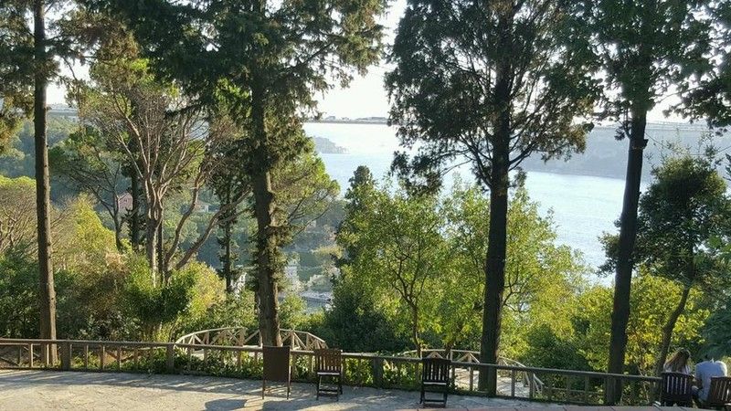
Mihrabat Nature Park (Turkish: Mihrabat Tabiat Parkı) is a nature park located on the Asian part in Beykoz district of Istanbul Province. Situated southeast of Kanlıca neighborhood of Beykoz next to the Bosphorus, it covers an area of 20.12 ha (49.7 acres). Mihrabat Grove is situated on a hill, overlooking the Bosphorus from Asia. It has one of best views of the water and the Bosphorus Bridge.
The nature park offers outdoor recreational activities such as hiking, cycling and picnicing for visitors on daily basis. There are open-air basketball courts and football field. Access to the nature park is at Mihrabat Cad. 50. Admission is charged for visitors and vehicles.
There are variety of gardens as well as with monumental cypresses, umbrealla pines, Judas and bay trees. Mihrabad Grove is also a favorite place for the ones who want to have an open buffet breakfast and dinner at the weekends. It is one of the best parks and gardens in Istanbul. The park has a cafe-restaurant where you can enjoy tea, a meal or nargile. Families with children are welcomed because there is children playground.
It is argued that Mihrabat Grove was named after the Mihrabat Palace, built by Damat İbrahim Pasha and given to Sultan Ahmad III as a present. Unfortunately, the palace was destroyed during the riots of the janissaries. Despite its glorious history, Mihrabat Grove has been reduced over time, but it still features small bridges and underground water reservoirs. Mihrabat Grove is located on a hill with a view of the entire city; it was created by Sultan Mahmud I in Kanlıca.
Mihrabat Nature Park has a 400-car parking lot and is able to seat 2,500 people. There are two grand halls where large events including weddings, training sessions and business meetings are held. The restaurant and cafe are the most popular places in the grove. There is also a park for children to play in. An open-air restaurant and a snack bar serve the visitors. Use of the nature park for events like weddings, music concerts and meetings is also permitted.
Flora
The nature park is the habitat for diverse species of plant with deciduous trees in the majority. Present deciduous vegetation include common hornbeam (Carpinus betulus), sweet chestnut (Castanea sativa), oriental plane (Platanus orientalis), silver linden (Tilia argentea), kermes oak (Quercus coccifera), Irish oak (Quercus petraea), Norway maple (Acer platanoides), Balkan maple (Acer trautvetteri), crepe flower (Lagerstroemia indica), Mediterranean hackberry (Celtis australis), cigartree (Catalpa bignonioides), Judas tree Cercis siliquastrum, common ash (Fraxinus excelsior), silver wattle (Acacia dealbata), cherry plum (Prunus cerasifera) and southern magnolia (Magnolia grandiflora).
Present conifer trees are stone pine (Pinus pinea), Himalayan cedar (Cedrus deodara) and Syrian juniper (Juniperus drupacea). Foliage plants are Mediterranean cypress (Cupressus sempervirens), giant cedar (Thuja plicata), oriental cedar (Thuja orientalis), (Lebanon cedar (Cedrus libani) and Greek juniper (Juniperus excelsa). European ivy (Hedera helix) is found in the nature as creeper plant. On the hillsides, flowering plants such as stonecrops (Sedum hispanicum) and (Sedum spurium), oleander (Nerium oleander), rosemary (Rosmarinus officinalis) and nandina (Nandina domestica).
Shrubs in the park are goat willow (Salix caprea), bay laurel (Laurus nobilis), Chinese photinia (Photinia serratifolia), laurestine (Viburnum tinus), strawberry tree (Arbutus unedo), English dogwood (Philadelphus coronarius), European holly (Ilex aquifolium), salt cedar (Tamarix), weaver's broom (Spartium junceum), scarlet firethorn (Pyracantha coccinea), blackberry (Rubus), Australian laurel (Pittosporum tobira), butcher's broom (Ruscus aculeatus), tree heath (Erica arborea), Japanese privet (Ligustrum japonicum), green olive tree (Phillyrea latifolia), dog-rose (Rosa canina) and common medlar (Mespilus germanica).
Fauna
Observed bird species in the nature park are sparrow, dunnock, common raven, woodpecker and European goldfinch. Other animals found in the park are hare, squirrel, tortoise, lizard.
LOCATION SATELLITE MAP
WEB SITE : Mihrabat Grove
MORE INFO & CONTACT
E-Mail : info@mihrabatkorusu.com
Phone : +90 216 425 8616
Fax : +90 216 322 3648
These scripts and photographs are registered under © Copyright 2017, respected writers and photographers from the internet. All Rights Reserved.
GPS : 41°05'40.5"N 29°04'12.0"E / 41.094583, 29.070000

PHOTOGRAPHS ALBUM
Mihrabat Nature Park (Turkish: Mihrabat Tabiat Parkı) is a nature park located on the Asian part in Beykoz district of Istanbul Province. Situated southeast of Kanlıca neighborhood of Beykoz next to the Bosphorus, it covers an area of 20.12 ha (49.7 acres). Mihrabat Grove is situated on a hill, overlooking the Bosphorus from Asia. It has one of best views of the water and the Bosphorus Bridge.
The nature park offers outdoor recreational activities such as hiking, cycling and picnicing for visitors on daily basis. There are open-air basketball courts and football field. Access to the nature park is at Mihrabat Cad. 50. Admission is charged for visitors and vehicles.
There are variety of gardens as well as with monumental cypresses, umbrealla pines, Judas and bay trees. Mihrabad Grove is also a favorite place for the ones who want to have an open buffet breakfast and dinner at the weekends. It is one of the best parks and gardens in Istanbul. The park has a cafe-restaurant where you can enjoy tea, a meal or nargile. Families with children are welcomed because there is children playground.
It is argued that Mihrabat Grove was named after the Mihrabat Palace, built by Damat İbrahim Pasha and given to Sultan Ahmad III as a present. Unfortunately, the palace was destroyed during the riots of the janissaries. Despite its glorious history, Mihrabat Grove has been reduced over time, but it still features small bridges and underground water reservoirs. Mihrabat Grove is located on a hill with a view of the entire city; it was created by Sultan Mahmud I in Kanlıca.
Mihrabat Nature Park has a 400-car parking lot and is able to seat 2,500 people. There are two grand halls where large events including weddings, training sessions and business meetings are held. The restaurant and cafe are the most popular places in the grove. There is also a park for children to play in. An open-air restaurant and a snack bar serve the visitors. Use of the nature park for events like weddings, music concerts and meetings is also permitted.
Flora
The nature park is the habitat for diverse species of plant with deciduous trees in the majority. Present deciduous vegetation include common hornbeam (Carpinus betulus), sweet chestnut (Castanea sativa), oriental plane (Platanus orientalis), silver linden (Tilia argentea), kermes oak (Quercus coccifera), Irish oak (Quercus petraea), Norway maple (Acer platanoides), Balkan maple (Acer trautvetteri), crepe flower (Lagerstroemia indica), Mediterranean hackberry (Celtis australis), cigartree (Catalpa bignonioides), Judas tree Cercis siliquastrum, common ash (Fraxinus excelsior), silver wattle (Acacia dealbata), cherry plum (Prunus cerasifera) and southern magnolia (Magnolia grandiflora).
Present conifer trees are stone pine (Pinus pinea), Himalayan cedar (Cedrus deodara) and Syrian juniper (Juniperus drupacea). Foliage plants are Mediterranean cypress (Cupressus sempervirens), giant cedar (Thuja plicata), oriental cedar (Thuja orientalis), (Lebanon cedar (Cedrus libani) and Greek juniper (Juniperus excelsa). European ivy (Hedera helix) is found in the nature as creeper plant. On the hillsides, flowering plants such as stonecrops (Sedum hispanicum) and (Sedum spurium), oleander (Nerium oleander), rosemary (Rosmarinus officinalis) and nandina (Nandina domestica).
Shrubs in the park are goat willow (Salix caprea), bay laurel (Laurus nobilis), Chinese photinia (Photinia serratifolia), laurestine (Viburnum tinus), strawberry tree (Arbutus unedo), English dogwood (Philadelphus coronarius), European holly (Ilex aquifolium), salt cedar (Tamarix), weaver's broom (Spartium junceum), scarlet firethorn (Pyracantha coccinea), blackberry (Rubus), Australian laurel (Pittosporum tobira), butcher's broom (Ruscus aculeatus), tree heath (Erica arborea), Japanese privet (Ligustrum japonicum), green olive tree (Phillyrea latifolia), dog-rose (Rosa canina) and common medlar (Mespilus germanica).
Fauna
Observed bird species in the nature park are sparrow, dunnock, common raven, woodpecker and European goldfinch. Other animals found in the park are hare, squirrel, tortoise, lizard.
LOCATION SATELLITE MAP
WEB SITE : Mihrabat Grove
MORE INFO & CONTACT
E-Mail : info@mihrabatkorusu.com
Phone : +90 216 425 8616
Fax : +90 216 322 3648
These scripts and photographs are registered under © Copyright 2017, respected writers and photographers from the internet. All Rights Reserved.
Subscribe to:
Posts (Atom)