Çayırbaşı, Sarıyer - İstanbul - Turkey
GPS : 41°08'26.0"N 29°01'39.0"E / 41.140556, 29.027500
Türkmenbaşı Nature Park (Turkish: Türkmenbaşı Tabiat Parkı) is a nature park located in Sarıyer district of Istanbul Province. Situated west of Hacı Osman Bayırı Avenue in Çayırbaşı neighborhood of Sarıyer, it covers an area of 5.6 ha (14 acres).
It was established in 1998 as a place, to dignify the cultural values shared by Turkey and Turkmenistan. It was named "Turkmenbashi" (literally: Head of Turkmens), in honor of Saparmurat Niyazov (1940–2006) , the leader of Turkmenistan.
There are car park, fountains, picnic areas, wc are available. The nature park offers outdoor recreation activities such as hiking and picnicing for visitors on daily basis. There is a playground for children.
Flora
Common plant of the nature park is pine. Other notable trees are oak (Quercus petraea), hornbeam (Carpinus betulus), oriental plane (Platanus orientalis), Norway spruce (Picea abies), Mediterranean cypress (Cupressus sempervirens), honeyberry, (Celtis australis), medlar (Mespilus germanica), shinglewood (Thuja plicata) and the shrubs lavender (Lavandula spica), barberry (Berberis vulgaris), glossy abelia (Abelia × grandiflora), pittosporum (Pittosporum tobira), cherry laurel (Laurocerasus officinalis), Chinese photinia (Photinia serratifolia), strawberry tree (Arbutus unedo), Japanese aucuba (Aucuba japonica), fountainplant (Ophiopogon japonicus).
Fauna
The main fauna of the nature park consists pf bird species. Observed bird species are finch, magpie, sparrow, Western jackdaw, woodpecker. Other species are lizard and chipmunk.
LOCATION SATELLITE MAP
These scripts and photographs are registered under © Copyright 2017, respected writers and photographers from the internet. All Rights Reserved.
Showing posts with label picnic area. Show all posts
Showing posts with label picnic area. Show all posts
Friday, January 13, 2017

Thursday, January 12, 2017
KÜÇÜKÇEKMECE LAKE
Küçükçekmece - Istanbul - Turkey
GPS : 40°59'11.4"N 28°44'13.8"E / 40.986503, 28.737166
PHOTOGRAPHS ALBUM
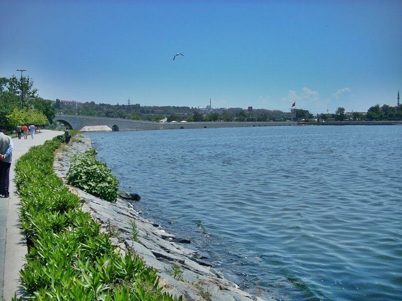
Lake Küçükçekmece (Turkish: Küçükçekmece Gölü) is a lagoon located between the Küçükçekmece, Esenyurt and Avcılar districts of the European portion of Istanbul Province, northwestern Turkey. The lake is neighbored in the south by state road D-100 and in the north by the motorway (European route E80).
Situated 15 km (9.3 mi) west of Istanbul's city center, the lake was formed in shallow water when a sandbank caused its separation from the Sea of Marmara. A narrow channel in the east interrupts this sandbank, and serves as an outlet emptying excessive water in the lake into the Sea of Marmara. However, in situations where the sea is rough or the lake's water level gets too low due to drought, sea water may penetrate into the lake, causing the lake water to become brackish.
The lake is fed from the north by the Nakkaş, Sazlıdere and Eşkinoz streams. The lake has a length of 10 km (6.2 mi) north-south by a maximum width of 6 km (3.7 mi). The lake's surface area is 16 km2 (6.2 sq mi), and its maximum depth is 20 m (66 ft).
The lake is significantly polluted due to rapid urbanization and industrialization activities over the last decade in the area around it. Its water is currently not compliant with safe drinking water standards.
Fauna observed in the lake basin consist of pygmy cormorant (microcarbo pygmeus), great cormorant (phalacrocorax carbo), and A4iii group waterbirds.
Within the lake basin, the ancient settlement of Bathonea was unearthed, which is estimated to be approximately 1,600 years old. Such archaeological finds extracted from and around the lake shed light on Istanbul’s historical chronology.
The finds include stone tools indicating early agricultural activities, potsherds dating back to the Neolithic and Iron Age periods (8,000 - 1,000 BC), amphora fragments from the Hellenistic period (fourth century BC), remains of walls along the lake shore, column capitals, and works from the Roman period. 440 small terracotta bottles 10–20 mm (0.39–0.79 in) in size containing tar-like fossilized material also were discovered. Vessel anchors were found in the lake and along the lake shore. In 2011, a 14 m (46 ft)-wide and 7 m (23 ft)-deep cistern was uncovered that might span 120 m (390 ft). It was built with bricks bearing signs of the Emperor Constantine and a notable cleric of the time.
In 2012, two underground water tunnels were discovered and subsequently, were surveyed by speleologists. They were built partly during the Roman Period and Late Roman period. Although one water tunnel is connected to the cistern, the other leads to a fountain still in use today. There are access shafts at certain points within the water tunnel. Structures in the ancient settlement, such as a lighthouse, port, and pier point toward the past existence of a port city.
From observations of aerial views, evidence of previous roads arranged in a grid plan was detected. According to the results of excavations and examinations carried out between 2007 and 2009, Bathonea was destroyed by a large-scale earthquake, after which it was abandoned.
An anthropological forensic study of a human skull extracted from one of the 70 historic graves in Bathonea, revealed that thousands of years ago, an attempt at brain surgery was made there.
Type : Lagoon
Primary inflows : Nakkaş, Sazlıdere and Eşkinoz
Catchment area : 622 km2 (240 sq mi)
Max. length : 10 km (6.2 mi)
Max. width : 6 km (3.7 mi)
Surface area : 16 km2 (6.2 sq mi)
Max. depth : 22 m (72 ft)
Since 1999, Galatasaray's rowing division is based in Kanarya neighborhood at Lake Küçükçekmece with its 120 racing boats.
Since 2012, the municipality of Küçükçekmece holds "Uniçek", an annual water sports festival for university students. Some of the events featured in the 2015 festival were rowing, modern dragon boat racing and stillwater canoe sprint, in which around 800 sportspeople from 18 different universities, 7 canoe clubs and 40 corporations competed. In addition, shows of wakeboarding, waterskiing, jet-skiing and paramotoring were held as well.
LOCATION SATELLITE MAP
These scripts and photographs are registered under © Copyright 2017, respected writers and photographers from the internet. All Rights Reserved.
GPS : 40°59'11.4"N 28°44'13.8"E / 40.986503, 28.737166

PHOTOGRAPHS ALBUM
Lake Küçükçekmece (Turkish: Küçükçekmece Gölü) is a lagoon located between the Küçükçekmece, Esenyurt and Avcılar districts of the European portion of Istanbul Province, northwestern Turkey. The lake is neighbored in the south by state road D-100 and in the north by the motorway (European route E80).
Situated 15 km (9.3 mi) west of Istanbul's city center, the lake was formed in shallow water when a sandbank caused its separation from the Sea of Marmara. A narrow channel in the east interrupts this sandbank, and serves as an outlet emptying excessive water in the lake into the Sea of Marmara. However, in situations where the sea is rough or the lake's water level gets too low due to drought, sea water may penetrate into the lake, causing the lake water to become brackish.
The lake is fed from the north by the Nakkaş, Sazlıdere and Eşkinoz streams. The lake has a length of 10 km (6.2 mi) north-south by a maximum width of 6 km (3.7 mi). The lake's surface area is 16 km2 (6.2 sq mi), and its maximum depth is 20 m (66 ft).
The lake is significantly polluted due to rapid urbanization and industrialization activities over the last decade in the area around it. Its water is currently not compliant with safe drinking water standards.
Fauna observed in the lake basin consist of pygmy cormorant (microcarbo pygmeus), great cormorant (phalacrocorax carbo), and A4iii group waterbirds.
Within the lake basin, the ancient settlement of Bathonea was unearthed, which is estimated to be approximately 1,600 years old. Such archaeological finds extracted from and around the lake shed light on Istanbul’s historical chronology.
The finds include stone tools indicating early agricultural activities, potsherds dating back to the Neolithic and Iron Age periods (8,000 - 1,000 BC), amphora fragments from the Hellenistic period (fourth century BC), remains of walls along the lake shore, column capitals, and works from the Roman period. 440 small terracotta bottles 10–20 mm (0.39–0.79 in) in size containing tar-like fossilized material also were discovered. Vessel anchors were found in the lake and along the lake shore. In 2011, a 14 m (46 ft)-wide and 7 m (23 ft)-deep cistern was uncovered that might span 120 m (390 ft). It was built with bricks bearing signs of the Emperor Constantine and a notable cleric of the time.
In 2012, two underground water tunnels were discovered and subsequently, were surveyed by speleologists. They were built partly during the Roman Period and Late Roman period. Although one water tunnel is connected to the cistern, the other leads to a fountain still in use today. There are access shafts at certain points within the water tunnel. Structures in the ancient settlement, such as a lighthouse, port, and pier point toward the past existence of a port city.
From observations of aerial views, evidence of previous roads arranged in a grid plan was detected. According to the results of excavations and examinations carried out between 2007 and 2009, Bathonea was destroyed by a large-scale earthquake, after which it was abandoned.
An anthropological forensic study of a human skull extracted from one of the 70 historic graves in Bathonea, revealed that thousands of years ago, an attempt at brain surgery was made there.
Type : Lagoon
Primary inflows : Nakkaş, Sazlıdere and Eşkinoz
Catchment area : 622 km2 (240 sq mi)
Max. length : 10 km (6.2 mi)
Max. width : 6 km (3.7 mi)
Surface area : 16 km2 (6.2 sq mi)
Max. depth : 22 m (72 ft)
Since 1999, Galatasaray's rowing division is based in Kanarya neighborhood at Lake Küçükçekmece with its 120 racing boats.
Since 2012, the municipality of Küçükçekmece holds "Uniçek", an annual water sports festival for university students. Some of the events featured in the 2015 festival were rowing, modern dragon boat racing and stillwater canoe sprint, in which around 800 sportspeople from 18 different universities, 7 canoe clubs and 40 corporations competed. In addition, shows of wakeboarding, waterskiing, jet-skiing and paramotoring were held as well.
LOCATION SATELLITE MAP
These scripts and photographs are registered under © Copyright 2017, respected writers and photographers from the internet. All Rights Reserved.
AYDOS FOREST AND LAKE
Sultanbeyli - İstanbul - Turkey
GPS : 40°57'09.0"N 29°13'57.0"E / 40.952500, 29.232500
PHOTOGRAPHS ALBUM
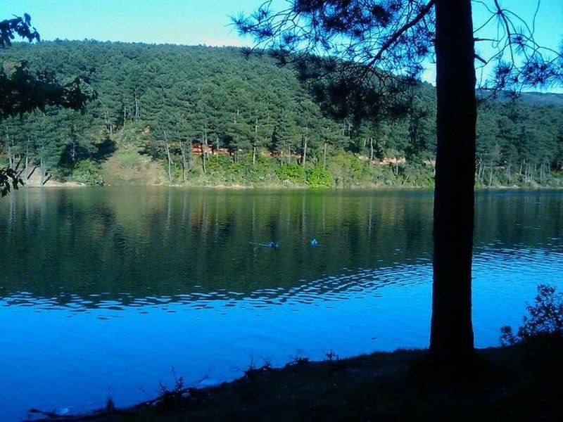
It is rich of mainly pine trees, contains jogging routes, picnic areas and a lake. Excellent spot for photo enthusiasts. 6620 acres in size, Aydos forest is a natural recreational area and oxygen source.
The old name of the Aydos Mountain which is Istanbul’s highest hill was Aetos which means Eagle in Greek. 23 different types of birds currently live in the forest which was used as a hunting area in the Ottoman times. The forest where there are remains of the historical Aydos Castle stands out as one of the rare places in the city where nature meets history.
Aydos Hill (Turkish: Aydos Tepesi) is a hill in the north of Kartal district of Istanbul, Turkey. Its peak at 537 m (1,762 ft) above sea level is the highest point of Istanbul. The hill is surrounded by woods.
Aydos' name comes from Aydos Fortress, which was situated next to the hill. The fortress was built in the first half of 6th century by the Roman Empire. Today, the ruins of Aydos Fortress are in the Sultanbeyli and Pendik district of Istanbul.
The area where we sat was quite conducive to talking because it was well-shaded. Sunlight peeked through various branches above us but its heat was reduced due to a steady, light breeze throughout the afternoon.
LOCATION SATELLITE MAP
These scripts and photographs are registered under © Copyright 2017, respected writers and photographers from the internet. All Rights Reserved.
GPS : 40°57'09.0"N 29°13'57.0"E / 40.952500, 29.232500

PHOTOGRAPHS ALBUM
It is rich of mainly pine trees, contains jogging routes, picnic areas and a lake. Excellent spot for photo enthusiasts. 6620 acres in size, Aydos forest is a natural recreational area and oxygen source.
The old name of the Aydos Mountain which is Istanbul’s highest hill was Aetos which means Eagle in Greek. 23 different types of birds currently live in the forest which was used as a hunting area in the Ottoman times. The forest where there are remains of the historical Aydos Castle stands out as one of the rare places in the city where nature meets history.
Aydos Hill (Turkish: Aydos Tepesi) is a hill in the north of Kartal district of Istanbul, Turkey. Its peak at 537 m (1,762 ft) above sea level is the highest point of Istanbul. The hill is surrounded by woods.
Aydos' name comes from Aydos Fortress, which was situated next to the hill. The fortress was built in the first half of 6th century by the Roman Empire. Today, the ruins of Aydos Fortress are in the Sultanbeyli and Pendik district of Istanbul.
The area where we sat was quite conducive to talking because it was well-shaded. Sunlight peeked through various branches above us but its heat was reduced due to a steady, light breeze throughout the afternoon.
LOCATION SATELLITE MAP
These scripts and photographs are registered under © Copyright 2017, respected writers and photographers from the internet. All Rights Reserved.
Wednesday, January 11, 2017
ÇİLİNGOZ NATURE PARK
Binkılıç, Çatalca - İstanbul - Turkey
GPS : 41°31'30.6"N 28°13'08.0"E / 41.525168, 28.218875
PHOTOGRAPHS ALBUM
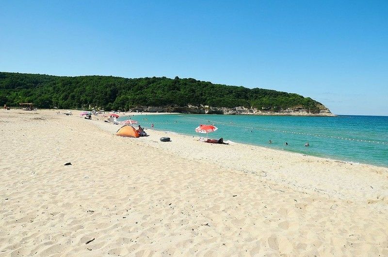
Çilingoz Nature Park (Turkish: Çilingoz Tabiat Parkı) is a nature park located in Çatalca district of Istanbul Province. Situated at Binkılıç town of Çatalca, northwest of Istanbul on the Black Sea coast, it covers an area of 17.75 ha (43.9 acres). It was established in 2011. The region incorporating the nature park was declared a Wildlife Protection Area for its rich flora and fauna in 2005. Therefore, hunting is continuously forbidden in the region.
The nature park is on a bay featuring the combination of beach, forest, lake and reedy. The park has a 1,200 m (3,900 ft)-long and 80 m (260 ft)-wide beach with fine sand at its north. The Çilingoz Creek flows towards north into the Black Sea creating a sandy-alluvial mouth, which is narrow. There, it forms a large lake surrounded by reedy.
The nature park offers outdoor recreational activities such as camping, angling, hiking and picnicing for visitors. A restaurant and a snack bar serve the visitors. 60 tents are available for rent. Camping season continues until mid September. There is a RV park for recreational vehicles. The 30 wooden bungalows in the park area are for the use of personnel of the Forestry Administration, and can not be rented by visitors. Nearest comfortable lodging opportunity is available in Yalıköy.
Admission to the nature park and to the beach is charged for visitors and vehicles. Camping is charged for tents on the overnight basis. Parks area offers Restaurant, Market, Fast Food Buffet, Tea Garden, Room.
Flora
The nature park is habitat of diverse vegetation. Plants of the wood area are mainly Oriental beech (Fagus orientalis), Oriental alder (Alnus orientalis), European hornbeam (Carpinus betulus) and Turkey oak (Quercus cerris). Shrubs present are common rhododendron (Rhododendron ponticum), butcher's-broom (Ruscus aculeatus), myrtle, (Myrtus communis), laurel (Laurus nobilis), heather (Erica arborea), strawberry tree (Arbutus unedo), blackberry (Rubus), pampas grass (Cortaderia selloana). Observed plants in sandy areas are species such as field eryngo (Eryngium campestre), alkanet (Alkanna tinctoria) and golden-flowered Onosma (Onosma taurica).
Fauna
The nature park has a population of diverse bird species. Some of them are quail, cormorant, Eurasian woodcock, hawk, eagle-owl, woodpecker, common blackbird, stork, magpie, European goldfinch and passer. Mammals of the park are deer, roe deer, fox, European pine marten, wolf, jackal, squirrel, porcupine, hare, mole and ortoise. Fish species found in the waters of coastal area are red mullet, jack mackerel, grey mullet, bonito and thornback ray. Fish species inhabited in the sweet waters are trout, carp, European chub and eel.
LOCATION SATELLITE MAP
These scripts and photographs are registered under © Copyright 2017, respected writers and photographers from the internet. All Rights Reserved.
GPS : 41°31'30.6"N 28°13'08.0"E / 41.525168, 28.218875

PHOTOGRAPHS ALBUM
Çilingoz Nature Park (Turkish: Çilingoz Tabiat Parkı) is a nature park located in Çatalca district of Istanbul Province. Situated at Binkılıç town of Çatalca, northwest of Istanbul on the Black Sea coast, it covers an area of 17.75 ha (43.9 acres). It was established in 2011. The region incorporating the nature park was declared a Wildlife Protection Area for its rich flora and fauna in 2005. Therefore, hunting is continuously forbidden in the region.
The nature park is on a bay featuring the combination of beach, forest, lake and reedy. The park has a 1,200 m (3,900 ft)-long and 80 m (260 ft)-wide beach with fine sand at its north. The Çilingoz Creek flows towards north into the Black Sea creating a sandy-alluvial mouth, which is narrow. There, it forms a large lake surrounded by reedy.
The nature park offers outdoor recreational activities such as camping, angling, hiking and picnicing for visitors. A restaurant and a snack bar serve the visitors. 60 tents are available for rent. Camping season continues until mid September. There is a RV park for recreational vehicles. The 30 wooden bungalows in the park area are for the use of personnel of the Forestry Administration, and can not be rented by visitors. Nearest comfortable lodging opportunity is available in Yalıköy.
Admission to the nature park and to the beach is charged for visitors and vehicles. Camping is charged for tents on the overnight basis. Parks area offers Restaurant, Market, Fast Food Buffet, Tea Garden, Room.
Flora
The nature park is habitat of diverse vegetation. Plants of the wood area are mainly Oriental beech (Fagus orientalis), Oriental alder (Alnus orientalis), European hornbeam (Carpinus betulus) and Turkey oak (Quercus cerris). Shrubs present are common rhododendron (Rhododendron ponticum), butcher's-broom (Ruscus aculeatus), myrtle, (Myrtus communis), laurel (Laurus nobilis), heather (Erica arborea), strawberry tree (Arbutus unedo), blackberry (Rubus), pampas grass (Cortaderia selloana). Observed plants in sandy areas are species such as field eryngo (Eryngium campestre), alkanet (Alkanna tinctoria) and golden-flowered Onosma (Onosma taurica).
Fauna
The nature park has a population of diverse bird species. Some of them are quail, cormorant, Eurasian woodcock, hawk, eagle-owl, woodpecker, common blackbird, stork, magpie, European goldfinch and passer. Mammals of the park are deer, roe deer, fox, European pine marten, wolf, jackal, squirrel, porcupine, hare, mole and ortoise. Fish species found in the waters of coastal area are red mullet, jack mackerel, grey mullet, bonito and thornback ray. Fish species inhabited in the sweet waters are trout, carp, European chub and eel.
LOCATION SATELLITE MAP
These scripts and photographs are registered under © Copyright 2017, respected writers and photographers from the internet. All Rights Reserved.
AYVAT BENDİ NATURE PARK
Kemerburgaz, Eyüp - İstanbul - Turkey
GPS : 41°11'52.0"N 28°55'15.0"E / 41.197778, 28.920833
PHOTOGRAPHS ALBUM
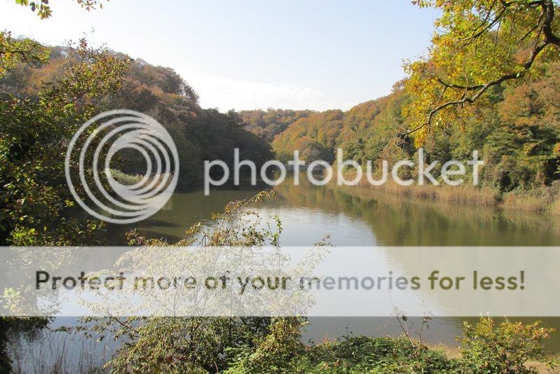
Ayvat Bendi Nature Park, meaning "Ayvat Dam", (Turkish: Ayvat Bendi Tabiat Parkı) is a nature park located in Eyüp district of Istanbul Province. Situated 9 km (5.6 mi) north of Kemerburgaz neighborhood of Eyüp, it covers an area of 50 ha (120 acres). It was established in 2011, and is one of the nine nature parks inside the Belgrad Forest.
Flora
Trees in the nature park area are (Quercus vulcanica), sessile oak (Quercus petraea), Turkey oak (Quercus cerris), blackthorn (Prunus spinosa), Oriental beech (Fagus orientalis), sweet chestnut (Castanea sativa), common hornbeam (Carpinus betulus) and common alder (Alnus glutinosa). As shrub and bush species, tree heath (Erica arborea), butcher's-broom (Ruscus aculeatus), blackberry (Rubus), European ivy (Hedera helix), Smilax excelsa, catnip (Nepeta cataria) and aubretia (Aubrieata cultorum) are found.
Fauna
Common mammals of the park are wild boar, golden jackal, deer, roe, fox, wolf, weasel, hare and squirrel. Obsered bird species are falcon, hawk, magpie, crow, woodpecker, sparrow, finch and goldfinch.
Dam
Ayvat Bendi is situated 4,3 km in the northwest of Büyük Bent in the Belgrad forest. It is located over Ayvad Stream. The other streams flowing to this stream are Eşek Stream and Göller Stream. Past the dam, Ayvat Stream runs to the Kâğıthane Stream via Davutpaşa Stream.
Ayvat Dam (Turkish: Ayvat Bendi), which was built by Ottoman Sultan Mustafa III (reigned 1757–1774) in 1765 on the Ayvat Creek, a tributary of the Kağıthane Creek. The dam has a reservoir capacity of 156.000 m3. Ayvat Bendi is situated 4,3 km in the northwest of Büyük Bent in the Belgrad forest. It is located over Ayvad Stream. The other streams flowing to this stream are Eşek Stream and Göller Stream. Past the dam, Ayvat Stream runs to the Kâğıthane Stream via Davutpaşa Stream.
Parks area offers Autopark, Activity Area, Fountain, Buffet, Picnic Areas, Historic Building, Dam, Dam Lake, Aqueduct, Pool.
The nature park can be accessed from the west over Kemerburgaz or from the east over Bahçeköy, Sarıyer. City bus lines #42M or #42HM serve Bahçeköy from Zincirlikuyu and Hacıosman respectively, from where a taxi ride is needed.
LOCATION SATELLITE MAP
These scripts and photographs are registered under © Copyright 2017, respected writers and photographers from the internet. All Rights Reserved.
GPS : 41°11'52.0"N 28°55'15.0"E / 41.197778, 28.920833

PHOTOGRAPHS ALBUM
Ayvat Bendi Nature Park, meaning "Ayvat Dam", (Turkish: Ayvat Bendi Tabiat Parkı) is a nature park located in Eyüp district of Istanbul Province. Situated 9 km (5.6 mi) north of Kemerburgaz neighborhood of Eyüp, it covers an area of 50 ha (120 acres). It was established in 2011, and is one of the nine nature parks inside the Belgrad Forest.
Flora
Trees in the nature park area are (Quercus vulcanica), sessile oak (Quercus petraea), Turkey oak (Quercus cerris), blackthorn (Prunus spinosa), Oriental beech (Fagus orientalis), sweet chestnut (Castanea sativa), common hornbeam (Carpinus betulus) and common alder (Alnus glutinosa). As shrub and bush species, tree heath (Erica arborea), butcher's-broom (Ruscus aculeatus), blackberry (Rubus), European ivy (Hedera helix), Smilax excelsa, catnip (Nepeta cataria) and aubretia (Aubrieata cultorum) are found.
Fauna
Common mammals of the park are wild boar, golden jackal, deer, roe, fox, wolf, weasel, hare and squirrel. Obsered bird species are falcon, hawk, magpie, crow, woodpecker, sparrow, finch and goldfinch.
Dam
Ayvat Bendi is situated 4,3 km in the northwest of Büyük Bent in the Belgrad forest. It is located over Ayvad Stream. The other streams flowing to this stream are Eşek Stream and Göller Stream. Past the dam, Ayvat Stream runs to the Kâğıthane Stream via Davutpaşa Stream.
Ayvat Dam (Turkish: Ayvat Bendi), which was built by Ottoman Sultan Mustafa III (reigned 1757–1774) in 1765 on the Ayvat Creek, a tributary of the Kağıthane Creek. The dam has a reservoir capacity of 156.000 m3. Ayvat Bendi is situated 4,3 km in the northwest of Büyük Bent in the Belgrad forest. It is located over Ayvad Stream. The other streams flowing to this stream are Eşek Stream and Göller Stream. Past the dam, Ayvat Stream runs to the Kâğıthane Stream via Davutpaşa Stream.
Parks area offers Autopark, Activity Area, Fountain, Buffet, Picnic Areas, Historic Building, Dam, Dam Lake, Aqueduct, Pool.
The nature park can be accessed from the west over Kemerburgaz or from the east over Bahçeköy, Sarıyer. City bus lines #42M or #42HM serve Bahçeköy from Zincirlikuyu and Hacıosman respectively, from where a taxi ride is needed.
LOCATION SATELLITE MAP
These scripts and photographs are registered under © Copyright 2017, respected writers and photographers from the internet. All Rights Reserved.
Tuesday, January 10, 2017
FALİH RIFKI ATAY NATURE PARK
Bahçeköy, Sarıyer - İstanbul - Turkey
GPS : 41°11'33.0"N 28°57'39.0"E / 41.192500, 28.960833
PHOTOGRAPHS ALBUM
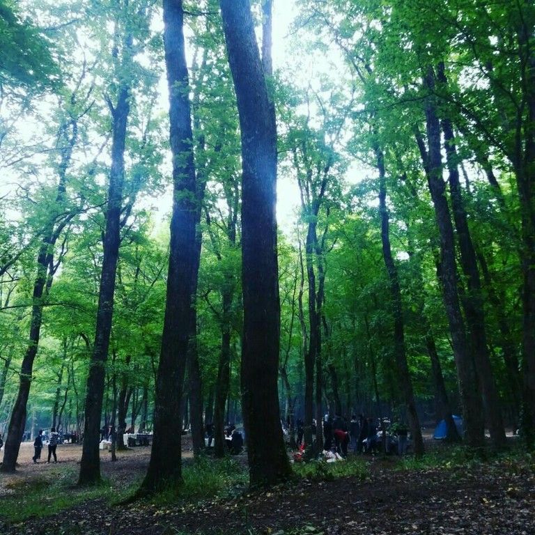
Falih Rıfkı Atay Nature Park (Turkish: Falih Rıfkı Atay Tabiat Parkı) is a nature park located in Sarıyer district of Istanbul Province.
Situated 7 km (4.3 mi) northwest of Bahçeköy neighborhood of Sarıyer and next to the Neşet Suyu Nature Park, it covers an area of 16.33 ha (40.4 acres). It was established in 2011, and is one of the nine nature parks inside the Belgrad Forest. The protected area is named in honor of journalist, writer and politician Falih Rıfkı Atay (1894–1971).
Serbs who were taken prisoners of war at the Siege of Belgrade (1521) by Ottoman Sultan Süleyman the Magnificent (reigned 1520–1566), were brought to Istanbul and settled in a village, which used to lie within the park boundaries. The nature park contains the ruins of a church, which is a protected historic building and was registered as cultural heritage in November 1999.
The nature park offers outdoor recreational activities such as hiking, cycling and picnicing for visitors on daily basis. There are playgrounds for children. Admission is charged for visitors and vehicles and an open-air restaurant serves the visitors. There are car park, fountains, buffet breakfast and dinner, picnic areas, wc, historic buildings are available.
Flora
The park is the habitat for diverse species of plant. The main trees present are oak (Quercus robur) and hornbeam (Carpinus betulus). Other deciduous trees include sessile oak (Quercus petraea), kasnak oak (Quercus vulcanica) and shrubs are blackberry (Rubus plicatus), butcher's-broom (Ruscus aculeatus), tree heath (Erica arborea) and bay laurel (Laurus nobilis). Some uncommon trees include silver linden (Tilia argentea) and oriental beech (Fagus orientalis). Anatolian catbrier (Smilax excelsa), aubretia (Aubrieata cultorum), wild strawberry (Fragaria) and cathip (Nepeta cataria) are some of the flowering plants found in the nature park.
Fauna
Mainly observed fauna of the nature park are porcupines, squirrels, turtles, magpies, crows, woodpeckers, sparrows and finches.
Across the nature park, there is Bahçeköy Deer Farm (Turkish: Geyik Üretme İstasyonu).
LOCATION SATELLITE MAP
These scripts and photographs are registered under © Copyright 2017, respected writers and photographers from the internet. All Rights Reserved.
GPS : 41°11'33.0"N 28°57'39.0"E / 41.192500, 28.960833

PHOTOGRAPHS ALBUM
Falih Rıfkı Atay Nature Park (Turkish: Falih Rıfkı Atay Tabiat Parkı) is a nature park located in Sarıyer district of Istanbul Province.
Situated 7 km (4.3 mi) northwest of Bahçeköy neighborhood of Sarıyer and next to the Neşet Suyu Nature Park, it covers an area of 16.33 ha (40.4 acres). It was established in 2011, and is one of the nine nature parks inside the Belgrad Forest. The protected area is named in honor of journalist, writer and politician Falih Rıfkı Atay (1894–1971).
Serbs who were taken prisoners of war at the Siege of Belgrade (1521) by Ottoman Sultan Süleyman the Magnificent (reigned 1520–1566), were brought to Istanbul and settled in a village, which used to lie within the park boundaries. The nature park contains the ruins of a church, which is a protected historic building and was registered as cultural heritage in November 1999.
The nature park offers outdoor recreational activities such as hiking, cycling and picnicing for visitors on daily basis. There are playgrounds for children. Admission is charged for visitors and vehicles and an open-air restaurant serves the visitors. There are car park, fountains, buffet breakfast and dinner, picnic areas, wc, historic buildings are available.
Flora
The park is the habitat for diverse species of plant. The main trees present are oak (Quercus robur) and hornbeam (Carpinus betulus). Other deciduous trees include sessile oak (Quercus petraea), kasnak oak (Quercus vulcanica) and shrubs are blackberry (Rubus plicatus), butcher's-broom (Ruscus aculeatus), tree heath (Erica arborea) and bay laurel (Laurus nobilis). Some uncommon trees include silver linden (Tilia argentea) and oriental beech (Fagus orientalis). Anatolian catbrier (Smilax excelsa), aubretia (Aubrieata cultorum), wild strawberry (Fragaria) and cathip (Nepeta cataria) are some of the flowering plants found in the nature park.
Fauna
Mainly observed fauna of the nature park are porcupines, squirrels, turtles, magpies, crows, woodpeckers, sparrows and finches.
Across the nature park, there is Bahçeköy Deer Farm (Turkish: Geyik Üretme İstasyonu).
LOCATION SATELLITE MAP
These scripts and photographs are registered under © Copyright 2017, respected writers and photographers from the internet. All Rights Reserved.
BENTLER NATURE PARK
Belgrad Forest, Sarıyer - İstanbul - Turkey
GPS : 41°11'22.1"N 28°59'13.0"E / 41.189472, 28.986944
PHOTOGRAPHS ALBUM
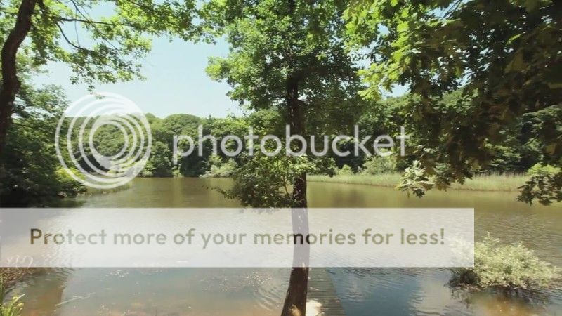
Bentler Nature Park (Turkish: Bentler Tabiat Parkı) is a nature park located in Sarıyer district of Istanbul Province, Turkey. Bentler means "dams" in Turkish language. Situated 1 km (0.62 mi) from Bahçeköy neighborhood of Sarıyer, it covers an area of 16.3 ha (40 acres). It was established in 2011, and is one of the nine nature parks inside the Belgrad Forest. There are fountain, wc, buffet, picnic areas, activity area, autopark facilities.
The protected area is named after the historic dams, the Topuzlu Dam (Topuzlu Bendi, built 1750), Valide Dam (Valide Bendi, built 1796) and New Dam (Yeni Bent or II. Mahmud Bendi, built 1839), which are located north of the park area. There are other structures as the Iskara Bendi and historical fountains from the Ottoman Empire era. Bentler Nature Park has two entrances, the main entrance of Belgrad Forest and Kurtkemeri Gate.
The nature park offers outdoor recreation activities such as hiking, cycling and picnicing, autopark, fountains, buffets, WC, historic buildings for visitors on daily basis. There is playgrounds for children. Admission is charged for visitors and vehicles.
Flora
Main tree species are oak (Quercus petraea) and hornbeam (Carpinus betulus). A 270-year old (2016) plane tree (Platanus) next to the Valide Dam was registered as a monument.
The park is habitat for diverse plant species. As coniferous tree Turkish pine (Pinus brutia), as deciduous trees oriental plane (Platanus orientalis), silver linden (Tilia argentea), European hornbeam (Carpinus betulus), oriental beech (Fagus orientalis), kasnak oak (Quercus vulcanica), Turkey oak (Quercus cerris), Aleppo oak (Quercus infectoria), European ash (Fraxinus excelsior), sweet chestnut (Castanea sativa), alder (Alnus orientalis), blackthorn (Prunus spinosa), medlar (Mespilus germanica), Turkish hazel (Corylus colurna) are found in the park. Shrubs of the nature park are blackberry (Rubus plicatus), butcher's-broom (Ruscus aculeatus) and buttercup (Clematis).
Fauna
The main fauna of the nature park consists of the mammals wild boar (Sus scrofa), fox (Vulpes vulpes), deer (Cervidae), roe deer (Capreolus capreolus), hare (Lepus), chipmunk, the reptile turtle. Observed bird species are hawk, sparrow, finch, magpie.
VALİDE DAM
GPS : 41°11'28.3"N 28°59'16.7"E / 41.191203, 28.987967
Valide Dam (Turkish: Valide Bendi) is a historic dam located in Sarıyer district of Istanbul Province, Turkey. The dam is situated north of Bahçeköy, Sarıyer inside the Bentler Nature Park, which is part of the Belgrad Forest.
Valide Dam was built in 1796 by Ottoman Sultan Selim III (reigned 1789–1807) to provide water for the donations in Eyüp of his mother Mihrişah Sultan (c. 1745–1805), who was titled Valide sultan during his reign.
Valide Dam impounds Ayazağa Creek, a tributary of Acıelma Creek, and has a catchment area of 1.825 km2 (0.705 sq mi). It is a solid gravity dam constructed in masonry with its crest and the waterside wall covered by marble. Two buttresses in 6.30 m (20.7 ft) distance at toe are attached to the downstream wall to reinforce the structure.
The dam is 11.25 m (36.9 ft) high from the thalweg and 103.90 m (340.9 ft) long at crest. The crest is 4.72 m (15.5 ft) and the base is 6.30 m (20.7 ft) wide. The dam has a reservoir capacity of 255,000 m3 (9,000,000 cu ft).
YENİ BEND
GPS : 41°11'23.0"N 28°59'09.6"E / 41.189710, 28.985987
The New Dam (Turkish: Yeni Bent), aka Sultan Mahmud II Dam (Turkish: II. Mahmut Bendi), is a historic dam located in Sarıyer district of Istanbul Province. The dam is situated next to Valide Dam north of Bahçeköy, Sarıyer inside the Bentler Nature Park, which is part of the Belgrad Forest. The New Dam was built in 1830 by Ottoman Sultan Mahmud II (reigned 1808–1839).
The New Dam impounds a tributary of Acıelma Creek and has a catchment area of 0.83 km2 (0.32 sq mi). It is a solid gravity dam constructed in masonry having a circular form. The dam is 15.62 m (51.2 ft) high from the thalweg and 101.55 m (333.2 ft) long at crest. The crest is 6.90 m (22.6 ft) and the base is 9.40 m (30.8 ft) wide. The dam has a reservoir capacity of 217,500 m3 (7,680,000 cu ft).
TOPUZLU DAM
GPS : 41°10'58.9"N 28°59'35.8"E / 41.183038, 28.993269
Topuzlu Dam (Turkish: Topuzlu Bent) is a historic dam located in Sarıyer district of Istanbul Province, Turkey. The dam is situated just north of Bahçeköy, Sarıyer inside the Bentler Nature Park, which is part of the Belgrad Forest.
Topuzlu Dam was built in 1750 by Ottoman Sultan Mahmud I (reigned 1730–1754). In 1786, its crest was raised about 3.40 m (11.2 ft) higher by Sultan Abdul Hamid I (reigned 1774–1789). The dam is named "Topuzlu" meaning "bulged" due to a bulge-formed central part of the upstream wall side.
Topuzlu Dam impounds Eskibağlar Creek and has a catchment area of 0.92 km2 (0.36 sq mi). It is a solid gravity dam constructed in masonry. The dam is 14.00 m (45.93 ft) high from the thalweg and 80.65 m (264.6 ft) long at crest. The crest is 4.30 m (14.1 ft) and the base is 7.00 m (22.97 ft) wide. The dam has a reservoir capacity of 160,000 m3 (5,700,000 cu ft).
LOCATION SATELLITE MAP
These scripts and photographs are registered under © Copyright 2017, respected writers and photographers from the internet. All Rights Reserved.
GPS : 41°11'22.1"N 28°59'13.0"E / 41.189472, 28.986944

PHOTOGRAPHS ALBUM
Bentler Nature Park (Turkish: Bentler Tabiat Parkı) is a nature park located in Sarıyer district of Istanbul Province, Turkey. Bentler means "dams" in Turkish language. Situated 1 km (0.62 mi) from Bahçeköy neighborhood of Sarıyer, it covers an area of 16.3 ha (40 acres). It was established in 2011, and is one of the nine nature parks inside the Belgrad Forest. There are fountain, wc, buffet, picnic areas, activity area, autopark facilities.
The protected area is named after the historic dams, the Topuzlu Dam (Topuzlu Bendi, built 1750), Valide Dam (Valide Bendi, built 1796) and New Dam (Yeni Bent or II. Mahmud Bendi, built 1839), which are located north of the park area. There are other structures as the Iskara Bendi and historical fountains from the Ottoman Empire era. Bentler Nature Park has two entrances, the main entrance of Belgrad Forest and Kurtkemeri Gate.
The nature park offers outdoor recreation activities such as hiking, cycling and picnicing, autopark, fountains, buffets, WC, historic buildings for visitors on daily basis. There is playgrounds for children. Admission is charged for visitors and vehicles.
Flora
Main tree species are oak (Quercus petraea) and hornbeam (Carpinus betulus). A 270-year old (2016) plane tree (Platanus) next to the Valide Dam was registered as a monument.
The park is habitat for diverse plant species. As coniferous tree Turkish pine (Pinus brutia), as deciduous trees oriental plane (Platanus orientalis), silver linden (Tilia argentea), European hornbeam (Carpinus betulus), oriental beech (Fagus orientalis), kasnak oak (Quercus vulcanica), Turkey oak (Quercus cerris), Aleppo oak (Quercus infectoria), European ash (Fraxinus excelsior), sweet chestnut (Castanea sativa), alder (Alnus orientalis), blackthorn (Prunus spinosa), medlar (Mespilus germanica), Turkish hazel (Corylus colurna) are found in the park. Shrubs of the nature park are blackberry (Rubus plicatus), butcher's-broom (Ruscus aculeatus) and buttercup (Clematis).
Fauna
The main fauna of the nature park consists of the mammals wild boar (Sus scrofa), fox (Vulpes vulpes), deer (Cervidae), roe deer (Capreolus capreolus), hare (Lepus), chipmunk, the reptile turtle. Observed bird species are hawk, sparrow, finch, magpie.
VALİDE DAM
GPS : 41°11'28.3"N 28°59'16.7"E / 41.191203, 28.987967
Valide Dam (Turkish: Valide Bendi) is a historic dam located in Sarıyer district of Istanbul Province, Turkey. The dam is situated north of Bahçeköy, Sarıyer inside the Bentler Nature Park, which is part of the Belgrad Forest.
Valide Dam was built in 1796 by Ottoman Sultan Selim III (reigned 1789–1807) to provide water for the donations in Eyüp of his mother Mihrişah Sultan (c. 1745–1805), who was titled Valide sultan during his reign.
Valide Dam impounds Ayazağa Creek, a tributary of Acıelma Creek, and has a catchment area of 1.825 km2 (0.705 sq mi). It is a solid gravity dam constructed in masonry with its crest and the waterside wall covered by marble. Two buttresses in 6.30 m (20.7 ft) distance at toe are attached to the downstream wall to reinforce the structure.
The dam is 11.25 m (36.9 ft) high from the thalweg and 103.90 m (340.9 ft) long at crest. The crest is 4.72 m (15.5 ft) and the base is 6.30 m (20.7 ft) wide. The dam has a reservoir capacity of 255,000 m3 (9,000,000 cu ft).
YENİ BEND
GPS : 41°11'23.0"N 28°59'09.6"E / 41.189710, 28.985987
The New Dam (Turkish: Yeni Bent), aka Sultan Mahmud II Dam (Turkish: II. Mahmut Bendi), is a historic dam located in Sarıyer district of Istanbul Province. The dam is situated next to Valide Dam north of Bahçeköy, Sarıyer inside the Bentler Nature Park, which is part of the Belgrad Forest. The New Dam was built in 1830 by Ottoman Sultan Mahmud II (reigned 1808–1839).
The New Dam impounds a tributary of Acıelma Creek and has a catchment area of 0.83 km2 (0.32 sq mi). It is a solid gravity dam constructed in masonry having a circular form. The dam is 15.62 m (51.2 ft) high from the thalweg and 101.55 m (333.2 ft) long at crest. The crest is 6.90 m (22.6 ft) and the base is 9.40 m (30.8 ft) wide. The dam has a reservoir capacity of 217,500 m3 (7,680,000 cu ft).
TOPUZLU DAM
GPS : 41°10'58.9"N 28°59'35.8"E / 41.183038, 28.993269
Topuzlu Dam (Turkish: Topuzlu Bent) is a historic dam located in Sarıyer district of Istanbul Province, Turkey. The dam is situated just north of Bahçeköy, Sarıyer inside the Bentler Nature Park, which is part of the Belgrad Forest.
Topuzlu Dam was built in 1750 by Ottoman Sultan Mahmud I (reigned 1730–1754). In 1786, its crest was raised about 3.40 m (11.2 ft) higher by Sultan Abdul Hamid I (reigned 1774–1789). The dam is named "Topuzlu" meaning "bulged" due to a bulge-formed central part of the upstream wall side.
Topuzlu Dam impounds Eskibağlar Creek and has a catchment area of 0.92 km2 (0.36 sq mi). It is a solid gravity dam constructed in masonry. The dam is 14.00 m (45.93 ft) high from the thalweg and 80.65 m (264.6 ft) long at crest. The crest is 4.30 m (14.1 ft) and the base is 7.00 m (22.97 ft) wide. The dam has a reservoir capacity of 160,000 m3 (5,700,000 cu ft).
LOCATION SATELLITE MAP
These scripts and photographs are registered under © Copyright 2017, respected writers and photographers from the internet. All Rights Reserved.
NEŞET SUYU NATURE PARK
Bahçeköy, Sarıyer - İstanbul - Turkey
GPS : 41°11'14.8"N 28°58'05.7"E / 41.187437, 28.968247
PHOTOGRAPHS ALBUM
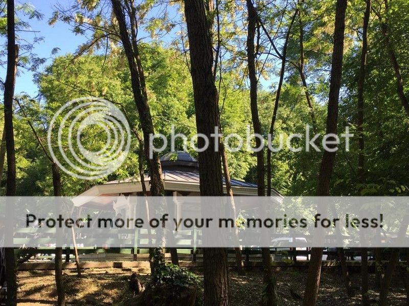
Neşet Suyu Nature Park, aka Neşetsuyu Nature Park, (Turkish: Neşet Suyu Tabiat Parkı or Neşetsuyu Tabiat Parkı) is a nature park located in Sarıyer district of Istanbul Province, Turkey.
Situated 6 km (3.7 mi) northwest of Bahçeköy neighborhood of Sarıyer and next to the Falih Rıfkı Atay Nature Park, it covers an area of 67.47 ha (166.7 acres). It was established in 2011, and is one of the nine nature parks inside the Belgrad Forest. The protected area is named in honor of Professor (Ottoman Turkish: Müderris) Neşet Bey (1881–1924).
Neşet Bey was born in Resen, Ottoman Empire, today in the Republic of Macedonia, in 1881. He taught at the (Ottoman Turkish: Orman Mekteb-i alisi), today Forestry Faculty of Istanbul University, and served as its rector. He was much respected for his works in forestry by his colleagues and students. A memorial marble inscription erected by the Turkish Directorate General of Forestry on September 21, 1953 is situated inside the nature park.
In 2000, the soil in the park area, which is one of the most popular recreation places in Istanbul, was loosened up by earth movers since the soil became hardened throughout the years like concrete endangering the trees. It was found that the growth of the tree roots stopped, bacteria and fungi population increased due to lack of oxygen in the soil. Fallen leaves could not merge with the hardened soil to make it nutrient for the vegetation.
There are car park, activity areas, fountains, buffet breakfast and dinner, picnic areas, wc, historic buildings are available.
Flora
Dominant tree species of the nature park are oak and European hornbeam (Carpinus betulus). Other vegetat,on in the area are various shrubs and bushes.
Fauna
There are mammals and bird species in significant numbers in the Belgrad Forest. The main fauna species of the forestry are wild boar, golden jackal, deer, roe, fox, wolf, weasel, hare, squirrel, tortoise and hedgehog. As bird species observed are falcon, hawk, magpie, crow, woodpecker, sparrow, finch and goldfinch.
BÜYÜK BEND
In the southwest of the nature park, the Büyük Bent (liaterally: Big Dam) is situated on the Kırkçeşme water canal. Remains of a cistern and the mihrab of an open-air prayer place (Turkish: namazgah) are registered protected cultural heritage in the park area.
LOCATION SATELLITE MAP
These scripts and photographs are registered under © Copyright 2017, respected writers and photographers from the internet. All Rights Reserved.
GPS : 41°11'14.8"N 28°58'05.7"E / 41.187437, 28.968247

PHOTOGRAPHS ALBUM
Neşet Suyu Nature Park, aka Neşetsuyu Nature Park, (Turkish: Neşet Suyu Tabiat Parkı or Neşetsuyu Tabiat Parkı) is a nature park located in Sarıyer district of Istanbul Province, Turkey.
Situated 6 km (3.7 mi) northwest of Bahçeköy neighborhood of Sarıyer and next to the Falih Rıfkı Atay Nature Park, it covers an area of 67.47 ha (166.7 acres). It was established in 2011, and is one of the nine nature parks inside the Belgrad Forest. The protected area is named in honor of Professor (Ottoman Turkish: Müderris) Neşet Bey (1881–1924).
Neşet Bey was born in Resen, Ottoman Empire, today in the Republic of Macedonia, in 1881. He taught at the (Ottoman Turkish: Orman Mekteb-i alisi), today Forestry Faculty of Istanbul University, and served as its rector. He was much respected for his works in forestry by his colleagues and students. A memorial marble inscription erected by the Turkish Directorate General of Forestry on September 21, 1953 is situated inside the nature park.
In 2000, the soil in the park area, which is one of the most popular recreation places in Istanbul, was loosened up by earth movers since the soil became hardened throughout the years like concrete endangering the trees. It was found that the growth of the tree roots stopped, bacteria and fungi population increased due to lack of oxygen in the soil. Fallen leaves could not merge with the hardened soil to make it nutrient for the vegetation.
There are car park, activity areas, fountains, buffet breakfast and dinner, picnic areas, wc, historic buildings are available.
Flora
Dominant tree species of the nature park are oak and European hornbeam (Carpinus betulus). Other vegetat,on in the area are various shrubs and bushes.
Fauna
There are mammals and bird species in significant numbers in the Belgrad Forest. The main fauna species of the forestry are wild boar, golden jackal, deer, roe, fox, wolf, weasel, hare, squirrel, tortoise and hedgehog. As bird species observed are falcon, hawk, magpie, crow, woodpecker, sparrow, finch and goldfinch.
BÜYÜK BEND
In the southwest of the nature park, the Büyük Bent (liaterally: Big Dam) is situated on the Kırkçeşme water canal. Remains of a cistern and the mihrab of an open-air prayer place (Turkish: namazgah) are registered protected cultural heritage in the park area.
LOCATION SATELLITE MAP
These scripts and photographs are registered under © Copyright 2017, respected writers and photographers from the internet. All Rights Reserved.
Sunday, January 8, 2017
TERKOS LAKE
Sarıyer - İstanbul - Turkey
GPS : 41°20'50.0"N 28°34'04.0"E / 41.347222, 28.567778

PHOTOGRAPHS ALBUM
It's 50 kilometers to the north of Istanbul on the Black Sea coast, having an area of 25 square kilometers and surrounded by small forests. The lake is fed by Istiranca river so its waters are fresh. It's one of the main fresh water sources of Istanbul using huge pipes connecting to the main water distribution center of the city.
The excessive water from the lake is discharged to the sea, if needed. Nearby the lake, there is a small village bearing the same name of the lake. Fresh water fishing and goose hunting is also possible with special regulations at and around Terkos Lake. There are a couple of country style small hotels around it, and attracts many local people especially during summer weekends.
It is situated in 50 km north -west of Istanbul in the Thrace region, behind the Karaburun. Terkos Lake which is also called Durusu Lake has 25 km square surface area. The deepest place of the lake is eleven meters. Catchment area of the lake is 619 km2. Although it is 2.75 meter higher than the sea level, it does not flow to Black Sea.
Reception Basin of Terkos Lake is small, but there are many runnels carrying water to the lake. Among these runnels, Istrance Runnel carries the most water. After the lake was separated from the sea, its water has become sweet. Approximately 196 million meter cube water enters into Terkos Lake annually. In high rainfall periods this water quantity rises to 237 million meter cube.
Terkos Village is situated near the lake. The lake is named after this village. The village dates back to the year 1000. It was built on the lakeside in the northwest direction of today’s village as a pirate’s bay by the Genoese, on the peninsula known as the inner fortress. It is seen that then the sea and the lake was in contact, but then they were separated by the natural factors. We understand from the remains of the fortress on the peninsula that there was a monastery called Trikos in the inner part of the fortress and that the village and the lake are named after this monastery.
A French ambassador who came to Istanbul in the 19th century sees the drought in the city and invites a delegation from the Ottoman Court to France. The French claim that the water-related problems in the city can be solved indeed. They show the Terkos Lake as a water resource in the sketches they have drawn. The foundations of the today’s factory building is laid in the year 1855 and following the completion of the factory’s construction in 2 years, water is supplied to Istanbul.
These facilities which have been supplying water to Istanbul for a hundred years still exist. The water is taken from the lake and after being purified in the facilities in Kagıthane, is distributed in Istanbul. Since the drought and the population in Istanbul have been increasing in recent years, the water obtained from the probes on the seaside is discharged to the Terkos Lake through pumps in order to meet the water need of the city.
In addition, The Terkos Lake is fishing and hunting place where various wild birds live. Durusu is among the favorite places of hunters. Fishing and bird hunting is available during the hunting season. However only wild duck and goose hunting is allowed. It is forbidden to shoot bird species such as black morass, coot, heron, pelican, and pheasant. The fish variety of the lake is: freshwater perch, salmon, pike, trout, roach, and carp. The lake is shallow and surrounded by rushes and touring by motorboat is not allowed. However there are boats for rent for you to row on the lake.
LOCATION SATELLITE MAP
These scripts and photographs are registered under © Copyright 2017, respected writers and photographers from the internet. All Rights Reserved.
GPS : 41°20'50.0"N 28°34'04.0"E / 41.347222, 28.567778

PHOTOGRAPHS ALBUM
It's 50 kilometers to the north of Istanbul on the Black Sea coast, having an area of 25 square kilometers and surrounded by small forests. The lake is fed by Istiranca river so its waters are fresh. It's one of the main fresh water sources of Istanbul using huge pipes connecting to the main water distribution center of the city.
The excessive water from the lake is discharged to the sea, if needed. Nearby the lake, there is a small village bearing the same name of the lake. Fresh water fishing and goose hunting is also possible with special regulations at and around Terkos Lake. There are a couple of country style small hotels around it, and attracts many local people especially during summer weekends.
It is situated in 50 km north -west of Istanbul in the Thrace region, behind the Karaburun. Terkos Lake which is also called Durusu Lake has 25 km square surface area. The deepest place of the lake is eleven meters. Catchment area of the lake is 619 km2. Although it is 2.75 meter higher than the sea level, it does not flow to Black Sea.
Reception Basin of Terkos Lake is small, but there are many runnels carrying water to the lake. Among these runnels, Istrance Runnel carries the most water. After the lake was separated from the sea, its water has become sweet. Approximately 196 million meter cube water enters into Terkos Lake annually. In high rainfall periods this water quantity rises to 237 million meter cube.
Terkos Village is situated near the lake. The lake is named after this village. The village dates back to the year 1000. It was built on the lakeside in the northwest direction of today’s village as a pirate’s bay by the Genoese, on the peninsula known as the inner fortress. It is seen that then the sea and the lake was in contact, but then they were separated by the natural factors. We understand from the remains of the fortress on the peninsula that there was a monastery called Trikos in the inner part of the fortress and that the village and the lake are named after this monastery.
A French ambassador who came to Istanbul in the 19th century sees the drought in the city and invites a delegation from the Ottoman Court to France. The French claim that the water-related problems in the city can be solved indeed. They show the Terkos Lake as a water resource in the sketches they have drawn. The foundations of the today’s factory building is laid in the year 1855 and following the completion of the factory’s construction in 2 years, water is supplied to Istanbul.
These facilities which have been supplying water to Istanbul for a hundred years still exist. The water is taken from the lake and after being purified in the facilities in Kagıthane, is distributed in Istanbul. Since the drought and the population in Istanbul have been increasing in recent years, the water obtained from the probes on the seaside is discharged to the Terkos Lake through pumps in order to meet the water need of the city.
In addition, The Terkos Lake is fishing and hunting place where various wild birds live. Durusu is among the favorite places of hunters. Fishing and bird hunting is available during the hunting season. However only wild duck and goose hunting is allowed. It is forbidden to shoot bird species such as black morass, coot, heron, pelican, and pheasant. The fish variety of the lake is: freshwater perch, salmon, pike, trout, roach, and carp. The lake is shallow and surrounded by rushes and touring by motorboat is not allowed. However there are boats for rent for you to row on the lake.
LOCATION SATELLITE MAP
These scripts and photographs are registered under © Copyright 2017, respected writers and photographers from the internet. All Rights Reserved.
Friday, January 6, 2017
YILDIZ GROVE PARK
Yıldız, Beşiktaş - Istanbul - Turkey
GPS : 41°02'57.0"N 29°00'57.0"E / 41.049167, 29.015833
PHOTOGRAPHS ALBUM
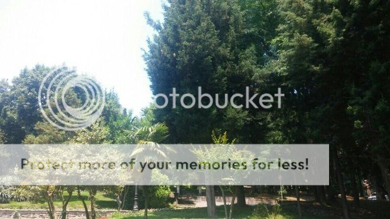
Yıldız Park is a historical, urban park in Beşiktaş district of Istanbul, Turkey. It is one of the largest public parks in Istanbul. The park is located in Yıldız quarter between the palaces of Yıldız and Çırağan.
Yıldız Park is the biggest green field of Beşiktaş. The history of it dates back to early 17th century. This extensive field owned by the daughter of Sultan Murad IV was then owned by Mehmed Pasha, brother of Damat İbrahim Pasha in 18th century. The plantation, today called Yıldız Park, was named "Çırağan" after the festivals held by Mehmed Pasha in the coastal side open for Bosphorus. Yıldız Park, again comes to life with Çırağan Palace and the bridge built between the palace and the plantation.
History
Yıldız Park was once part of the imperial garden of Yıldız Palace. Extending down the slopes from the palace, this walled park was reserved only for palace dwellers during the reign of Sultan Abdülhamid II.
The area of Yıldız used to be a forest in Byzantine times. Starting during the reign of Sultan Süleyman the Magnificent, the sultans made it their hunting grounds. In the next centuries, it remained as a grove behind the seaside palaces. The neighbourhood began to flourish in the wake of construction of the palace in the 19th century. It took its name from the first pavilion, namely Yıldız Kasrı, commissioned by Sultan Selim III in early 19th century.
The 25-acre (0.10 km2) of the palace's external garden were surrounded by high walls and detached from a grove during the reign of Sultan Abdülhamid II in the 19th century. A small artificial lake, pavilions, summer houses and a porcelain factory were established in this section.
Women of the palace who were allowed to go out in the days of springs after the cold days of winter, purified from the presence of men in the plantation, come together with green and and nature in this particular place. Borders of the plantation was then enlarged after Sultan Abdülhamid II moves to Yıldız Palace. After the disenthrone of Sultan Abdülhamid II, doors of the plantation was closed.
Today
Currently Yıldız Park is a beautiful garden complex with set in a very large park of flowers, plants and trees, gathered from every part of the world dating from the Ottoman era. Park grounds offer panoramic views of the Bosphorus. The park is a popular picnic place especially for the weekends. Two beautiful old pavilions, namely Çadır and Malta pavilions, are used to rest, drink tea, eat breakfast and have lunch.
The park is separated into two sections, the outer section is open to the public and comprises the Şale, Çadır and Malta pavilions and the still-operating Yıldız porcelain factory. The vegetation of the park includes magnolia, bay leaves, Judas trees, silver limes and horse-chestnuts. Furthermore, the park shelters oak, cypress, pine, yew, cedar and ash trees. Besides, the outer section has two man-made lakes.
Pavilions
The plantation was ascribed to Greater Municipality of Istanbul in 1940s with the pavilions of Malta and Çadır. Its’ name was changed to Yıldız Park in the same period. Municipality of İstanbul, takes over the management of the park. Today, the park is a place for having a good breath and a moment of relaxation, especially for the residents of Beşiktaş. Malta and Çadır Pavilions in the park were restored in 1979 and a covered cafe "Pembe Sera" was built.
Tent Pavilion
One of the two historical houses in Yıldız Groves. It was built in the backyard of Çırağan Palace for daily tours. After the foundation of the Republic, it had remained closed for a long time. In present day, it is open to public.
Malta Pavilion
It was known to have been built in Abdülaziz period and has a marvelous landscape. It was restored by remaining loyal to its original form. You can see the gorgeous ceiling ornaments and also have a pleasing dinner with your friends. Malta and Çadır Pavilions in the park were restored in 1979 and a covered cafe "Pembe Sera" was built. Malta and Çadır Pavilions in the park were restored in 1979 and a covered cafe "Pembe Sera" was built.
This park is a real hidden treasure in the heart of the city. Whenever you wish to spend pleasant hours relaxing admist greenery Yıldız Park would be a good choice with its walking routes, cafes, century old trees, ponds and water canals.
Currently Yıldız Park is a beautiful garden complex with set in a very large park of flowers, plants and trees, gathered from every part of the world dating from the Ottoman era. Park grounds offer panoramic views of the Bosphorus. The park is a popular picnic place especially for the weekends. Two beautiful old pavilions, namely Çadır and Malta pavilions, is used to rest, drink tea, eat breakfast and have lunch.
Yıldız Groves where you can see every tone of green is on the slopes between Beşiktaş and Ortaköy. These groves which we can define as the oxygen store for Beşiktaş, was one of the most important places in the Ottoman times with its tulip gardens. Yıldız Korusu had experienced legendary feasts, but had been closed after Sultan Abdülhamid II was dethroned.
In addition to Yıldız Palace which we describe in detail in the subsequent pages, and Şale Pavilion the grove accommodates, there are also Yıldız Palace’ Clock Tower, Tent Pavilion and Malta Pavilion.
Currently Yıldız Park is a beautiful garden complex with set in a very large park of flowers, plants and trees, gathered from every part of the world dating from the Ottoman era. Park grounds offer panoramic views of the Bosphorus. The park is a popular picnic place especially for the weekends. Two beautiful old pavilions, namely Çadır and Malta pavilions, are used to rest, drink tea, eat breakfast and have lunch.
LOCATION SATELLITE MAP
These scripts and photographs are registered under © Copyright 2017, respected writers and photographers from the internet. All Rights Reserved.
GPS : 41°02'57.0"N 29°00'57.0"E / 41.049167, 29.015833

PHOTOGRAPHS ALBUM
Yıldız Park is a historical, urban park in Beşiktaş district of Istanbul, Turkey. It is one of the largest public parks in Istanbul. The park is located in Yıldız quarter between the palaces of Yıldız and Çırağan.
Yıldız Park is the biggest green field of Beşiktaş. The history of it dates back to early 17th century. This extensive field owned by the daughter of Sultan Murad IV was then owned by Mehmed Pasha, brother of Damat İbrahim Pasha in 18th century. The plantation, today called Yıldız Park, was named "Çırağan" after the festivals held by Mehmed Pasha in the coastal side open for Bosphorus. Yıldız Park, again comes to life with Çırağan Palace and the bridge built between the palace and the plantation.
History
Yıldız Park was once part of the imperial garden of Yıldız Palace. Extending down the slopes from the palace, this walled park was reserved only for palace dwellers during the reign of Sultan Abdülhamid II.
The area of Yıldız used to be a forest in Byzantine times. Starting during the reign of Sultan Süleyman the Magnificent, the sultans made it their hunting grounds. In the next centuries, it remained as a grove behind the seaside palaces. The neighbourhood began to flourish in the wake of construction of the palace in the 19th century. It took its name from the first pavilion, namely Yıldız Kasrı, commissioned by Sultan Selim III in early 19th century.
The 25-acre (0.10 km2) of the palace's external garden were surrounded by high walls and detached from a grove during the reign of Sultan Abdülhamid II in the 19th century. A small artificial lake, pavilions, summer houses and a porcelain factory were established in this section.
Women of the palace who were allowed to go out in the days of springs after the cold days of winter, purified from the presence of men in the plantation, come together with green and and nature in this particular place. Borders of the plantation was then enlarged after Sultan Abdülhamid II moves to Yıldız Palace. After the disenthrone of Sultan Abdülhamid II, doors of the plantation was closed.
Today
Currently Yıldız Park is a beautiful garden complex with set in a very large park of flowers, plants and trees, gathered from every part of the world dating from the Ottoman era. Park grounds offer panoramic views of the Bosphorus. The park is a popular picnic place especially for the weekends. Two beautiful old pavilions, namely Çadır and Malta pavilions, are used to rest, drink tea, eat breakfast and have lunch.
The park is separated into two sections, the outer section is open to the public and comprises the Şale, Çadır and Malta pavilions and the still-operating Yıldız porcelain factory. The vegetation of the park includes magnolia, bay leaves, Judas trees, silver limes and horse-chestnuts. Furthermore, the park shelters oak, cypress, pine, yew, cedar and ash trees. Besides, the outer section has two man-made lakes.
Pavilions
The plantation was ascribed to Greater Municipality of Istanbul in 1940s with the pavilions of Malta and Çadır. Its’ name was changed to Yıldız Park in the same period. Municipality of İstanbul, takes over the management of the park. Today, the park is a place for having a good breath and a moment of relaxation, especially for the residents of Beşiktaş. Malta and Çadır Pavilions in the park were restored in 1979 and a covered cafe "Pembe Sera" was built.
Tent Pavilion
One of the two historical houses in Yıldız Groves. It was built in the backyard of Çırağan Palace for daily tours. After the foundation of the Republic, it had remained closed for a long time. In present day, it is open to public.
Malta Pavilion
It was known to have been built in Abdülaziz period and has a marvelous landscape. It was restored by remaining loyal to its original form. You can see the gorgeous ceiling ornaments and also have a pleasing dinner with your friends. Malta and Çadır Pavilions in the park were restored in 1979 and a covered cafe "Pembe Sera" was built. Malta and Çadır Pavilions in the park were restored in 1979 and a covered cafe "Pembe Sera" was built.
This park is a real hidden treasure in the heart of the city. Whenever you wish to spend pleasant hours relaxing admist greenery Yıldız Park would be a good choice with its walking routes, cafes, century old trees, ponds and water canals.
Currently Yıldız Park is a beautiful garden complex with set in a very large park of flowers, plants and trees, gathered from every part of the world dating from the Ottoman era. Park grounds offer panoramic views of the Bosphorus. The park is a popular picnic place especially for the weekends. Two beautiful old pavilions, namely Çadır and Malta pavilions, is used to rest, drink tea, eat breakfast and have lunch.
Yıldız Groves where you can see every tone of green is on the slopes between Beşiktaş and Ortaköy. These groves which we can define as the oxygen store for Beşiktaş, was one of the most important places in the Ottoman times with its tulip gardens. Yıldız Korusu had experienced legendary feasts, but had been closed after Sultan Abdülhamid II was dethroned.
In addition to Yıldız Palace which we describe in detail in the subsequent pages, and Şale Pavilion the grove accommodates, there are also Yıldız Palace’ Clock Tower, Tent Pavilion and Malta Pavilion.
Currently Yıldız Park is a beautiful garden complex with set in a very large park of flowers, plants and trees, gathered from every part of the world dating from the Ottoman era. Park grounds offer panoramic views of the Bosphorus. The park is a popular picnic place especially for the weekends. Two beautiful old pavilions, namely Çadır and Malta pavilions, are used to rest, drink tea, eat breakfast and have lunch.
LOCATION SATELLITE MAP
These scripts and photographs are registered under © Copyright 2017, respected writers and photographers from the internet. All Rights Reserved.
Subscribe to:
Posts (Atom)