Showing posts with label flora. Show all posts

Friday, January 13, 2017

BÜYÜKÇEKMECE LAKE

Küçükçekmece - Istanbul - Turkey

GPS : 41°05'20.0"N 28°31'10.4"E / 41.088898, 28.519551

Buyukcekmece Lake / Catalca - Istanbul photo bcekmece910.jpg

PHOTOGRAPHS ALBUM

Lake Büyükçekmece (Turkish: Büyükçekmece Gölü) is a liman formed at the point where the river Karasudere flows into the Marmara Sea. The lake is located south of the Çatalca district, west of Istanbul, Turkey. It is used as a freshwater reservoir.

The lake's bar was reinforced in 1988 by a dam. The area of the lake is 28.47 km2 (10.99 sq mi), and is 7 km (4.3 mi) long and 2 km (1.2 mi) wide. The maximum depth is 8.6 m (28 ft), following deepening carried out by the State Hydraulic Works.

The fluvial lake developed as the flow of Karasudere, and as it came downwards from Çatalca it was blocked off and formed by the resulting sandbank it created. A reedy, brackish salt-water lake exists between the Büyükçekmece Dam and the Marmara Sea. Another lagoon, Lake Küçükçekmece, is located around 12 km (7.5 mi) east of Lake Büyükçekmece.

The number of fish species observed in the lake has decreased from 30 in the past to 15 currently.

A historic 635 m (2,083 ft) long and 7.17 m (23.5 ft) wide multiple arch bridge, named after the Ottoman architect Mimar Sinan (1489-1588), spans the narrow opening at the bar connecting the lake to the sea.

At the northern shore of the lake, Istanbul Hezarfen Airfield is situated on a peninsula.

Primary inflows : Karasudere
Catchment area : 622 km2 (240 sq mi)
Max. length : 7 km (4.3 mi)
Max. width : 2 km (1.2 mi)
Surface area : 28.47 km2 (10.99 sq mi)
Max. depth : 8.6 m (28 ft)
Water volume : 16,161 hm3 (3.877 cu mi)

The lake, which is not protected, was declared by Bird Life International as an Important Bird Area in 1989 for its numerous distinct and threatened waterfowl species.

Among the breeding birds are Small Honeysuckle, Spinach, Elm, Oak, Hare, Long lLg, Marsh Falcon, Mallard, Little Grebe, Great Crested Grebe, Greater Flamingo, Grey Heron, Little Egret, Pygmy Cormorant, Great Cormorant, Eurasian Coot, Black-headed Gull, Mediterranean Gull, Yellow-legged Gull, Sandwich Tern, Common Tern, Rock Dove, Eurasian Collared Dove, Alpine Swift, Common Swift, Common Kingfisher, Eurasian Magpie, Western Jackdaw, Hooded Crow, Great Tit, Barn Swallow, Common Starling, House Sparrow, Western Yellow Wagtail, White Wagtail, Common Chaffinch.

LOCATION SATELLITE MAP


These scripts and photographs are registered under © Copyright 2017, respected writers and photographers from the internet. All Rights Reserved.

TÜRKMENBAŞI NATURE PARK

Çayırbaşı, Sarıyer - İstanbul - Turkey

GPS : 41°08'26.0"N 29°01'39.0"E / 41.140556, 29.027500

Türkmenbaşı Nature Park (Turkish: Türkmenbaşı Tabiat Parkı) is a nature park located in Sarıyer district of Istanbul Province. Situated west of Hacı Osman Bayırı Avenue in Çayırbaşı neighborhood of Sarıyer, it covers an area of 5.6 ha (14 acres).

It was established in 1998 as a place, to dignify the cultural values shared by Turkey and Turkmenistan. It was named "Turkmenbashi" (literally: Head of Turkmens), in honor of Saparmurat Niyazov (1940–2006) , the leader of Turkmenistan.

There are car park, fountains, picnic areas, wc are available. The nature park offers outdoor recreation activities such as hiking and picnicing for visitors on daily basis. There is a playground for children.

Flora
Common plant of the nature park is pine. Other notable trees are oak (Quercus petraea), hornbeam (Carpinus betulus), oriental plane (Platanus orientalis), Norway spruce (Picea abies), Mediterranean cypress (Cupressus sempervirens), honeyberry, (Celtis australis), medlar (Mespilus germanica), shinglewood (Thuja plicata) and the shrubs lavender (Lavandula spica), barberry (Berberis vulgaris), glossy abelia (Abelia × grandiflora), pittosporum (Pittosporum tobira), cherry laurel (Laurocerasus officinalis), Chinese photinia (Photinia serratifolia), strawberry tree (Arbutus unedo), Japanese aucuba (Aucuba japonica), fountainplant (Ophiopogon japonicus).

Fauna
The main fauna of the nature park consists pf bird species. Observed bird species are finch, magpie, sparrow, Western jackdaw, woodpecker. Other species are lizard and chipmunk.

LOCATION SATELLITE MAP


These scripts and photographs are registered under © Copyright 2017, respected writers and photographers from the internet. All Rights Reserved.

Thursday, January 12, 2017

KÜÇÜKÇEKMECE LAKE

Küçükçekmece - Istanbul - Turkey

GPS : 40°59'11.4"N 28°44'13.8"E / 40.986503, 28.737166

Kucukcekmece Lake / Istanbul photo kcekmece907.jpg

PHOTOGRAPHS ALBUM

Lake Küçükçekmece (Turkish: Küçükçekmece Gölü) is a lagoon located between the Küçükçekmece, Esenyurt and Avcılar districts of the European portion of Istanbul Province, northwestern Turkey. The lake is neighbored in the south by state road D-100 and in the north by the  motorway (European route E80).

Situated 15 km (9.3 mi) west of Istanbul's city center, the lake was formed in shallow water when a sandbank caused its separation from the Sea of Marmara. A narrow channel in the east interrupts this sandbank, and serves as an outlet emptying excessive water in the lake into the Sea of Marmara. However, in situations where the sea is rough or the lake's water level gets too low due to drought, sea water may penetrate into the lake, causing the lake water to become brackish.

The lake is fed from the north by the Nakkaş, Sazlıdere and Eşkinoz streams. The lake has a length of 10 km (6.2 mi) north-south by a maximum width of 6 km (3.7 mi). The lake's surface area is 16 km2 (6.2 sq mi), and its maximum depth is 20 m (66 ft).

The lake is significantly polluted due to rapid urbanization and industrialization activities over the last decade in the area around it. Its water is currently not compliant with safe drinking water standards.

Fauna observed in the lake basin consist of pygmy cormorant (microcarbo pygmeus), great cormorant (phalacrocorax carbo), and A4iii group waterbirds.

Within the lake basin, the ancient settlement of Bathonea was unearthed, which is estimated to be approximately 1,600 years old. Such archaeological finds extracted from and around the lake shed light on Istanbul’s historical chronology.

The finds include stone tools indicating early agricultural activities, potsherds dating back to the Neolithic and Iron Age periods (8,000 - 1,000 BC), amphora fragments from the Hellenistic period (fourth century BC), remains of walls along the lake shore, column capitals, and works from the Roman period. 440 small terracotta bottles 10–20 mm (0.39–0.79 in) in size containing tar-like fossilized material also were discovered. Vessel anchors were found in the lake and along the lake shore. In 2011, a 14 m (46 ft)-wide and 7 m (23 ft)-deep cistern was uncovered that might span 120 m (390 ft). It was built with bricks bearing signs of the Emperor Constantine and a notable cleric of the time.

In 2012, two underground water tunnels were discovered and subsequently, were surveyed by speleologists. They were built partly during the Roman Period and Late Roman period. Although one water tunnel is connected to the cistern, the other leads to a fountain still in use today. There are access shafts at certain points within the water tunnel. Structures in the ancient settlement, such as a lighthouse, port, and pier point toward the past existence of a port city.

From observations of aerial views, evidence of previous roads arranged in a grid plan was detected. According to the results of excavations and examinations carried out between 2007 and 2009, Bathonea was destroyed by a large-scale earthquake, after which it was abandoned.

An anthropological forensic study of a human skull extracted from one of the 70 historic graves in Bathonea, revealed that thousands of years ago, an attempt at brain surgery was made there.

Type : Lagoon
Primary inflows : Nakkaş, Sazlıdere and Eşkinoz
Catchment area : 622 km2 (240 sq mi)
Max. length : 10 km (6.2 mi)
Max. width : 6 km (3.7 mi)
Surface area : 16 km2 (6.2 sq mi)
Max. depth : 22 m (72 ft)

Since 1999, Galatasaray's rowing division is based in Kanarya neighborhood at Lake Küçükçekmece with its 120 racing boats.

Since 2012, the municipality of Küçükçekmece holds "Uniçek", an annual water sports festival for university students. Some of the events featured in the 2015 festival were rowing, modern dragon boat racing and stillwater canoe sprint, in which around 800 sportspeople from 18 different universities, 7 canoe clubs and 40 corporations competed. In addition, shows of wakeboarding, waterskiing, jet-skiing and paramotoring were held as well.

LOCATION SATELLITE MAP


These scripts and photographs are registered under © Copyright 2017, respected writers and photographers from the internet. All Rights Reserved.

AYDOS FOREST AND LAKE

Sultanbeyli - İstanbul - Turkey

GPS : 40°57'09.0"N 29°13'57.0"E / 40.952500, 29.232500

Aydos Forest & Lake / Sultanbeyli - Istanbul photo aydos_forest111.jpg

PHOTOGRAPHS ALBUM

It is rich of mainly pine trees, contains jogging routes, picnic areas and a lake. Excellent spot for photo enthusiasts. 6620 acres in size, Aydos forest is a natural recreational area and oxygen source.

The old name of the Aydos Mountain which is Istanbul’s highest hill was Aetos which means Eagle in Greek. 23 different types of birds currently live in the forest which was used as a hunting area in the Ottoman times. The forest where there are remains of the historical Aydos Castle stands out as one of the rare places in the city where nature meets history.

Aydos Hill (Turkish: Aydos Tepesi) is a hill in the north of Kartal district of Istanbul, Turkey. Its peak at 537 m (1,762 ft) above sea level is the highest point of Istanbul. The hill is surrounded by woods.

Aydos' name comes from Aydos Fortress, which was situated next to the hill. The fortress was built in the first half of 6th century by the Roman Empire. Today, the ruins of Aydos Fortress are in the Sultanbeyli and Pendik district of Istanbul.

The area where we sat was quite conducive to talking because it was well-shaded. Sunlight peeked through various branches above us but its heat was reduced due to a steady, light breeze throughout the afternoon.

LOCATION SATELLITE MAP


These scripts and photographs are registered under © Copyright 2017, respected writers and photographers from the internet. All Rights Reserved.

Wednesday, January 11, 2017

ÇİLİNGOZ NATURE PARK

Binkılıç, Çatalca - İstanbul - Turkey

GPS : 41°31'30.6"N 28°13'08.0"E / 41.525168, 28.218875

Cilingoz Nature Park / Binkilic, Catalca - Istanbul photo cilingoz_park110.jpg

PHOTOGRAPHS ALBUM

Çilingoz Nature Park (Turkish: Çilingoz Tabiat Parkı) is a nature park located in Çatalca district of Istanbul Province. Situated at Binkılıç town of Çatalca, northwest of Istanbul on the Black Sea coast, it covers an area of 17.75 ha (43.9 acres). It was established in 2011. The region incorporating the nature park was declared a Wildlife Protection Area for its rich flora and fauna in 2005. Therefore, hunting is continuously forbidden in the region.

The nature park is on a bay featuring the combination of beach, forest, lake and reedy. The park has a 1,200 m (3,900 ft)-long and 80 m (260 ft)-wide beach with fine sand at its north. The Çilingoz Creek flows towards north into the Black Sea creating a sandy-alluvial mouth, which is narrow. There, it forms a large lake surrounded by reedy.

The nature park offers outdoor recreational activities such as camping, angling, hiking and picnicing for visitors. A restaurant and a snack bar serve the visitors. 60 tents are available for rent. Camping season continues until mid September. There is a RV park for recreational vehicles. The 30 wooden bungalows in the park area are for the use of personnel of the Forestry Administration, and can not be rented by visitors. Nearest comfortable lodging opportunity is available in Yalıköy.

Admission to the nature park and to the beach is charged for visitors and vehicles. Camping is charged for tents on the overnight basis. Parks area offers Restaurant, Market, Fast Food Buffet, Tea Garden, Room.

Flora
The nature park is habitat of diverse vegetation. Plants of the wood area are mainly Oriental beech (Fagus orientalis), Oriental alder (Alnus orientalis), European hornbeam (Carpinus betulus) and Turkey oak (Quercus cerris). Shrubs present are common rhododendron (Rhododendron ponticum), butcher's-broom (Ruscus aculeatus), myrtle, (Myrtus communis), laurel (Laurus nobilis), heather (Erica arborea), strawberry tree (Arbutus unedo), blackberry (Rubus), pampas grass (Cortaderia selloana). Observed plants in sandy areas are species such as field eryngo (Eryngium campestre), alkanet (Alkanna tinctoria) and golden-flowered Onosma (Onosma taurica).

Fauna
The nature park has a population of diverse bird species. Some of them are quail, cormorant, Eurasian woodcock, hawk, eagle-owl, woodpecker, common blackbird, stork, magpie, European goldfinch and passer. Mammals of the park are deer, roe deer, fox, European pine marten, wolf, jackal, squirrel, porcupine, hare, mole and ortoise. Fish species found in the waters of coastal area are red mullet, jack mackerel, grey mullet, bonito and thornback ray. Fish species inhabited in the sweet waters are trout, carp, European chub and eel.

LOCATION SATELLITE MAP


These scripts and photographs are registered under © Copyright 2017, respected writers and photographers from the internet. All Rights Reserved.

AYVAT BENDİ NATURE PARK

Kemerburgaz, Eyüp - İstanbul - Turkey

GPS : 41°11'52.0"N 28°55'15.0"E / 41.197778, 28.920833

Ayvat Dam Nature Park / Kemerburgaz - Eyup photo ayvatdam_kemerburgaz106.jpg

PHOTOGRAPHS ALBUM

Ayvat Bendi Nature Park, meaning "Ayvat Dam", (Turkish: Ayvat Bendi Tabiat Parkı) is a nature park located in Eyüp district of Istanbul Province. Situated 9 km (5.6 mi) north of Kemerburgaz neighborhood of Eyüp, it covers an area of 50 ha (120 acres). It was established in 2011, and is one of the nine nature parks inside the Belgrad Forest.

Flora
Trees in the nature park area are (Quercus vulcanica), sessile oak (Quercus petraea), Turkey oak (Quercus cerris), blackthorn (Prunus spinosa), Oriental beech (Fagus orientalis), sweet chestnut (Castanea sativa), common hornbeam (Carpinus betulus) and common alder (Alnus glutinosa). As shrub and bush species, tree heath (Erica arborea), butcher's-broom (Ruscus aculeatus), blackberry (Rubus), European ivy (Hedera helix), Smilax excelsa, catnip (Nepeta cataria) and aubretia (Aubrieata cultorum) are found.

Fauna
Common mammals of the park are wild boar, golden jackal, deer, roe, fox, wolf, weasel, hare and squirrel. Obsered bird species are falcon, hawk, magpie, crow, woodpecker, sparrow, finch and goldfinch.

Dam
Ayvat Bendi is situated 4,3 km in the northwest of Büyük Bent in the Belgrad forest. It is located over Ayvad Stream. The other streams flowing to this stream are Eşek Stream and Göller Stream. Past the dam, Ayvat Stream runs to the Kâğıthane Stream via Davutpaşa Stream.

Ayvat Dam (Turkish: Ayvat Bendi), which was built by Ottoman Sultan Mustafa III (reigned 1757–1774) in 1765 on the Ayvat Creek, a tributary of the Kağıthane Creek. The dam has a reservoir capacity of 156.000 m3. Ayvat Bendi is situated 4,3 km in the northwest of Büyük Bent in the Belgrad forest. It is located over Ayvad Stream. The other streams flowing to this stream are Eşek Stream and Göller Stream. Past the dam, Ayvat Stream runs to the Kâğıthane Stream via Davutpaşa Stream.

Parks area offers Autopark, Activity Area, Fountain, Buffet, Picnic Areas, Historic Building, Dam, Dam Lake, Aqueduct, Pool.

The nature park can be accessed from the west over Kemerburgaz or from the east over Bahçeköy, Sarıyer. City bus lines #42M or #42HM serve Bahçeköy from Zincirlikuyu and Hacıosman respectively, from where a taxi ride is needed.

LOCATION SATELLITE MAP


These scripts and photographs are registered under © Copyright 2017, respected writers and photographers from the internet. All Rights Reserved.

Tuesday, January 10, 2017

FALİH RIFKI ATAY NATURE PARK

Bahçeköy, Sarıyer - İstanbul - Turkey

GPS : 41°11'33.0"N 28°57'39.0"E / 41.192500, 28.960833

Falih Rifki Atay Nature Park / Sariyer - Istanbul photo fratay_naturepark133.jpg

PHOTOGRAPHS ALBUM

Falih Rıfkı Atay Nature Park (Turkish: Falih Rıfkı Atay Tabiat Parkı) is a nature park located in Sarıyer district of Istanbul Province.

Situated 7 km (4.3 mi) northwest of Bahçeköy neighborhood of Sarıyer and next to the Neşet Suyu Nature Park, it covers an area of 16.33 ha (40.4 acres). It was established in 2011, and is one of the nine nature parks inside the Belgrad Forest. The protected area is named in honor of journalist, writer and politician Falih Rıfkı Atay (1894–1971).

Serbs who were taken prisoners of war at the Siege of Belgrade (1521) by Ottoman Sultan Süleyman the Magnificent (reigned 1520–1566), were brought to Istanbul and settled in a village, which used to lie within the park boundaries. The nature park contains the ruins of a church, which is a protected historic building and was registered as cultural heritage in November 1999.

The nature park offers outdoor recreational activities such as hiking, cycling and picnicing for visitors on daily basis. There are playgrounds for children. Admission is charged for visitors and vehicles and an open-air restaurant serves the visitors. There are car park, fountains, buffet breakfast and dinner, picnic areas, wc, historic buildings are available.

Flora
The park is the habitat for diverse species of plant. The main trees present are oak (Quercus robur) and hornbeam (Carpinus betulus). Other deciduous trees include sessile oak (Quercus petraea), kasnak oak (Quercus vulcanica) and shrubs are blackberry (Rubus plicatus), butcher's-broom (Ruscus aculeatus), tree heath (Erica arborea) and bay laurel (Laurus nobilis). Some uncommon trees include silver linden (Tilia argentea) and oriental beech (Fagus orientalis). Anatolian catbrier (Smilax excelsa), aubretia (Aubrieata cultorum), wild strawberry (Fragaria) and cathip (Nepeta cataria) are some of the flowering plants found in the nature park.

Fauna
Mainly observed fauna of the nature park are porcupines, squirrels, turtles, magpies, crows, woodpeckers, sparrows and finches.

Across the nature park, there is Bahçeköy Deer Farm (Turkish: Geyik Üretme İstasyonu).

LOCATION SATELLITE MAP


These scripts and photographs are registered under © Copyright 2017, respected writers and photographers from the internet. All Rights Reserved.

BENTLER NATURE PARK

Belgrad Forest, Sarıyer - İstanbul - Turkey

GPS : 41°11'22.1"N 28°59'13.0"E / 41.189472, 28.986944

Bentler Nature Park / Sariyer - Istanbul photo bentler_naturepark160.jpg

PHOTOGRAPHS ALBUM

Bentler Nature Park (Turkish: Bentler Tabiat Parkı) is a nature park located in Sarıyer district of Istanbul Province, Turkey. Bentler means "dams" in Turkish language. Situated 1 km (0.62 mi) from Bahçeköy neighborhood of Sarıyer, it covers an area of 16.3 ha (40 acres). It was established in 2011, and is one of the nine nature parks inside the Belgrad Forest. There are fountain, wc, buffet, picnic areas, activity area, autopark facilities.

The protected area is named after the historic dams, the Topuzlu Dam (Topuzlu Bendi, built 1750), Valide Dam (Valide Bendi, built 1796) and New Dam (Yeni Bent or II. Mahmud Bendi, built 1839), which are located north of the park area. There are other structures as the Iskara Bendi and historical fountains from the Ottoman Empire era. Bentler Nature Park has two entrances, the main entrance of Belgrad Forest and Kurtkemeri Gate.

The nature park offers outdoor recreation activities such as hiking, cycling and picnicing, autopark, fountains, buffets, WC, historic buildings for visitors on daily basis. There is playgrounds for children. Admission is charged for visitors and vehicles.

Flora
Main tree species are oak (Quercus petraea) and hornbeam (Carpinus betulus). A 270-year old (2016) plane tree (Platanus) next to the Valide Dam was registered as a monument.

The park is habitat for diverse plant species. As coniferous tree Turkish pine (Pinus brutia), as deciduous trees oriental plane (Platanus orientalis), silver linden (Tilia argentea), European hornbeam (Carpinus betulus), oriental beech (Fagus orientalis), kasnak oak (Quercus vulcanica), Turkey oak (Quercus cerris), Aleppo oak (Quercus infectoria), European ash (Fraxinus excelsior), sweet chestnut (Castanea sativa), alder (Alnus orientalis), blackthorn (Prunus spinosa), medlar (Mespilus germanica), Turkish hazel (Corylus colurna) are found in the park. Shrubs of the nature park are blackberry (Rubus plicatus), butcher's-broom (Ruscus aculeatus) and buttercup (Clematis).

Fauna
The main fauna of the nature park consists of the mammals wild boar (Sus scrofa), fox (Vulpes vulpes), deer (Cervidae), roe deer (Capreolus capreolus), hare (Lepus), chipmunk, the reptile turtle. Observed bird species are hawk, sparrow, finch, magpie.

VALİDE DAM
GPS : 41°11'28.3"N 28°59'16.7"E / 41.191203, 28.987967

Valide Dam (Turkish: Valide Bendi) is a historic dam located in Sarıyer district of Istanbul Province, Turkey. The dam is situated north of Bahçeköy, Sarıyer inside the Bentler Nature Park, which is part of the Belgrad Forest.

Valide Dam was built in 1796 by Ottoman Sultan Selim III (reigned 1789–1807) to provide water for the donations in Eyüp of his mother Mihrişah Sultan (c. 1745–1805), who was titled Valide sultan during his reign.

Valide Dam impounds Ayazağa Creek, a tributary of Acıelma Creek, and has a catchment area of 1.825 km2 (0.705 sq mi). It is a solid gravity dam constructed in masonry with its crest and the waterside wall covered by marble. Two buttresses in 6.30 m (20.7 ft) distance at toe are attached to the downstream wall to reinforce the structure.

The dam is 11.25 m (36.9 ft) high from the thalweg and 103.90 m (340.9 ft) long at crest. The crest is 4.72 m (15.5 ft) and the base is 6.30 m (20.7 ft) wide. The dam has a reservoir capacity of 255,000 m3 (9,000,000 cu ft).

YENİ BEND
GPS : 41°11'23.0"N 28°59'09.6"E / 41.189710, 28.985987

The New Dam (Turkish: Yeni Bent), aka Sultan Mahmud II Dam (Turkish: II. Mahmut Bendi), is a historic dam located in Sarıyer district of Istanbul Province. The dam is situated next to Valide Dam north of Bahçeköy, Sarıyer inside the Bentler Nature Park, which is part of the Belgrad Forest. The New Dam was built in 1830 by Ottoman Sultan Mahmud II (reigned 1808–1839).

The New Dam impounds a tributary of Acıelma Creek and has a catchment area of 0.83 km2 (0.32 sq mi). It is a solid gravity dam constructed in masonry having a circular form. The dam is 15.62 m (51.2 ft) high from the thalweg and 101.55 m (333.2 ft) long at crest. The crest is 6.90 m (22.6 ft) and the base is 9.40 m (30.8 ft) wide. The dam has a reservoir capacity of 217,500 m3 (7,680,000 cu ft).

TOPUZLU DAM
GPS : 41°10'58.9"N 28°59'35.8"E / 41.183038, 28.993269

Topuzlu Dam (Turkish: Topuzlu Bent) is a historic dam located in Sarıyer district of Istanbul Province, Turkey. The dam is situated just north of Bahçeköy, Sarıyer inside the Bentler Nature Park, which is part of the Belgrad Forest.

Topuzlu Dam was built in 1750 by Ottoman Sultan Mahmud I (reigned 1730–1754). In 1786, its crest was raised about 3.40 m (11.2 ft) higher by Sultan Abdul Hamid I (reigned 1774–1789). The dam is named "Topuzlu" meaning "bulged" due to a bulge-formed central part of the upstream wall side.

Topuzlu Dam impounds Eskibağlar Creek and has a catchment area of 0.92 km2 (0.36 sq mi). It is a solid gravity dam constructed in masonry. The dam is 14.00 m (45.93 ft) high from the thalweg and 80.65 m (264.6 ft) long at crest. The crest is 4.30 m (14.1 ft) and the base is 7.00 m (22.97 ft) wide. The dam has a reservoir capacity of 160,000 m3 (5,700,000 cu ft).

LOCATION SATELLITE MAP


These scripts and photographs are registered under © Copyright 2017, respected writers and photographers from the internet. All Rights Reserved.

NEŞET SUYU NATURE PARK

Bahçeköy, Sarıyer - İstanbul - Turkey

GPS : 41°11'14.8"N 28°58'05.7"E / 41.187437, 28.968247

Neset Suyu Nature Park / Bahcekoy - Sariyer photo nesetsuyu_naturepark105.jpg

PHOTOGRAPHS ALBUM

Neşet Suyu Nature Park, aka Neşetsuyu Nature Park, (Turkish: Neşet Suyu Tabiat Parkı or Neşetsuyu Tabiat Parkı) is a nature park located in Sarıyer district of Istanbul Province, Turkey.

Situated 6 km (3.7 mi) northwest of Bahçeköy neighborhood of Sarıyer and next to the Falih Rıfkı Atay Nature Park, it covers an area of 67.47 ha (166.7 acres). It was established in 2011, and is one of the nine nature parks inside the Belgrad Forest. The protected area is named in honor of Professor (Ottoman Turkish: Müderris‎) Neşet Bey (1881–1924).

Neşet Bey was born in Resen, Ottoman Empire, today in the Republic of Macedonia, in 1881. He taught at the (Ottoman Turkish: Orman Mekteb-i alisi‎), today Forestry Faculty of Istanbul University, and served as its rector. He was much respected for his works in forestry by his colleagues and students. A memorial marble inscription erected by the Turkish Directorate General of Forestry on September 21, 1953 is situated inside the nature park.

In 2000, the soil in the park area, which is one of the most popular recreation places in Istanbul, was loosened up by earth movers since the soil became hardened throughout the years like concrete endangering the trees. It was found that the growth of the tree roots stopped, bacteria and fungi population increased due to lack of oxygen in the soil. Fallen leaves could not merge with the hardened soil to make it nutrient for the vegetation.

There are car park, activity areas, fountains, buffet breakfast and dinner, picnic areas, wc, historic buildings are available.

Flora
Dominant tree species of the nature park are oak and European hornbeam (Carpinus betulus). Other vegetat,on in the area are various shrubs and bushes.

Fauna
There are mammals and bird species in significant numbers in the Belgrad Forest. The main fauna species of the forestry are wild boar, golden jackal, deer, roe, fox, wolf, weasel, hare, squirrel, tortoise and hedgehog. As bird species observed are falcon, hawk, magpie, crow, woodpecker, sparrow, finch and goldfinch.

BÜYÜK BEND

In the southwest of the nature park, the Büyük Bent (liaterally: Big Dam) is situated on the Kırkçeşme water canal. Remains of a cistern and the mihrab of an open-air prayer place (Turkish: namazgah) are registered protected cultural heritage in the park area.

LOCATION SATELLITE MAP


These scripts and photographs are registered under © Copyright 2017, respected writers and photographers from the internet. All Rights Reserved.

Monday, January 9, 2017

MİHRABAT NATURE PARK

Kanlıca, Beykoz - İstanbul - Turkey

GPS : 41°05'40.5"N 29°04'12.0"E / 41.094583, 29.070000

Mihrabat Nature Park / Kanlica, Beykoz - Istanbul photo mihrabat911.jpg

PHOTOGRAPHS ALBUM

Mihrabat Nature Park (Turkish: Mihrabat Tabiat Parkı) is a nature park located on the Asian part in Beykoz district of Istanbul Province. Situated southeast of Kanlıca neighborhood of Beykoz next to the Bosphorus, it covers an area of 20.12 ha (49.7 acres). Mihrabat Grove is situated on a hill, overlooking the Bosphorus from Asia. It has one of best views of the water and the Bosphorus Bridge.

The nature park offers outdoor recreational activities such as hiking, cycling and picnicing for visitors on daily basis. There are open-air basketball courts and football field. Access to the nature park is at Mihrabat Cad. 50. Admission is charged for visitors and vehicles.

There are variety of gardens as well as with monumental cypresses, umbrealla pines, Judas and bay trees. Mihrabad Grove is also a favorite place for the ones who want to have an open buffet breakfast and dinner at the weekends. It is one of the best parks and gardens in Istanbul. The park has a cafe-restaurant where you can enjoy tea, a meal or nargile. Families with children are welcomed because there is children playground.

It is argued that Mihrabat Grove was named after the Mihrabat Palace, built by Damat İbrahim Pasha and given to Sultan Ahmad III as a present. Unfortunately, the palace was destroyed during the riots of the janissaries. Despite its glorious history, Mihrabat Grove has been reduced over time, but it still features small bridges and underground water reservoirs. Mihrabat Grove is located on a hill with a view of the entire city; it was created by Sultan Mahmud I in Kanlıca.

Mihrabat Nature Park has a 400-car parking lot and is able to seat 2,500 people. There are two grand halls where large events including weddings, training sessions and business meetings are held. The restaurant and cafe are the most popular places in the grove. There is also a park for children to play in. An open-air restaurant and a snack bar serve the visitors. Use of the nature park for events like weddings, music concerts and meetings is also permitted.

Flora
The nature park is the habitat for diverse species of plant with deciduous trees in the majority. Present deciduous vegetation include common hornbeam (Carpinus betulus), sweet chestnut (Castanea sativa), oriental plane (Platanus orientalis), silver linden (Tilia argentea), kermes oak (Quercus coccifera), Irish oak (Quercus petraea), Norway maple (Acer platanoides), Balkan maple (Acer trautvetteri), crepe flower (Lagerstroemia indica), Mediterranean hackberry (Celtis australis), cigartree (Catalpa bignonioides), Judas tree Cercis siliquastrum, common ash (Fraxinus excelsior), silver wattle (Acacia dealbata), cherry plum (Prunus cerasifera) and southern magnolia (Magnolia grandiflora).

Present conifer trees are stone pine (Pinus pinea), Himalayan cedar (Cedrus deodara) and Syrian juniper (Juniperus drupacea). Foliage plants are Mediterranean cypress (Cupressus sempervirens), giant cedar (Thuja plicata), oriental cedar (Thuja orientalis), (Lebanon cedar (Cedrus libani) and Greek juniper (Juniperus excelsa). European ivy (Hedera helix) is found in the nature as creeper plant. On the hillsides, flowering plants such as stonecrops (Sedum hispanicum) and (Sedum spurium), oleander (Nerium oleander), rosemary (Rosmarinus officinalis) and nandina (Nandina domestica).

Shrubs in the park are goat willow (Salix caprea), bay laurel (Laurus nobilis), Chinese photinia (Photinia serratifolia), laurestine (Viburnum tinus), strawberry tree (Arbutus unedo), English dogwood (Philadelphus coronarius), European holly (Ilex aquifolium), salt cedar (Tamarix), weaver's broom (Spartium junceum), scarlet firethorn (Pyracantha coccinea), blackberry (Rubus), Australian laurel (Pittosporum tobira), butcher's broom (Ruscus aculeatus), tree heath (Erica arborea), Japanese privet (Ligustrum japonicum), green olive tree (Phillyrea latifolia), dog-rose (Rosa canina) and common medlar (Mespilus germanica).

Fauna
Observed bird species in the nature park are sparrow, dunnock, common raven, woodpecker and European goldfinch. Other animals found in the park are hare, squirrel, tortoise, lizard.

LOCATION SATELLITE MAP


WEB SITE : Mihrabat Grove

MORE INFO & CONTACT
E-Mail : info@mihrabatkorusu.com
Phone : +90 216 425 8616
Fax : +90 216 322 3648

These scripts and photographs are registered under © Copyright 2017, respected writers and photographers from the internet. All Rights Reserved.

FENERBAHÇE PARK

Fenerbahçe, Kadıköy - İstanbul - Turkey

GPS : 40°58'04.0"N 29°02'04.0"E / 40.967778, 29.034444

Fenerbahce Park / Kadikoy - Istanbul photo fenerbahce_park109.jpg

PHOTOGRAPHS ALBUM

The Fenerbahçe Park is located on the Fenerbahçe Peninsula, Kadikoy and the park is very popular with the Istanbul locals with its beautiful open and closed areas. The park overlooks the famous Princes Islands. In order to reach this beautiful park follow the Fenerbahçe signs when going towards Bostancı from Kızıltoprak. When you pass the marina located on the right and cross a very small bridge, you will come to a peninsula where the park is located.

Fenerbahçe, besides being the name of one of the oldest and most famous soccer teams in Turkey, it is among the most beautiful and elite districts of Anatolian side. Although the team is named after the district, when one mentions Fenerbahçe the first thing that comes to mind is the name of the soccer team. Well it should be considered normal in a country where soccer is so fervently admired.

Fenerbahçe (Fener: Lighthouse, Bahçe: Garden) named after the white lighthouse standing on the headland of a cozy peninsula also hosts quite a big park by the same name. Fenerbahçe was also a favorite promenade during the Ottoman Empire with its natural flora and stunning panorama. The restoration of the park lasted six months and was a costly project.

The flora has been renewed, jogging routes, resting sites, picnic areas and a special garden for dogs have been added. A parking lot and sport areas have also been constructed. At the edge of the park you'll be fascinated by the panoramic view. From here you can see the Princes' Islands on the south east and old Istanbul, Sultanahmet, Topkapı Palace and Haghia Sophia on the west.

The sunsets behind the elegant minarets are irresistible. During summer evenings the youngsters play guitar and sing songs. Moreover a moonlight stroll at Fenerbahçe should not be missed. The moon which rises and brightens the islands has always been a source of inspiration to lovers and amateur poets. You'll meet people of every age walking, running, exercising on the grass, and riding bicycles at every hour of the day. Housewives and students playing hooky are around in the morning.

The park fills with lovers in the afternoon and evenings bring people who want to relax after a long workday. Unfortunately there is nothing in particular for children so you will have to use your imagine, or let them use their own. Throughout the park, you will see gypsies selling flowers and telling fortunes and peddlers selling cotton candy, simit (similar to bagels) and balloons.

While wandering in the park you can either drop by a café for a snack, coffee or tea or sit on the benches and eat what you have brought with you. The number of people having breakfast on Sundays increases proportionally with the good weather conditions. There is also a section within the park offering ecological products.

Cafe Romantica is a covered cafe and sparrows often fly by, sometimes stopping to visit your table for crumbs. In summertime you can have a relaxing time in the garden of Romantica which runs all the way to the seaside.

Set on a little peninsular behind the Fenerbahçe marina, this park has lots of little pergola-cafés and an impressive pavilion full of song birds and antique kitchenware. There used to be a palace here. When the park was first opened to the public in the 19th century it immediately became a hugely popular spot but suffered years of neglect before being re-opened in 1991.

This is a lovely park in a bustling neighborhood on the Anatolian side. On one edge of the park there is a fascinating and panoramic view of the city and the Bosphorus. The Park is often populated with young lovers, amateur artists and poets. Many people seeking respite come here and sit a bank idly, chewing on a sandwich or a bagel they brought with themselves. Sundays when the weather is nice, picnicers crowd the park.

An alternative to picnicking or hanging around on in the gardens or on the banks is to go to one of the cafes inside the park. The latter offers a peaceful and romantic respite inside the greenery.

LOCATION SATELLITE MAP


These scripts and photographs are registered under © Copyright 2017, respected writers and photographers from the internet. All Rights Reserved.

Friday, January 6, 2017

BOTANICAL GARDEN

Süleymaniye, Fatih - Istanbul - Turkey

GPS : 41°01'05.5"N 28°57'50.2"E / 41.018194, 28.963944
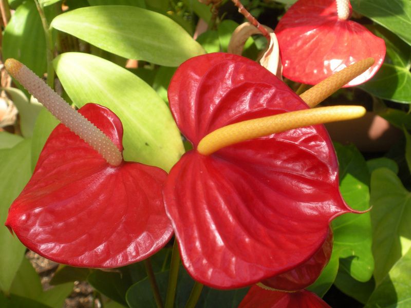
Botanical Garden / Suleymaniye, Fatih - Istanbul photo botanic_garden104.jpg

PHOTOGRAPHS ALBUM

The İstanbul University Botanical Garden first opened in 1935, yet many people who were born and bred in İstanbul don’t know anything about this rich botanical treasure trove. The variety of plants found in this garden is breathtaking - pineapples, avocados, Lebanon cedars, coffee trees, cacao trees, crocuses native to Anatolia, scores of orchids and many specimens of banana trees.

Another interesting aspect of the İstanbul University Botanic Garden is the parrots you might see here. These are parrots were originally brought to İstanbul to be sold in 1998; they were loaded from a cargo plane onto a truck but escaped when the truck was in an accident. Ultimately, the parrots wound up successfully living and breeding in İstanbul, and now they come to the botanical garden every morning, mostly because foods they love grow on trees in these gardens.

And so we, too, decide to drop in on the parrots’ favorite stopover, to take in the incredible diversity in these gardens and see a range of plants and trees from around the world that live here under expertly maintained conditions.

The botanical garden was first created by Alfred Heilbronn (1885-1961) but is now run by Dr. Erdal Üzen, who has given his life over to the study and care of these plants and trees. There are 400 trees and bushes and around 3,500 different kinds of plants and herbs growing here, with approximately 2,500 plants growing in greenhouses. There are plants from all points of the globe, brought to this garden through careful cooperation with other universities.

Istanbul University’s Botanical Garden (also known as the Alfred Heilbronn Botanical Garden, or AHBG) is the oldest and richest botanical garden in Turkey. Every year the garden and its greenhouses contribute to the education of more than 1000 undergraduate students of Biology, and interesting and rare samples from the plant world are shown to primary and secondary education students as well as visitors.

In the 1930s, Turkish educational institutions experienced something of a mass immigration of German academicians. Istanbul University became known as “the greatest and the best German university”. With students and voluntary translators helping to overcome the problem of language, this turned out to be hugely beneficial for Turkey in a number of ways.

Dr. Alfred Heilbronn had a special idea for the university shortly after he started lecturing. Having seen the beautiful botanical gardens of European universities, he immediately set to corresponding with Germany’s leading companies to provide high quality botanical equipment. A number of other German academics helped fund his initiative, as well as G.A. Catt (British) and Ahmet Atilla (Turkish), who were both curators with a prior interest in botany.

The AHBG was thus born in 1935. Heilbronn ensured that the botanical garden possessed the appropriate conditions. He worked on the garden plan drawings, the greenhouse project, and the garden’s heating and cooling systems.

There are Amazonian plants, special hyacinths from the Amazon that live in water, tropical bean trees and even some parasitic plants that live without soil. Though many of these plants would never be able to survive on their own in our country’s climate, here they are able to live and thrive in a warm, moist greenhouse atmosphere. Of course, there are some plants in the botanical garden which require a much colder setting.

There is one tree in particular that lives in the colder greenhouse that will pique the interest of anyone who has grown up in the shade of walnut, fir or juniper trees. The tree is called a sago palm, and its origins go back 380 million years. It bears fruit every 2.5 years, and it comes in female and male types. One of its most interesting characteristics is that is has distinct female or male organs when the plant is mature. Typically this kind of tree lives for 150 years, and that the female plants are particularly hard to breed. No need to explain that sago palms are extremely valuable!

There is another plant here that resembles a cactus, which is very poisonous. This plant has a milky substance stored inside that is so dangerous that a single drop could be lethal. Another notable resident of the botanical garden is aloe vera, which many women view as a beauty essential but which is not normally grown in Turkey.

Some of the plants that receive the most attention in the greenhouse are epiphytes, which need no soil to grow. These are plants that gain their nutrients from the moisture in the air and only need to find something on which to grow. Another object of extreme interest in this greenhouse is bean trees from the Amazon, whose beans measure about 50 centimeters each when fully grown. Of course, this is a tree which normally only grows in tropical climates. There are also pools present in these greenhouses where you can see a wide variety of tropical fish.

There is a wide variety of trees from different climes that are grown in the botanical garden. One of these is the Lebanon cedar. You can also see the black pine and American chestnut trees. The presence of these unusual trees is enough to attract many birds to this garden; in addition to the previously mentioned parrots, you can also see baby falcons and hawks here. And of course, the birds that come to enjoy the fruits and the branches of these trees not only add color and dimension to this garden, but also help with the pollination of these trees.

When entering the botanical garden, you will see a large tree to your left. This is a Ginkgo, also known as the maidenhair tree. Interestingly, this is a tree which in the Far East is traditionally found planted in cemeteries, as cypress trees are in Turkey. One of the lesser known characteristics of this tree is that its leaves are supposed to be quite beneficial for people suffering from Alzheimer’s or other mental disorders.

The people who have questions about the plants and trees they are growing in their homes can come to him with any kind of inquiry. There are lots of plants growing here which are about to disappear from Turkey altogether. There are some people who come to Turkey solely with the intention of taking samples of some of the plants and trees that grow here, and he advises the residents of Turkish villages and towns to be aware of this.

What people can do about this is to offer to sell samples of native Anatolian plants that they have grown themselves to those who are interested, but not allow the destruction or elimination of the country’s endemic plants and trees.

There are now 23 pools in the garden of various sizes, 15 of them are in the greenhouses, eight in a natural environment, and some of them are heated. There is also a rock garden. The garden covers an area of 15,000 m2 and is divided into six sections: Systematic division, Rock garden, Medicinal plants, Turkish plants, Experimental fields, and the Arboretum.

There are 400 woodland plants including trees and shrubs, 3500 herbal plant specimens from 160 families, and some endemic and rare plants for Turkish flora are located in the open fields. In the greenhouses there are also 2500 exotic specimens from different tropical regions of the world. In total, there are 6000 plant specimens, both native and exotic, from different taxonomical categories including Ferns, Gymnosperms and Angiosperms exhibited in the garden.

The garden is home to a number of rare and endangered plants. Botanical gardens in general have great importance for countries like Turkey. Turkey has a wide diversity of habitats and climatic conditions resulting from geological, topographical and continental characteristics of Anatolia as a meeting place of three different regions; the Euro-Siberian, Mediterranean, and Irano-Turanian.

However, this unique flora, including many areas that have yet to be surveyed, is under immense threat and declining fast. The threats facing the Turkish “Important Plant Areas” (IPAs) are diverse, ranging from agricultural reclamation, intensive forestry and industrial/urban development, as well as the collection of species for trade and the spread of invasive plant species in the environment. Overall, 94% of the IPAs are thought to be threatened to some extent by a potentially damaging activity.

Seed banks of many species listed in the Bern Convention Appendix I and “Red data book of Turkish plants” can be maintained and conserved in the AHBG (the garden trades seeds with approximately 400 foreign botanical gardens), in addition to the reproduction of some valuable floristic elements in tissue culture conditions including endemic, rare and endangered species.

The garden is open to the public. Approximately 10,000 visitors from come to the garden every year, including students, researchers and tourists. Even if a staff member is available to show you around, one of the faculty members will volunteer to do this.

LOCATION SATELLITE MAP


These scripts and photographs are registered under © Copyright 2017, respected writers and photographers from the internet. All Rights Reserved.