GPS : 41°04'15.5"N 28°51'04.3"E / 41.070972, 28.851194

PHOTOGRAPHS ALBUM
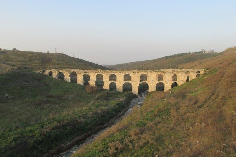
Mazulkemer Aqueduct (Kemerkece), located on Uzuncaova stream close to Esenler, Mazulkemer is within a restricted military zone. The name Mazulkemer means dismissed or suspended. The first water supply systems which were built in Istanbul date back to the foundation of the city. Two of the greatest aqueducts built in the Roman period are the Mazulkemer Aqueduct and the Valens Aqueduct.
These aqueducts were built in order to channel water from the Halkalı area in the western edge of the city to the Beyazıt district in the city center, which was known as the Forum Tauri in the Roman period. After reaching the city center, the water was later collected in the city's numerous cisterns, such as the famous Philoxenos (Binbirdirek) Cistern and the Basilica (Yerebatan) Cistern.
This aqueduct, which was built in the 4th century, underwent restoration in 741 - 775. An important part of the Süleymaniye Water Ways, the aqueduct was called the Beylik Water Way following its restoration in the reign of Sultan Mahmut I (1730 - 1754). The length of the aqueduct is 110 m, and there are thirteen arches above and seven arches (since two of them were broken, only five of the bottom ones can be seen.)
In addition to the Forest of Belgrade, to the north of the city, the rich aquiferous zone around Halkalı west of the city provided the main local sources of water (Çeçen 1991). The archaeology of water supply systems in both these areas is dominated by remains of the Ottoman supply systems that superceeded the Byzantine.
Extensive repairs to the Halkalı line immediately followed the conquest of the city by Sultan Mehmet II and more lines were gradually added. Some 17 individual channels dating to the Ottoman period are known to have emerged from the Halkali region to supply the city. However the commanding presence of the Mazulkemer, a massive two-tier water bridge perhaps alludes to a longer period of activity.
In form and composition the Mazulkemer appears to be different from other Ottoman aqueducts on the same line. For this reason it has been suggested that this aqueduct might originally have been built for the Roman system, that was supplemented in the 4th century by the long-distance line. Evidence of major rebuilding on this bridge suggest that it was active for a considerable period of time at at some point its arches required strengthening.
The bridge is now within the confines of a Military Zone, which has prevented closer study, but at the same time served to protect the monument.
LOCATION SATELLITE MAP
These scripts and photographs are registered under © Copyright 2016, respected writers and photographers from the internet. All Rights Reserved.
No comments:
Post a Comment