İstanbul - Turkey
 PHOTOGRAPHS ALBUM
The oldest surviving map of Constantinople, by Cristoforo Buondelmonti, dated to 1422. The fortifications of Constantinople and of Galata, at the northern shore of the Golden Horn, are prominently featured. The water trench in front of the Theodosian walls at the western end of the city is also depicted, as well as the Maiden's Tower in the middle of the Bosporus.
Galata, then the suburb of Sykai, was an integral part of the city by the early 5th century: the Notitia Urbis Constantinopolitanae of ca. 425 names it as the city's 13th region. It was probably fortified with walls in the 5th century, and under Justinian I it was granted the status of a city. The settlement declined and disappeared after the 7th century, leaving only the great tower (the kastellion tou Galatou) in modern Karaköy, that guarded the chain extending across the mouth of the Golden Horn.
After the sack of the city in 1204, Galata became a Venetian quarter, and later a Genoese extra territorial colony, effectively outside Byzantine control. Despite Byzantine opposition, the Genoese managed to surround their quarter with a moat, and by joining their castle-like houses with walls they created the first wall around the colony.
The Galata Tower, then called Christea Turris (Tower of Christ), and another stretch of walls to its north were built in 1349. Further expansions followed in 1387, 1397 and 1404, enclosing an area larger than that originally allocated to them, stretching from the modern district of Azapkapı north to Şişhane, from there to Tophane and thence to Karaköy.
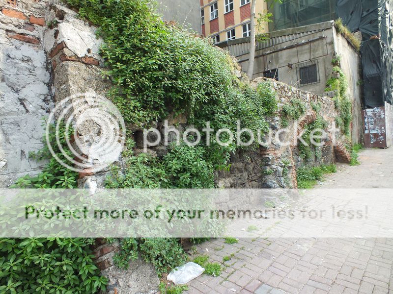
After the Ottoman conquest, the walls were maintained until the 1870s, when most were demolished to facilitate the expansion of the city. Today only the Galata Tower, visible from most of historical Constantinople, remains intact, along with several smaller fragments.
Galata, within the walls of which it is known there exist a church, forum, bath, theatre, a port and 431 big houses, has been used as a residential area since Constantinus I era. The walls were extended to 2800 metre in time, and to these walls, Tiberios II the Emperor (578-582) included a fort, to where the chains blocking the Golden Horn during the conquest were tied to Galata. The fort, still standing currently, has been used as Yer altı Camii (Underground Mosque) since 18th century.
On saving Constantinople from the Latin in the year 1261, the Byzantine Emperor let the Genoese settle in Galata. However, he made the walls removed and did not let them erect once again. In order to be secure against the external attacks, the Genoese, not allowed to erect walls, dug huge ditches around Galata. Houses were built around this region where the ditch started in 1303. Merging the whole houses after awhile, the walls were erected again. These walls were fortified during the course of period, and Galata Tower was included herein in 1349.
The Genoese, living on trade, took under guarantee not only themselves but also their goods. Galata, previously built in a region between the current Karaköy Square and Galata Tower, its area was enlarged as the Byzantine authority turned weaker and the Genoese stronger. The enlarged Galata was great enough to include the current Azapkapı - Şişhane - Kule - Tophane regions.
It is known that there was an harbor in settlement region of Sykai which gained importance during the period of I. Constantine (324-337) surrounded by the city wall. When the districts of the city were rearranged during the period of Theodosius II (408-450) the region of Sykai was included in the borders of the city. This settlement included a church, a forum, hamams and a theatre. Since Emperor Justinianus constructed new buildings and improved Sykai in 528, his name was given to this city which was sometimes called as Justinianai or Justinianopolis.
Today, the most specific feature of this region is Galata Tower. It is known that the tower was constructed after Genoeses settled in this region. Genoeses who had a privileged region in the shores of Golden Horn in Istanbul already in the 12th century lost this region in favor of Venetians in 1204 during invasion by IV. Crusade and started to settle in Galata region as from the middle of the 13th century. Emperor Mikhael VIII (1261-1282) who conquered Istanbul from Latin in 1261 and reestablished Byzantium administration, granted a lot of rights to Genoeses to establish trade guilds, palaces, public baths, bakeries, houses and shops and to make free trade.
However, it was heard that Genoeses intended to revolt, they were expelled from Byzantium and they could obtain the permit to settle in Galata in 1267. But, Byzantium Emperor destroyed city walls standing there and left only a Byzantium garrison. Since there were no walls , it was not possible to defend Galata and rival Venetian fleet fired Genoese colony in Galata in 1296.
After this event; Genoese decided that they had to surround their town with city walls. However, Byzantium administration did not permit them to surround their town, prohibited construction of city walls and castles, but by a Ferman dated 1303 Byzantium administration specified the borders of priviliged region which is granted to Genoeses.
Genoeses were definitely prohibited to build housesoutside this priviliged region and instructed to leave a line of empty field around this region. Genoeses who broke these prohibitions within time , made a trench along the borders of the region and have the heights of Byzantium houses to be free. And then they constructed stone, tall buildings alongside the borders with regular intervals.
Making the use of important crisis which Byzantium Empire experienced, Genoeses inconnected the houses, which were in form of bastions, into each other with walls which means surrounding the region with city walls. Genoeses administrated this colony under a governor called podesta. This governor was also permanent representative of Genoeses in Byzantium Empire. However; as Byzantium Empire weakened, the colony of Genoeses strengthened, become rich and widened the borders.
During the conquest of Istanbul, Galata tried to be impartial by following the policy of an independent state. After overthrow of Byzantium, the administer of Galata signed an agreement with Fatih II. Mehmet and Ottoman Empire acknowledged the priviliges of Galata. Galata was included in the territory of Ottoman-Turkish state and the churches of San Paolo and San Domenico were converted into mosques.
In this period Galata was administrated by a governor called voyvoda and some Greeks from Izmir were settled in this region. But since the 15th century, many European merchants had already settled there and the activities of Genoeses had been reduced. The coastal band stretching from the northern shores of the Golden Horn until Tophane and the slopes behing it have been known as Galata since the 8th century. Formerly this area was known as Sycae (Sykai), or as peran en Sykais, which essentially means ‘on opposite shore’.
It is thought that Galata’s foundation preceded that of Constantinopolis. The archaeological finds here indicate that it was an important settlement area in Antiquity. Although its borders can not be determined precisely, it is known that during the reign of Emperor Constantin (324 - 337), it was a fortified settlement consisting of a forum, a theatre, a church, a harbor and bath buildings, as well as 431 large houses. The present fortification walls were constructed by Emperor Justinian in 528.
The 2 meter wide land walls surrounded by a 15 meter deep moat were enclosing an area of 37 hectars. It is surmised that the renowned Castellion that used to control the entry into the Golden Horn was built by Emperor Tiberius I (578 - 582). Among the trading colonies in the area, that had acquired the commercial harbor functions due to favorable topographical conditions, the Italian presence had begun to be more prominent starting from 10th century onwards. The conditions that had created the Medieval Galata were being formed in these trading colonies.
At first Amalfi, then the Venetians and later the Pisans had obtained special privileges from the Byzantines. The Genovese, who had established themselves on the southern shores of the Golden Horn as a result of their rights recognized by Emperor Manuel Comnenos I (1143-1186), were forced to move over to Pera on the opposite shore when the Venetians seized their territory during the Latin invasion of 1204. When the Latins departed from Constantinople in 1261, the city was in complete ruins.
And the economic relations of the Byzantine capital were now completely in the hands of the Venetians and the Genovese merchants. Emperor Michael Paleologos VIII (1261-1282), who was able to recapture Constantinople from the Latins, signed the Nymfaion Treaty with the Genovese and permitted them to rebuild their commercial loggia, their palazzo comunale and other buildings of theirs. And they received consulate rights, as well as free trade privileges.
When rival Venetians attacked the Genovese colony in 1296, they wanted to renew their demolished fortification walls, but could not secure the necessary permission from the Emperor, and had to be contented with a moat only. On the other hand, they were able to formalize their borders as a result of a decree dated 1303.
As the Byzantine Empire grew weaker, however, the Genovese took advantage of this situation to strengthen their position, and started to build tower houses along this moat, connected them to each other with crenellated walls, thereby bringing the Galata region to a ready state of defence, and expanded their territory towards the environs of Azapkapı - Şişhane - Galata Tower - Tophane.
The Galata Tower was constructed in 1349. According to an agreement, the colony came under the responsibility of an administrator called podesta. The Podesta was considered, at the same time, as the ambassador of Genoa at the court of the Byzantine Emperor. The Podesta, in turn, was responsible towards a city council of 24 elected members known as "Magnifica Comunita di Pera". During the 14th century, Galata with its urban form and structures used to display its period’s typical features as a Mediterranean city.
It had become an important part of the city where commercial relations with the West were established and carried on, and this characteristic of the area had continued after the conquest, as well. It is known that the Genovese had strengthened and elevated the height of the fortifications and increased the number of city gates in 1446, a few years prior to the siege of the city.
However, following the conquest of Constantinople, Sultan Mehmet II had demanded the removal of the upper portion of the walls of Galata, and had signed an agreement with the Genovese recognizing their privileges which they had obtained during the period of the Byzantine Empire, in return for their acceptance of the ownership of the region by the Ottoman State.
The Podesta had been replaced by a new administrator called Vaivode. It is well known that a large number of Western merchants ha settled at Galata following this conquest. The most important axis of the region was the Voyvoda Avenue (today’s Bankalar Avenue), which extended parallel to the shore line and on which were lined the administrative structures of the colony.
These scripts and photographs are registered under © Copyright 2017, respected writers and photographers from the internet. All Rights Reserved.


